
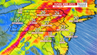
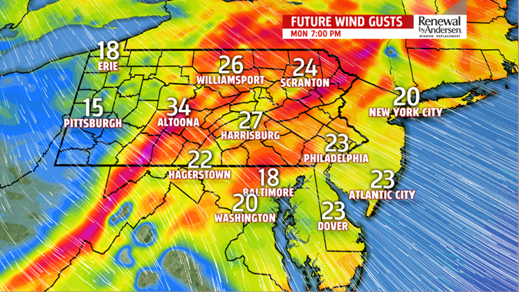


WINDY START: A warm westerly wind dominates the start of the work week. Constant winds associated with our next cool front intensify to 15-20MPH with gusts up to 30-35MPH throughout the day. The cold front passing through stays dry. Afternoon temperatures raise into the mid-40s area wide as cloud cover slowly clears today, too. It’ll be the first time we’ve seen the sunshine in several days!
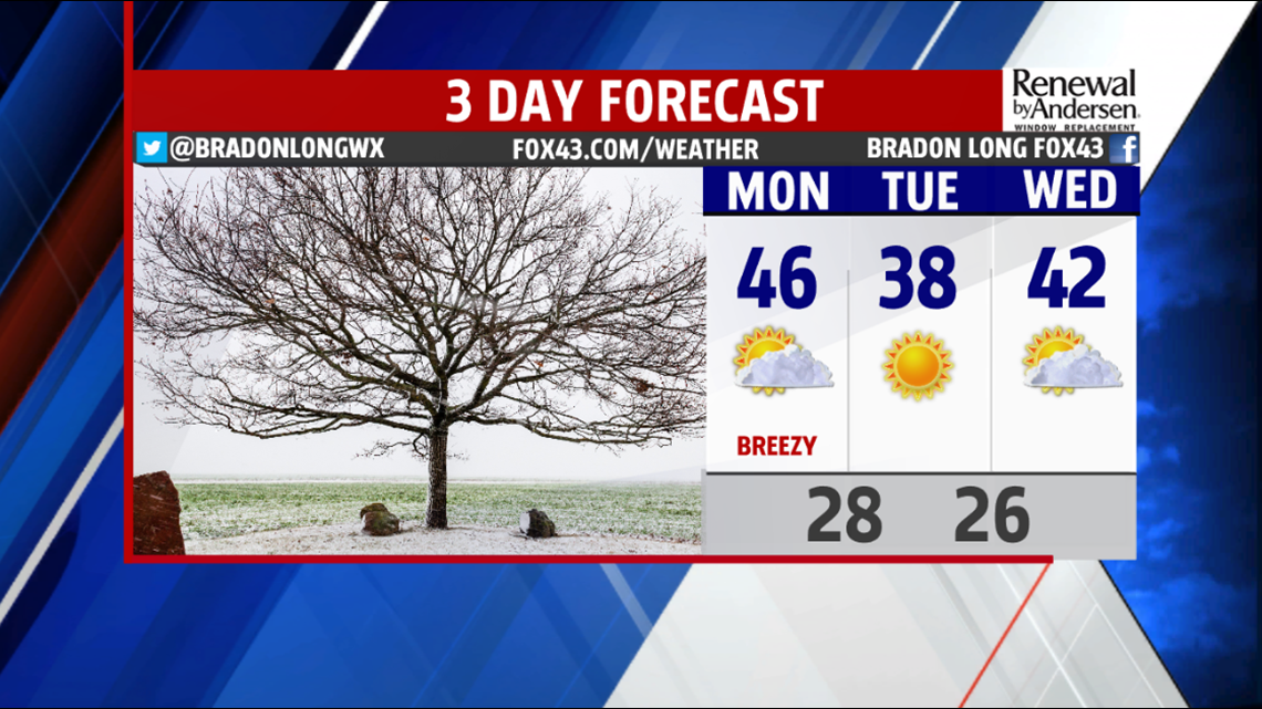
STAYING DRY: Cooler air overnight leads to cooler temperatures, even with abundant sunshine, for Tuesday. Morning 20s lead to afternoon upper-30s with mostly sunny skies. We gain a couple of degrees heading into Wednesday with highs in the low-40s.
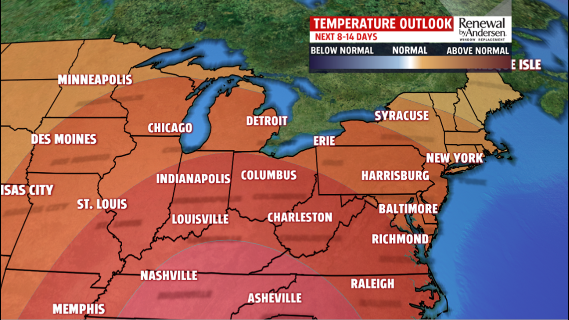
NEXT RAIN CHANCE: Our next rain chance, still a bit up in the air. Temperatures warm into the upper-40s on Thursday with showers beginning late in the day and into the overnight time frame. As a result of the extra cloud cover, morning lows stay right around the 40-degree mark. By Friday afternoon, highs near 50 with another shower chance persisting. Regardless, the weekend looks dry, just above average, as we head into the weekend before the Christmas holiday.
Have a great day!
-Meteorologist Bradon Long
