COOLER, SUNNY: Our cold northwesterly breeze calms down throughout the morning. Wind chills become a lessening factor throughout the afternoon with plentiful sunshine. Highs still struggle to reach 40-degrees with the northwesterly light wind. But, we stay dry through Wednesday. Highs for the middle part of the work week jump into the mid-40s with mostly sunny conditions.

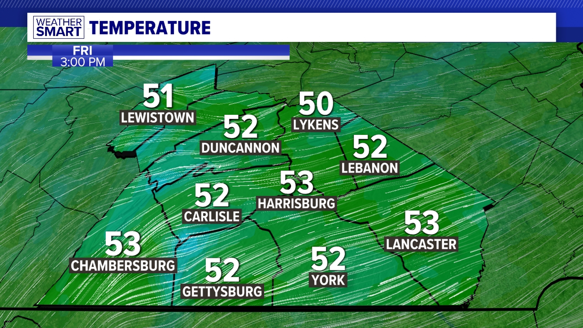
NEXT RAIN CHANCE: As high pressure breaks down Thursday, temperatures stay in the mid-40s with increasing cloud cover ahead of our next rain maker. Showers start very late on Thursday and take over the area heading into Friday, the first day of Winter. Highs, ironically enough, will be the warmest on Friday with showers throughout the day. Temperatures reach t he low-50s as rain continues into the wee hours of Saturday morning for another big drink of water over Central Pennsylvania.
LOOKING AT CHRISTMAS EVE: Breezy conditions remain on the back side of our rainmaker with cloudy skies Saturday. Temperatures drop into the low-40s for a dry Sunday. There is a very low chance of seeing a few flurries in our northern counties on Christmas Eve, but most of not all of us stay completely dry heading into the holiday. Temperatures in the afternoon stick right around the 40-degree mark.
Have a great day!
-Meteorologist Bradon Long