


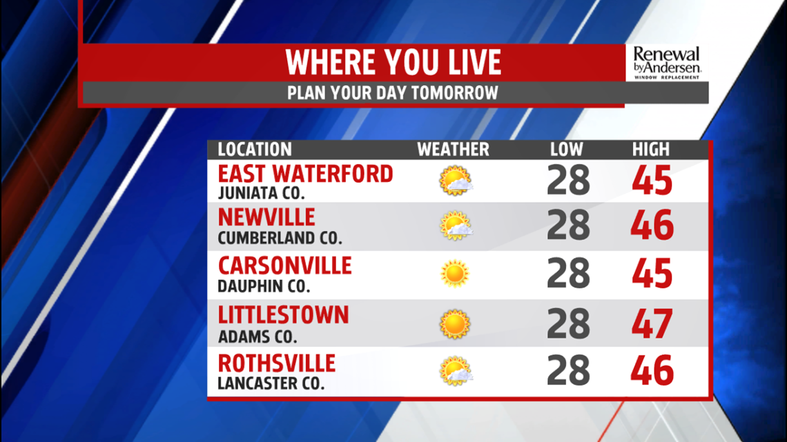
RECOVERY FROM THE HOLIDAY: The middle part of the week, right after Christmas, is uneventful in the weather department. Lows dip below freezing to kick off Wednesday with mostly sunny skies dominating the afternoon. Highs make it to the mid-40s with light southwesterly winds. We get a wind shift for Thursday to out of the southeast, which just might be strong enough to add some extra clouds and limit us by a degree or two. Regardless, we stay in the mid-40s heading into Friday.

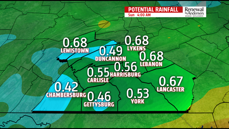
END OF THE WEEK RAIN: Rain chances start in the very late hours of Thursday, with the highest chance holding off into Friday morning before sunrise. Showers take over and remain with us all day long. Temperatures continue to warm throughout the day and top out in the mid-to-upper 50s. We’ll get break in the rain at times, which will be light with the occasional downpour. Showers end into Saturday morning. As the front swings through on the backside of the system, temperatures drop Saturday afternoon with clearing skies. The high will be early in the day, near 50.
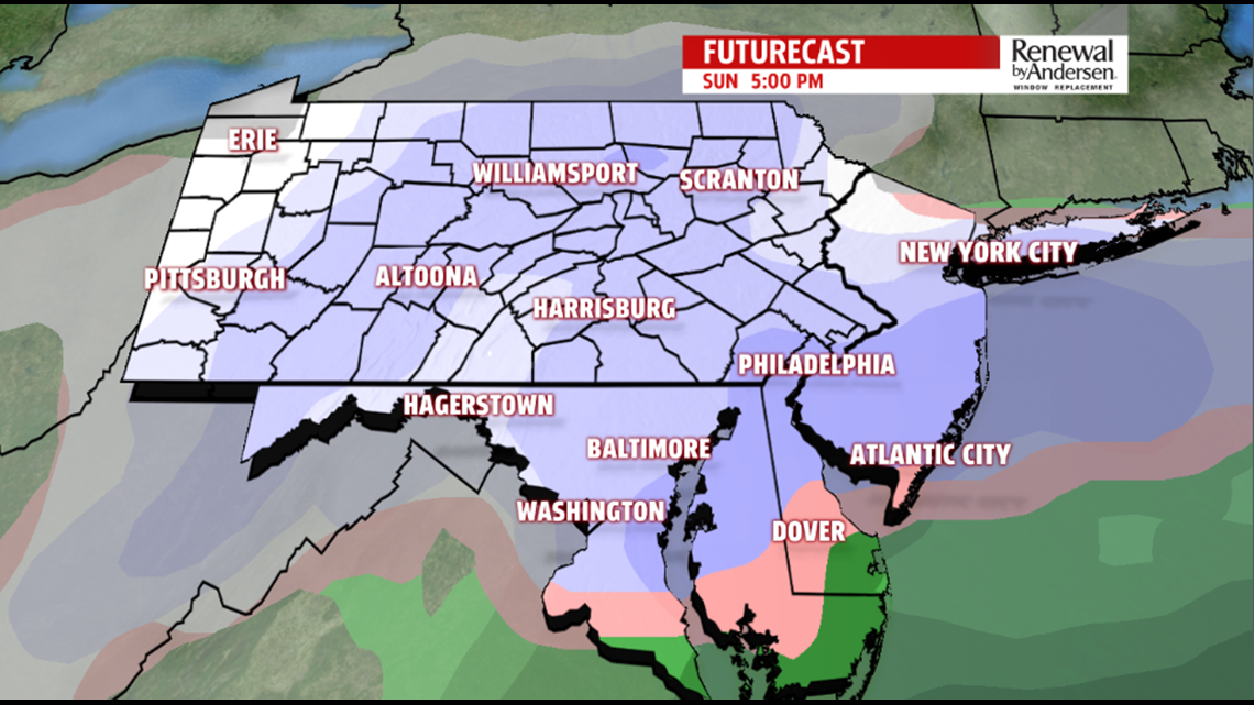
HEADING TOWARDS THE NEW YEAR: To finish the weekend, we turn to snow chances Sunday afternoon. Accumulation at this point looks unlikely, especially with the 50s just prior to the system and temperatures likely above freezing at the surface for most of the snowfall. We’ll update you as we get closer. New Year’s Eve temperatures stay near 40 with mostly sunny skies for the last day of 2018.
Have a great one!
-Meteorologist Bradon Long
