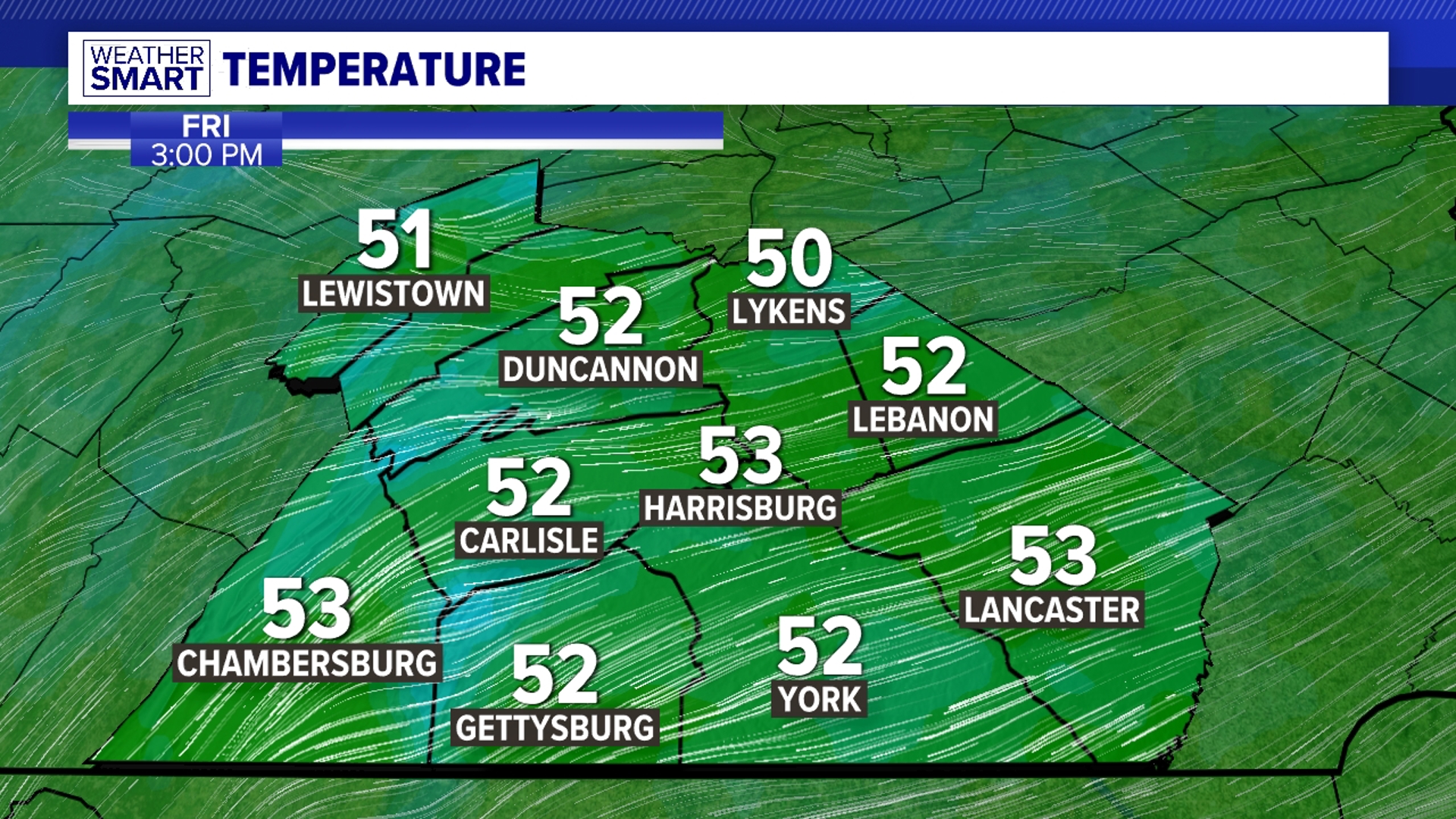

BREEZY WITH COLD WIND CHILLS: Wednesday is dry and gusty, with intervals of sunshine. Expect more seasonable temperatures in the middle to upper

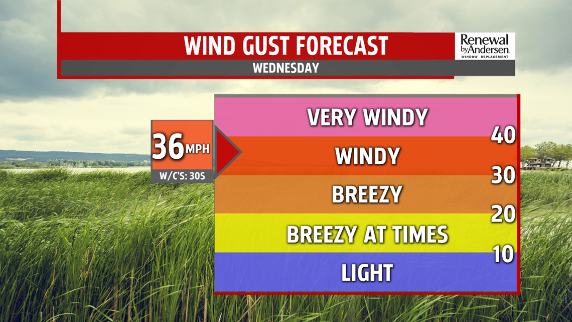
30s, with wind chill values in the 20s. Lake effect flurries are possible. It’s another breezy, dry day Thursday. A little more sunshine does little to warm temperatures. Highs are in the lower to middle 30s. Wind chill values are once again in the 20s. Skies are brighter Friday but does little to warm temperatures. Winds finally subside with high pressure overhead.
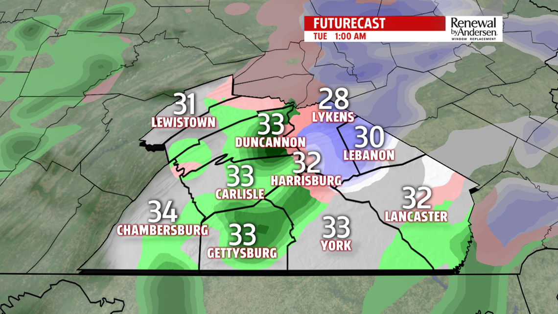
WEEKEND OUTLOOK: We are tracking the possibility for snow showers. A developing system to our southwest, brings the threat for late day and evening snow showers. Temperatures are cold in the lower 30s. Sunday, a secondary low develops along the coast keeping the snow threat around. Once again, it is quite chilly, in the lower to middle 30s.
The FOX43 Weather Team is keeping you “Weather Smart” 7 days a week!
Have a good day!
MaryEllen Pann,
Chief Meteorologist