


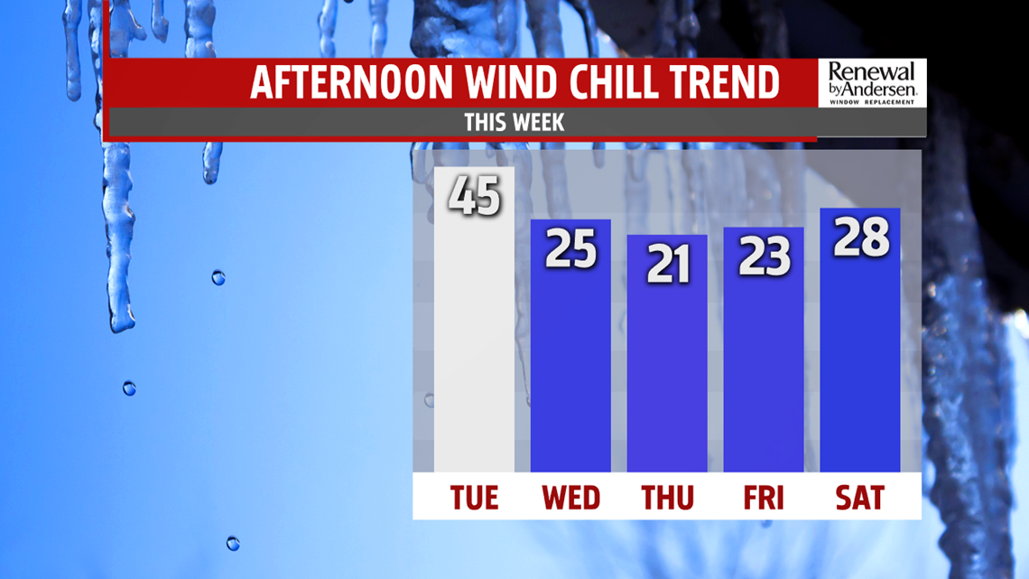
COLD & BREEZY MIDWEEK: Seasonably cold air returns to the region for the middle of the week. Wednesday is gusty, partly sunny, and cold. Temperatures reach the middle to upper 30s, with wind chill values in the 20s. Some lake effect flurries are possible. It’s a bit colder Thursday with partly sunny skies. It’s still a bit breezy, with temperatures in the lower to middle 30s. Wind chill values remain in the 20s. Friday brings more sunshine, but the cold remains. Temperatures don’t change much, and the winds ease a bit. Readings remain in the 30s.
WINTRY WEEKEND OUTLOOK: The appropriate wintry feel stays for the weekend, and we’re even tracking the possibility for some snow. Temperatures remain quite cold Saturday with the chance for some snow showers. Temperatures are in the lower 30s. Saturday night into Sunday we’re eying the chance for some snow showers or steady snow as a coastal system develops south of the region. Temperatures reach the upper 20s to lower 30s. It’s too early to get into specifics, but we’ve got our eye on it! Monday is drier with partly cloudy skies. It’s breezy, with temperatures in the middle 30s.
Stay Weather Smart with FOX43! Have a great Tuesday!
