


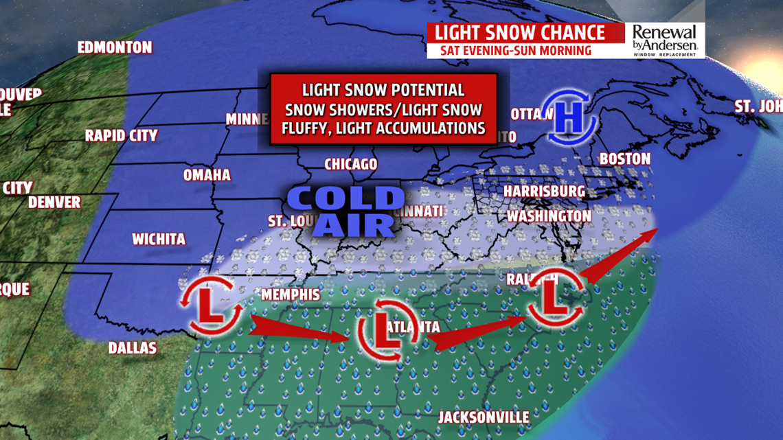
WINTRY WEEKEND OUTLOOK: The appropriate wintry feel stays for the weekend, and we’re still tracking the possibility for some snow. Temperatures remain quite cold Saturday with the chance for some snow showers, especially later during the day. Temperatures are in the upper 20s to lower 30s. Saturday night into early Sunday morning, we’re eying increasing chances for light snow as a system develops and passes us to the south. Minor to light accumulations look likely, with the higher amounts closest to the Mason-Dixon Line and lower amounts to the north and east. It would be a light and fluffy snow, and roads could be a bit slick. It’s out of here early Sunday morning. The rest of the day is partly sunny to mostly cloudy and breezy. Temperatures reach the upper 20s to lower 30s. Wind chill values are in the 20s.
NOT AS COLD NEXT WEEK: It’s not as cold to start next week, but a seasonable cold is in place. Monday is drier with partly cloudy skies. It’s breezy, with temperatures in the middle 30s. Wind chills feel like the middle 20s to lower 30s. Tuesday is a bit less cold with a mixture of sunshine and clouds. Expect temperatures in the upper 30s to near 40 degrees. Wednesday continues to moderate under mostly sunny skies. Expect temperatures in the upper 30s to lower 40s.
Stay Weather Smart with FOX43! Have a great Thursday!
