
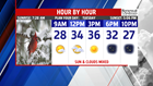

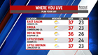
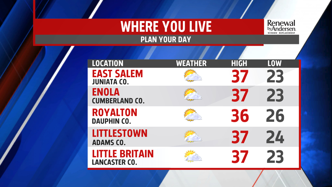


QUIET & TURNING MILDER: The pattern remains quiet with high pressure in control on this Tuesday morning. Skies are mostly clear through the early morning hours. Temperatures dip into the teens to lower 20s once again. Winds are light, so we are spared from too much wind chill effect. The rest of Tuesday is another quiet day in weather, and it’s a touch milder. Expect a mixture of sunshine and clouds. Temperatures reach the middle to upper 30s. It’s a mixture of clouds and sky through the night. Lows fall into the lower to middle 20s. Temperatures continue to climb a little higher on Wednesday. Skies are partly cloudy to mostly sunny. Afternoon temperatures reach the upper 30s to near 40 degrees.
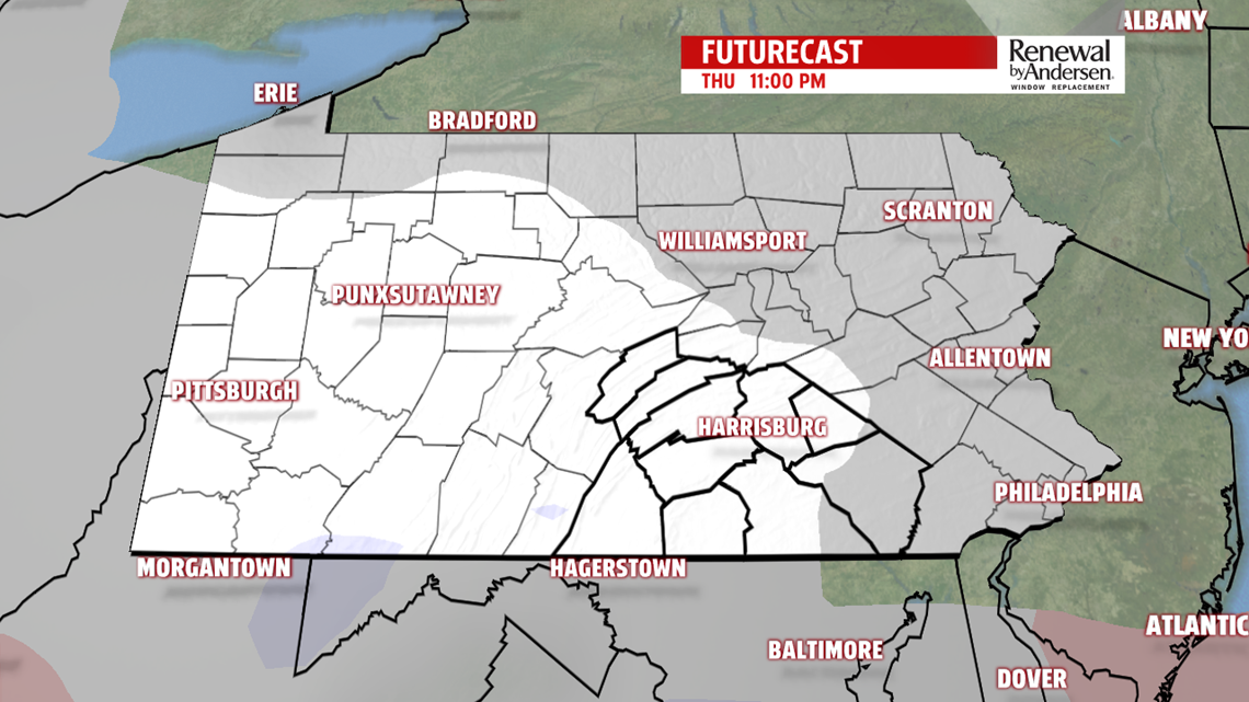
ANOTHER LIGHT SNOW: The end of the week forecast is quiet overall, but chances are increasing for a light kiss of snow overnight Thursday. In the meantime, Thursday sees increasing clouds. Temperatures reach the lower to middle 30s. Through the night, the weak system passes through Central PA. It brings some snow showers and light snow are possible. It’s out of here by Friday, with plenty of sunshine to start. Clouds increase ahead of what potentially could be an even bigger system for the weekend. Temperatures reach the upper 30s to lower 40s.

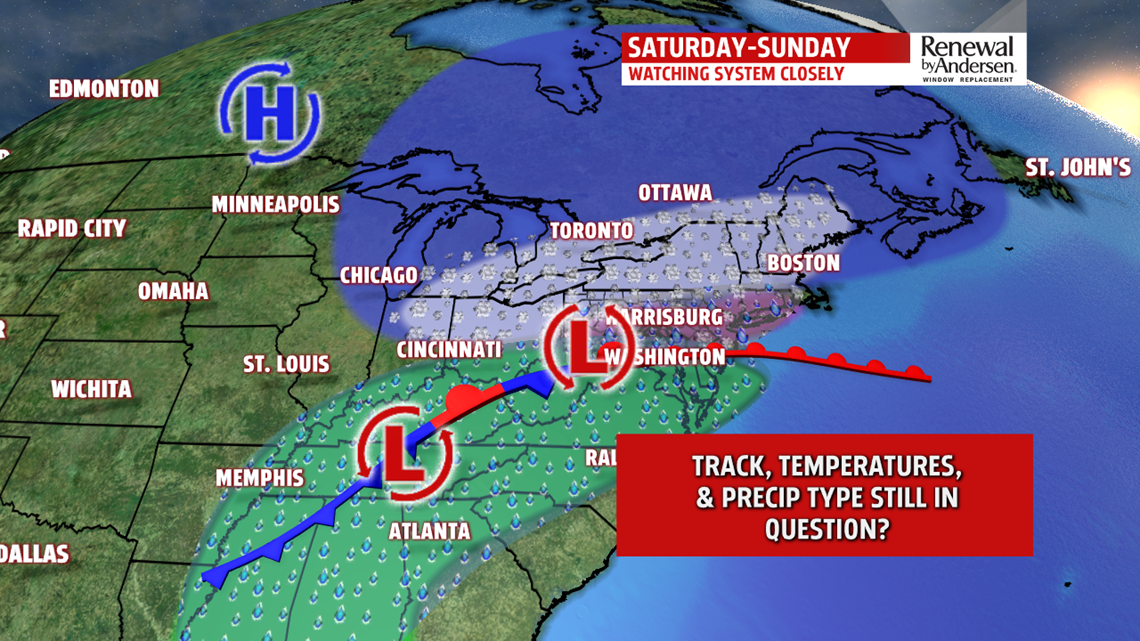
ANOTHER WEEKEND WINTER WEATHER SYSTEM: There’s yet another system we are monitoring for the upcoming weekend. Based on the way models are wobbling with the track, there’s strong indication it brings a wintry mix late Saturday and through Sunday. There’s plenty of uncertainty with track, timing, precipitation type, and amounts/timing of each type to even attempt giving a reliable forecast still at this time. So of course, as is typical with these types of systems so far in advance, it is way too early to tell, and we must wait for time to sort out the vast differences. Stay tuned through the week! Next week brings an Arctic blast of air! Monday temperatures are in the teens to near 20 degrees under partly sunny to mostly cloudy skies. It’s gusty with lake effect flurries.
Stay Weather Smart with FOX43! Have a great Tuesday!
