
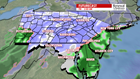
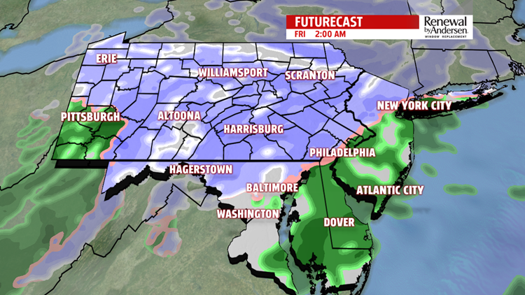

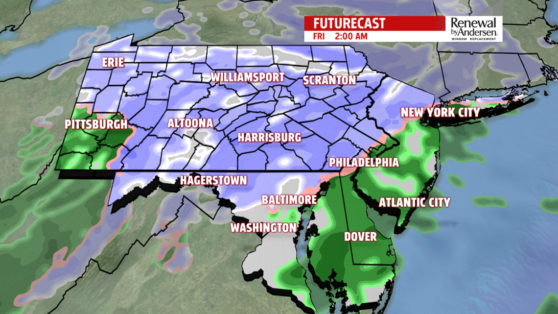
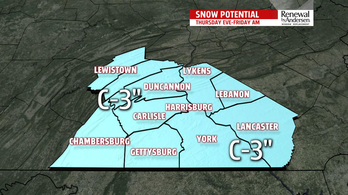
A BIT OF SNOW: We continue to keep the cloud cover into the overnight time frame, and for the next several days. Temperatures drop into the 20s once again overnight with partly to mostly cloudy skies. Afternoon highs hang right around the freezing mark as snow makes its way into the area. We start seeing a few flakes in the late portions of the evening commute as the snow becomes steadier throughout the evening. It’ll continue into the overnight time frame until slowing down into the morning commute. Widespread totals of a coating-to-2 inches will be the norm, but some of our higher elevations could see as much as 3 inches before all is said and done. Friday remains mostly quiet throughout the rest of the day with temperatures jumping into the low-40s.
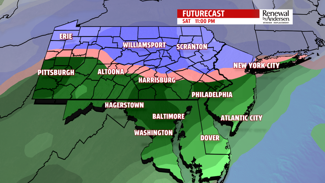
ROUND TWO: A powerful system works its way into the Mid-Atlantic for the weekend. Temperatures stay around freezing all Saturday afternoon as flakes start falling in the mid-to-late part of the day. They take over into the evening and intensify. We currently anticipate mixing to take place in our area, but the battle zone of the freezing line will be nearby, if not in Central PA itself, overnight into early Sunday morning. This switch over into sleet and rain, wherever it sets up, will make a sharp gradient for snow totals. It’s way too close of a call right now, but expect a bitter cold wind shift and change back over to snow as the sun rises Sunday morning. We’re done with the snow by the late morning as temperatures drop rapidly throughout the afternoon. Stay tuned for updates as we get closer.
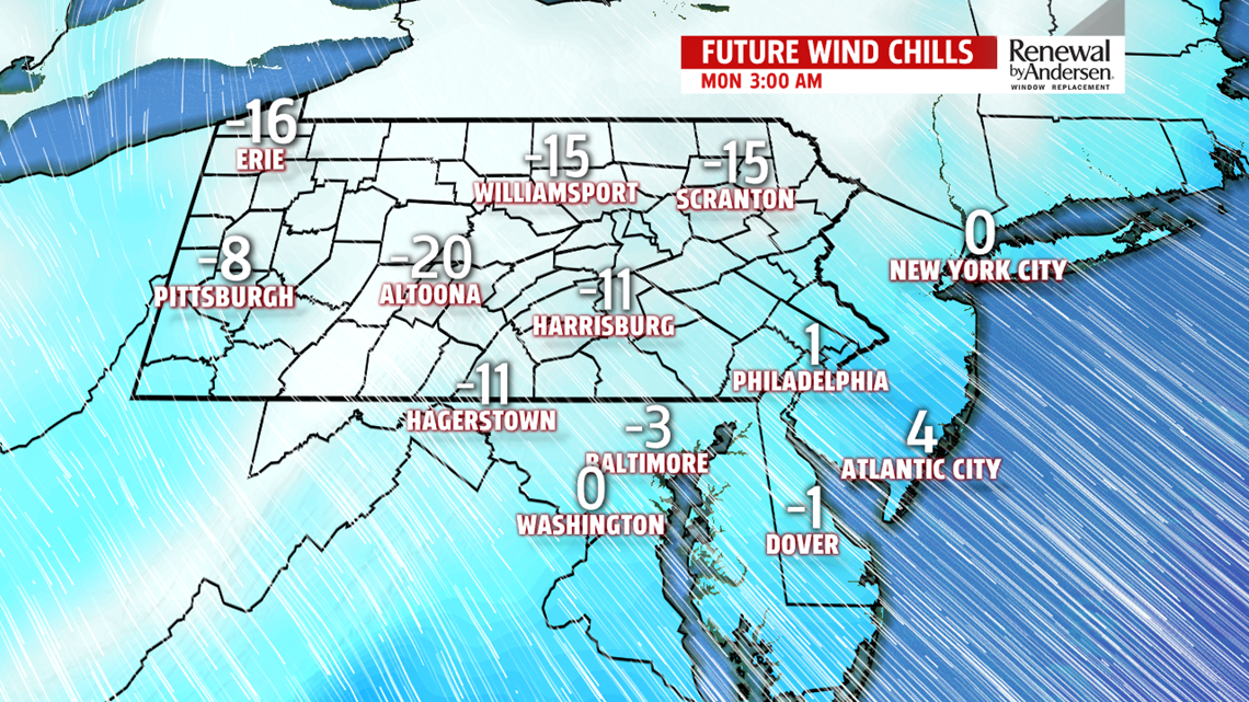
BITTER COLD NEXT WEEK: After starting Sunday warmest in the morning, we see a big temperature drop with northwesterly winds coming in at 25-30MPH, gusts over 40MPH likely. We drop through the 20s and into the teens in some spots before sunset. Overnight lows in the single digits take hold with wind chills below freezing in many, if not all, locations across the area. Afternoon temperatures on Martin Luther King, Jr. Day stay in the teens as we’re slow to warm up back to average by the middle part of next week.
Stay “Weather Smart” will the FOX43 Weather Team all week long!
-Chief Meteorologist MaryEllen Pann
