

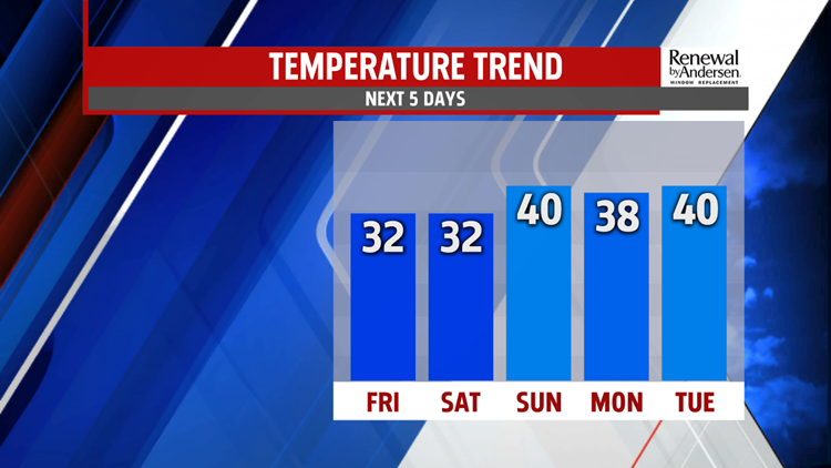
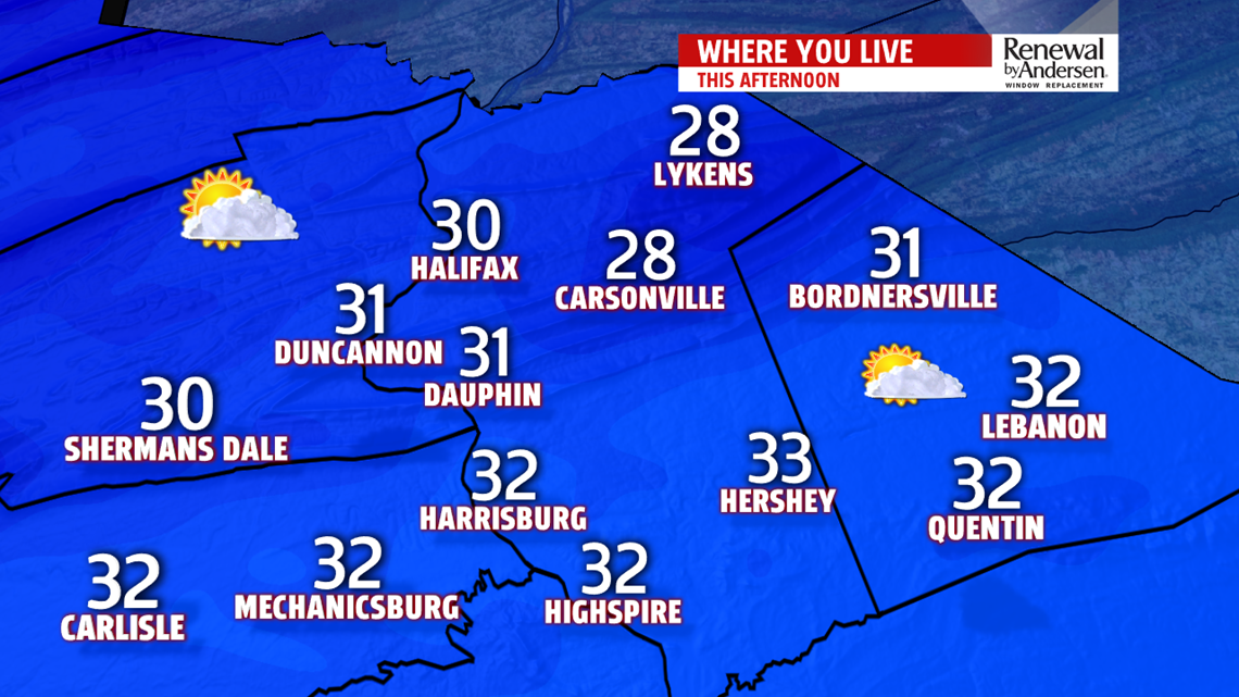
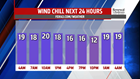


WEEKEND OUTLOOK: Colder air lingers into the first half of the weekend forecast. Saturday temperatures remain a bit on the cold side. Readings reach the upper 20s to lower 30s under partly sunny skies. Some flurries are possible. Readings quickly bounce back up into the middle to upper 30s to lower 40s on Sunday. A few snow showers are possible, but it’s not going to be anything major. Winds are lighter Saturday, but they should be light to calm on Sunday. Wind chills on Saturday feel like the lower to middle 20s.
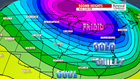
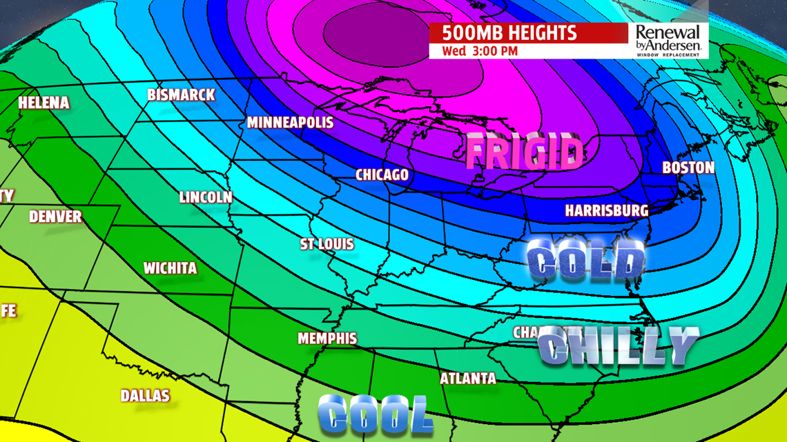
NEXT WEEK: We’re watching the next system early next week for a wintry mix potential. Monday is quiet with increasing clouds. Temperatures are in the 30s. Some light snow showers are possible overnight, and through Tuesday, there’s the potential for mixing with ice, perhaps rain depending on how warm temperatures can reach. This is still a decent amount of time away, and there continues to be plenty of disagreement from the computer models on a day-to-day basis. We’ll of course continue to watch it through the weekend, so stay tuned! No matter what happens here, there strong agreement on a push of frigid air into Wednesday. Temperatures fall into the 20s. Gusty conditions and flurries are possible, with wind chills in the teens. The cold air should linger into Thursday. Readings only reach the teens during the afternoon. It’s still a bit breezy too, so wind chills feel like the single digits.
Stay Weather Smart with FOX43! Have a great weekend!
