


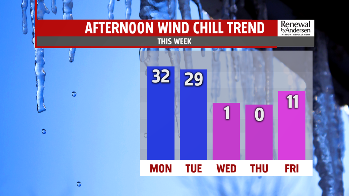
MORE ARCTIC AIR: Arctic air continues settling in through midweek, and it’s the coldest we’ll feel so far this season. Winds turn very gusty as the brutally cold air mass arrives. Skies become partly sunny to mostly cloudy very quickly too. Some lake effect flurries also pop up. Temperatures only reach the upper teens to lower 20s. Wind chills feel like the single digits to even below 0 degrees, especially as temperatures take a tumble through the night. Morning lows are near if not below 0 degrees Thursday morning, and wind chill values are even colder than that. It’s breezy and partly sunny on Thursday. Temperatures only reach the lower teens. Wind chills are near and below 0 degrees. Friday bring partly to mostly cloudy skies as a weak wave crosses through the region. A few snow showers are possible, but right now, it doesn’t look like anything too concerning. Temperatures are near 20 degrees, showing some improvement. However, a lighter wind still adds some chill. Wind chills feel like the upper single digits to lower teens.
SLOWLY THAWING THIS WEEKEND: A gradual thaw takes place through the weekend. Saturday brings partly cloudy skies as a warm front tries to lift north and usher in warmer air. Temperatures should reach the upper 20s to near 30 degrees. The moderation in temperatures continues through Sunday, but clouds also increase ahead of the next system. Temperatures reach the 40s. A few showers are possible depending on how quickly the next system arrives.
Stay Weather Smart with FOX43! Have a great Monday!
