


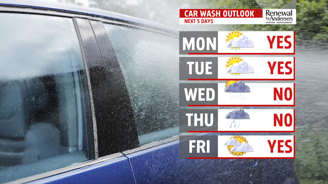
TEMPS LOWER, INCREASED SHOWER CHANCES: The next storm system brings some showers into the forecast. There’s plenty of clouds Wednesday, and also the chance for showers as the next storm system crosses through during the middle of the week. Temperatures are a little bit chillier, but still on the mild side for this time of year. Expect readings in the middle 40s. Plentiful showers continue through the night, and they last into Thursday. Readings are in the middle to upper 40s. Temperatures could briefly spike into the lower 50s overnight Thursday and into early Friday morning.
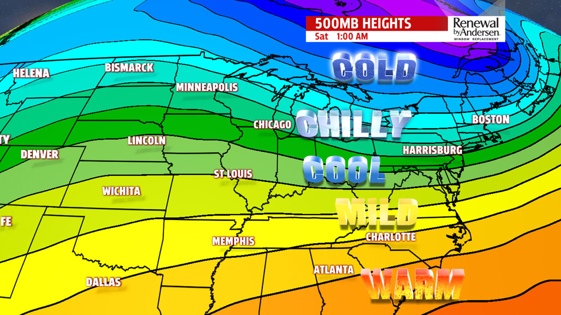
TURNING CHILLIER FOR THE WEEKEND: Chillier air returns to Central PA by the end of the week and into the upcoming weekend. Showers wrap up early Friday morning, possibly with mild temperatures to start. Then, as a cold front clears the region, breezes pick up, and chillier air knocks temperatures into the 40s by the afternoon. Skies are partly cloudy. Temperatures continue to drop through Friday night, and they dip into the lower to middle 20s by Saturday morning. The rest of the day is partly to mostly sunny. Temperatures are in the middle to upper 30s, making it much more seasonable for this time of year. Sunday starts with sunshine, but clouds likely increase ahead of the next system. Temperatures are a touch higher, with readings in the middle 30s to near 40 degrees.
Stay Weather Smart with FOX43! Have a great Monday!
