


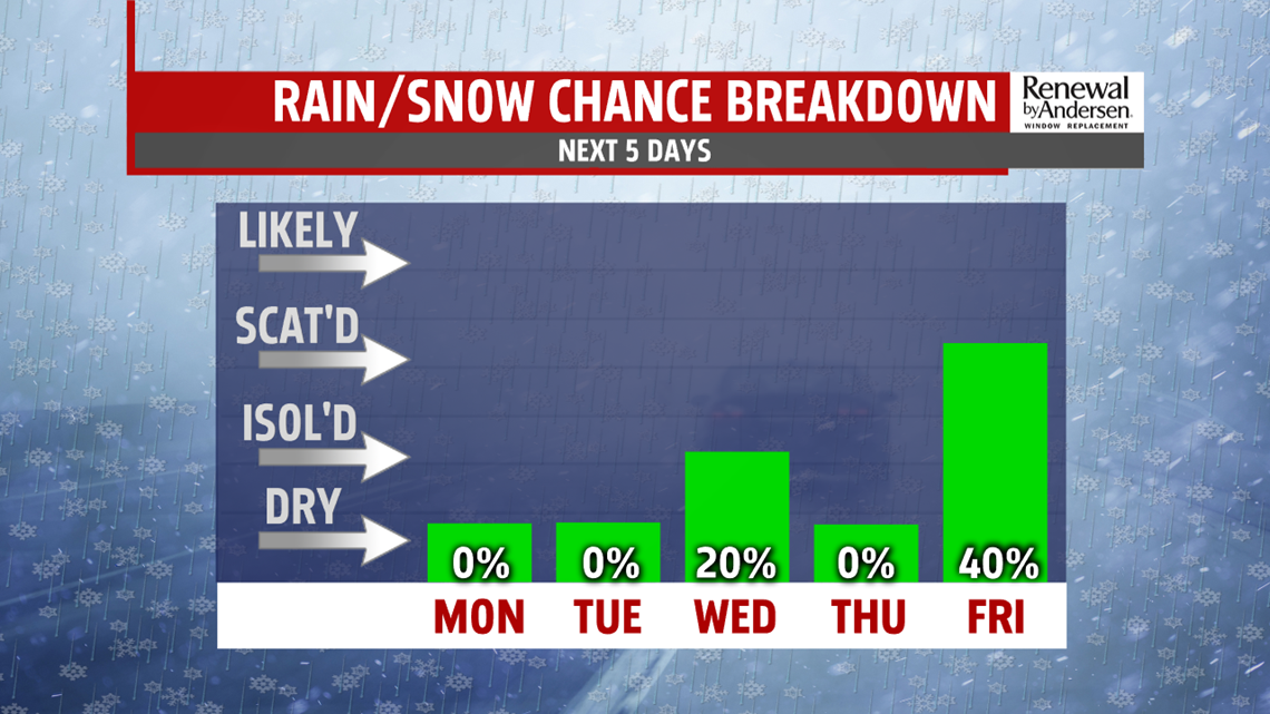
SMALL RAIN/SNOW CHANCES THROUGH MIDWEEK: Wednesday brings the next chance for precipitation. We’re monitoring the chance for a couple rain and/or snow showers, so it’s nothing major. It’s another chilly day too, with temperatures in the middle 30s to near 40 degrees. An isolated snow shower or two is possible through Wednesday night. Thursday is quiet with partly sunny skies. Expect temperatures in the upper 30s to lower 40s. Friday brings the next chance for rain and/or snow showers depending on the track of the next system. Temperatures fall back a bit, with readings in the upper 30s to near 40 degrees.
UNSETTLED WEEKEND OUTLOOK: The weekend forecast is currently looking 50/50 for the region. There’s the chance for showers to linger into the Saturday forecast. Be ready to have the umbrella nearby just in case. Temperatures are a bit milder, with readings in the upper 30s to lower 40s. Sunday dries out, but a potent burst of arctic air settles into the region. It’s breezy, with afternoon temperatures in the upper 20s to lower 30s. Winds chills in the teens and lower 20s are possible.
Stay Weather Smart with FOX43! Have a great Monday!
