


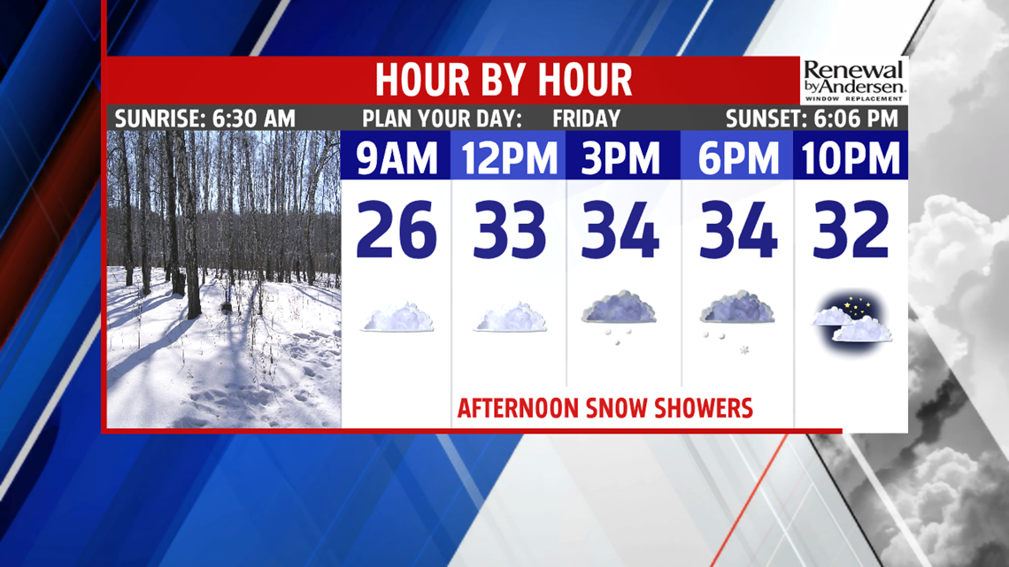

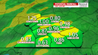
SOME FLAKES RETURN: A weak clipper system brings a kiss of snow to the region before milder temperatures arrive through the weekend. The morning starts with plenty of clouds, but it’s dry. Temperatures begin in the middle teens to lower 20s. Snow showers arrive during the midday hours, and a brief period of light snow is possible for some through late day and into the early evening. It would be nothing major, but it could make for some slippery spots. Accumulations range from a coating to an inch for most. It’s still on the cold side for this time of year, with temperatures in the lower to middle 30s. The snow showers are gone in time for Friday evening plans, but the clouds remain. Temperatures dip to near 30 degrees. The clouds linger through the rest of the night. Readings only dip a touch lower, with numbers in the middle 20s to near 30 degrees.


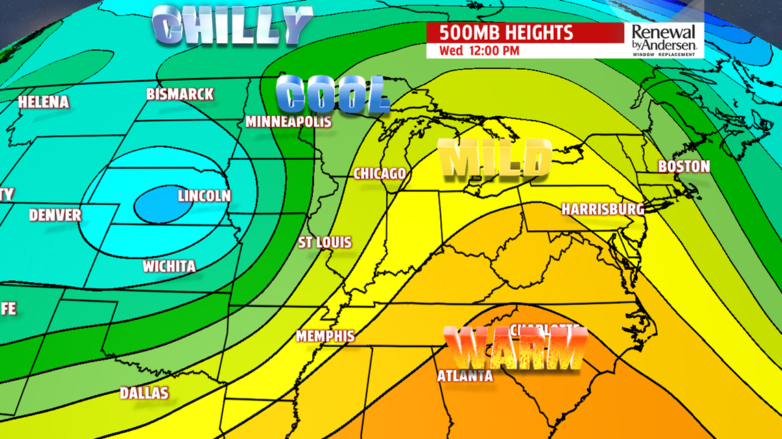
MILDER NEXT WEEK: Monday remains dry with mostly sunny skies. Although it is breezier, it’s another mild day. Expect readings in the upper 40s to lower 50s. There’s a dip in temperatures for Tuesday. Skies are still mostly sunny, and there’s still a bit of a breeze. Expect temperatures in the lower 40s. Wind chills feel like the middle to upper 30s. Wednesday temperatures start to increase again. Expect those readings in the middle to upper 40s. Skies start sunny, but more clouds are expected during the afternoon ahead of the next system. Showers chance from this system hold off until Thursday. Temperatures reach the upper 40s to lower 50s.
Stay Weather Smart with FOX43! Have a great weekend!
