


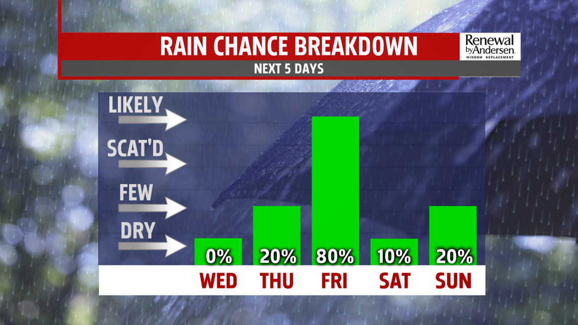
DAMP END TO THE WEEK: Thursday brings increasing clouds ahead of the next system. Most of the day is dry, but a few late day showers are possible. Temperatures reach the middle to upper 50s. Showers overspread through the night, and they continue into Friday. In fact, expect showers through the entire day. Temperatures are chillier, with readings in the upper 40s to lower 50s. The showers continue through Friday night.
WEEKEND/NEXT WEEK OUTLOOK: There’s some discrepancies on when the showers come to an end, but overall the weekend should turn much drier. Expect some morning showers on Saturday that lead to drier afternoon conditions. The clouds should start to break as well. It’s milder, with temperatures reaching the lower 60s. Sunday is mainly dry too, with some sunshine. Expect temperatures a little bit higher in the 60s. Monday is warm, but there’s the chance for some showers with the next system. Temperatures could reach 70 degrees before the showers arrive! Tuesday is still warm, but there’s still the chance for a few showers. Expect temperatures in the 60s.
Stay Weather Smart with FOX43! Have a great Wednesday!
