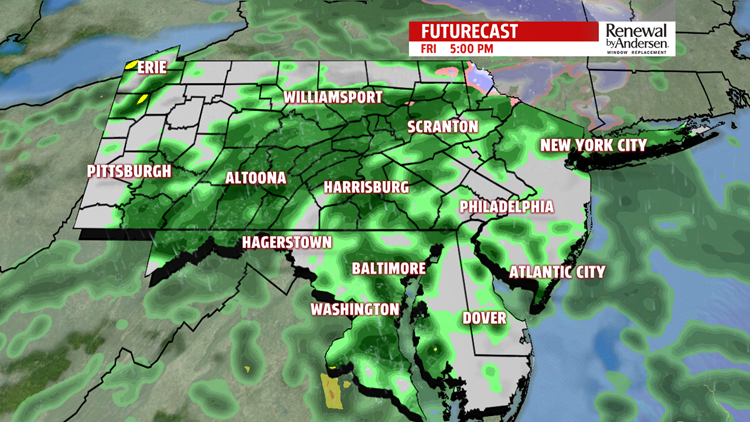

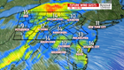

DAMP END TO THE WEEK: The next storm system is crossing through Central PA, and it makes for a dreary, chilly, breezy and damp Friday. Expect light, isolated showers through much of the morning. There is dry time, with temperatures starting in the upper 30s to lower 40s. Showers start to fill in throughout the rest of the region around the midday hours. Plenty of showers are expected to continue through the afternoon. Chilly east breezes make temperatures slow to rise through the day. They crawl through the 40s during the morning and the afternoon. Temperatures reach the middle to upper 40s by the evening. The showers fade through the late evening and the overnight, and they dry up before daybreak. Temperatures stay in the middle to upper 40s.


WEEKEND OUTLOOK: The weekend is much more optimistic overall for Central PA, especially on Saturday. Morning clouds lead to plenty of sunshine during the afternoon. The winds are light, and temperatures are much milder. Those temperatures reach the lower to middle 60s. Sunday is mainly dry too. Some sunshine to start leads to more clouds during the afternoon. It’s mainly dry, but a few light showers can’t be ruled out during the afternoon, especially west. Expect temperatures a little bit higher, with readings in the middle to upper 60s. Some spots could even touch 70 degrees, depending on how much sun can sneak in during the afternoon.
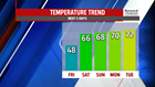
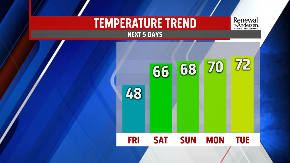
WARM/RAIN CHANCES NEXT WEEK: Monday is warm, but there’s the chance for some showers with the next system. Temperatures could reach 70 degrees before the brunt of the showers fill in across the region! Tuesday is still warm, but there’s still the chance for a few showers. Expect temperatures in the 60s. Wednesday dries out, with mostly sunny skies expected. Temperatures cool off a bit, with readings falling into the middle 50s. The next storm system approaches Thursday, bringing plenty of clouds. Depending on the timing and the positioning of the system, a shower or two could sneak into the region. Readings are closer to 60 degrees.
Stay Weather Smart with FOX43! Have a great weekend!