

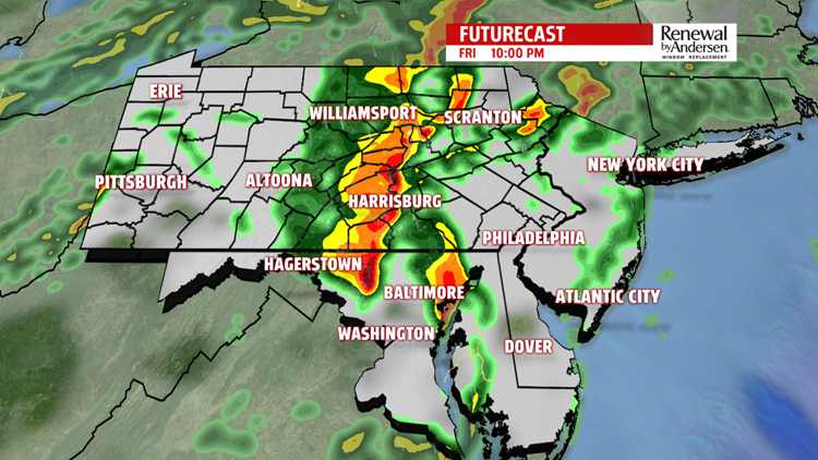
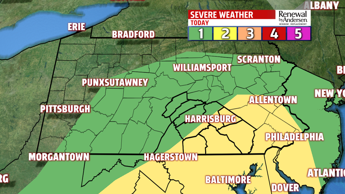

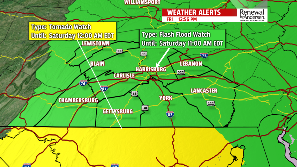

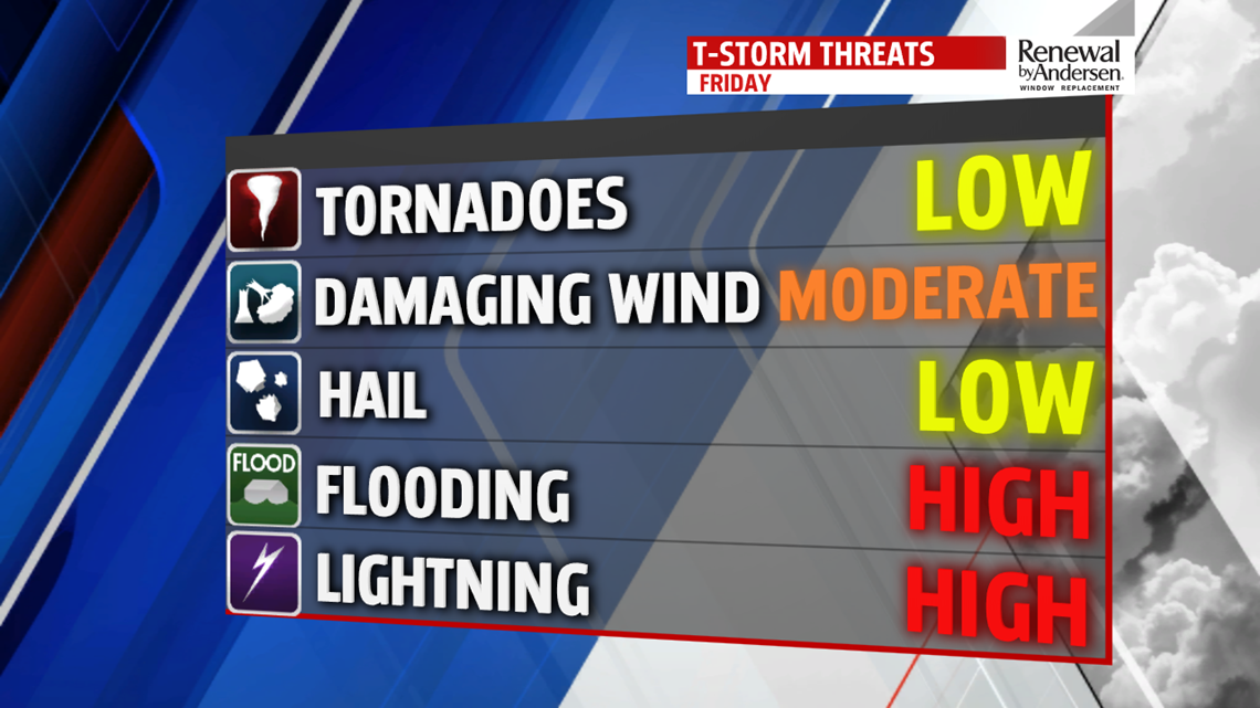
STRONG THUNDERSTORMS, FLASH FLOODING LIKELY: Parts of Central Pennsylvania is in a SLIGHT RISK threat for severe weather today. On a scale of 1-to-5, most of the area is at a 2. The northwest counties remain in a MARGINAL RISK or a 1 on a scale of 1 to 5. Most everyone will see moderate-to-occasionally heavy rainfall at some point today. A FLASH FLOOD WATCH is in effect from 2PM Friday through 11AM Saturday. A few thunderstorms start as early as 2PM in our southwestern spots. This time of spotty thunderstorms ahead of the main line will persist for a couple of hours.

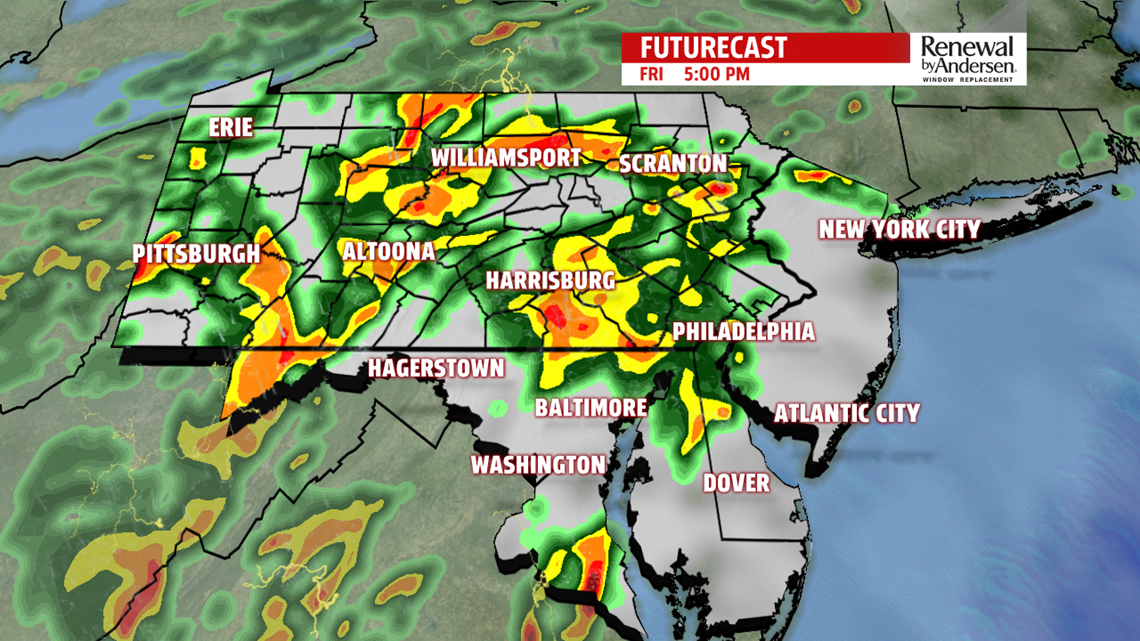
This is the prime time for any severe activity. However, the threat will continue through the evening as showers and storms become more widespread with a slowing front pushing through.
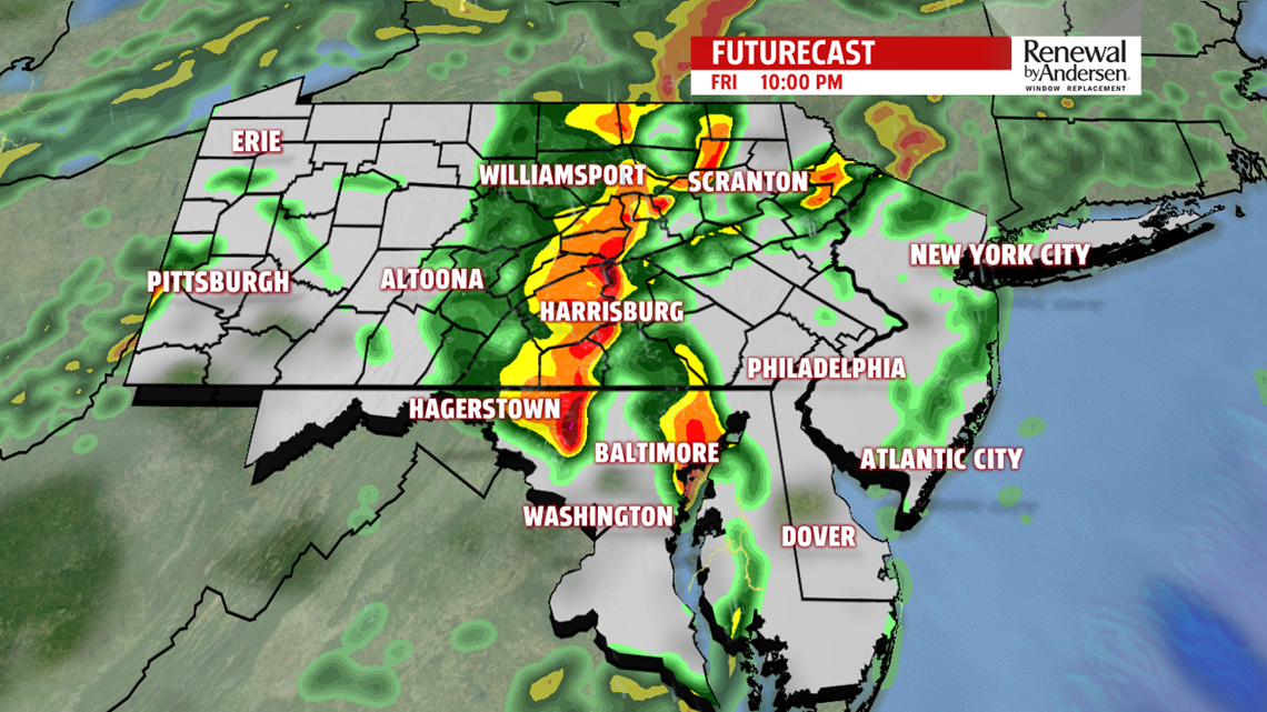


Gusty winds up to 60MPH will be possible with torrential rainfall at times area-wide. A very low tornado threat exists with the early storms, but is not likely. Thunder and lightning will be common throughout the evening and overnight. When all is said and done, 1-2″ of rainfall will be the norm for all of the area, with locally higher totals possible. We dry out around sunrise Saturday.

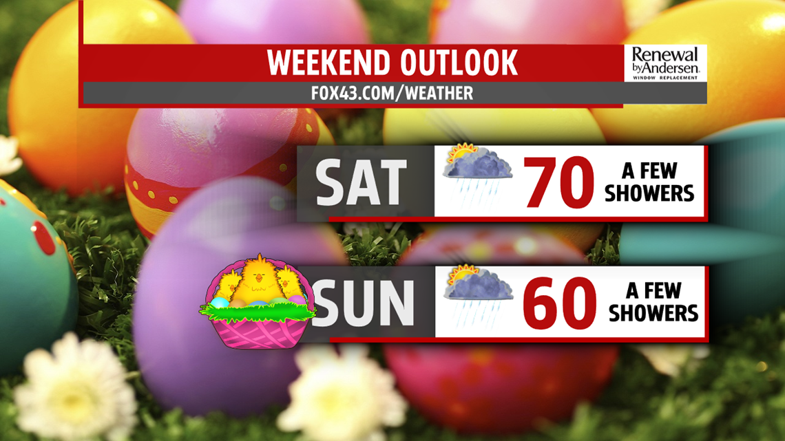
EASTER WEEKEND: Most of Saturday shapes up nicely. A few straggling morning showers will be possible, but we’ll see some sun throughout the day. A mild morning start in the 60s will give way to a high temperature near 70-degrees. Easter Sunday will have a few more showers and cooler temperatures. Don’t cancel any plans, but have an umbrella handy and be ready to bring plans inside temporarily. However, most of the day we should be in good shape. High temperatures near 60-degrees will be the norm.

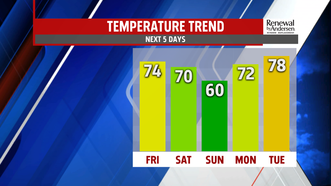
HEADING INTO NEXT WEEK: We warm up quickly next week. A couple showers will be possible Monday with high temperatures in the low-70s. Tuesday gets another boost with afternoon temperatures just shy of 80-degrees. We’re watching a thunderstorm chance Tuesday afternoon with another cool front passing through. The front will drop temperatures to the upper-60s and low-70s for the middle part of next week.
Stay “Weather Smart” with the FOX43 Weather Team all week long!
-Chief Meteorologist MaryEllen Pann
