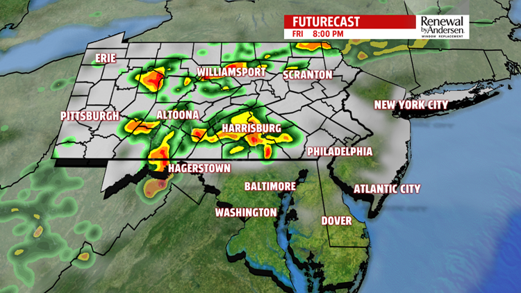

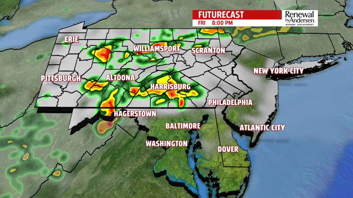
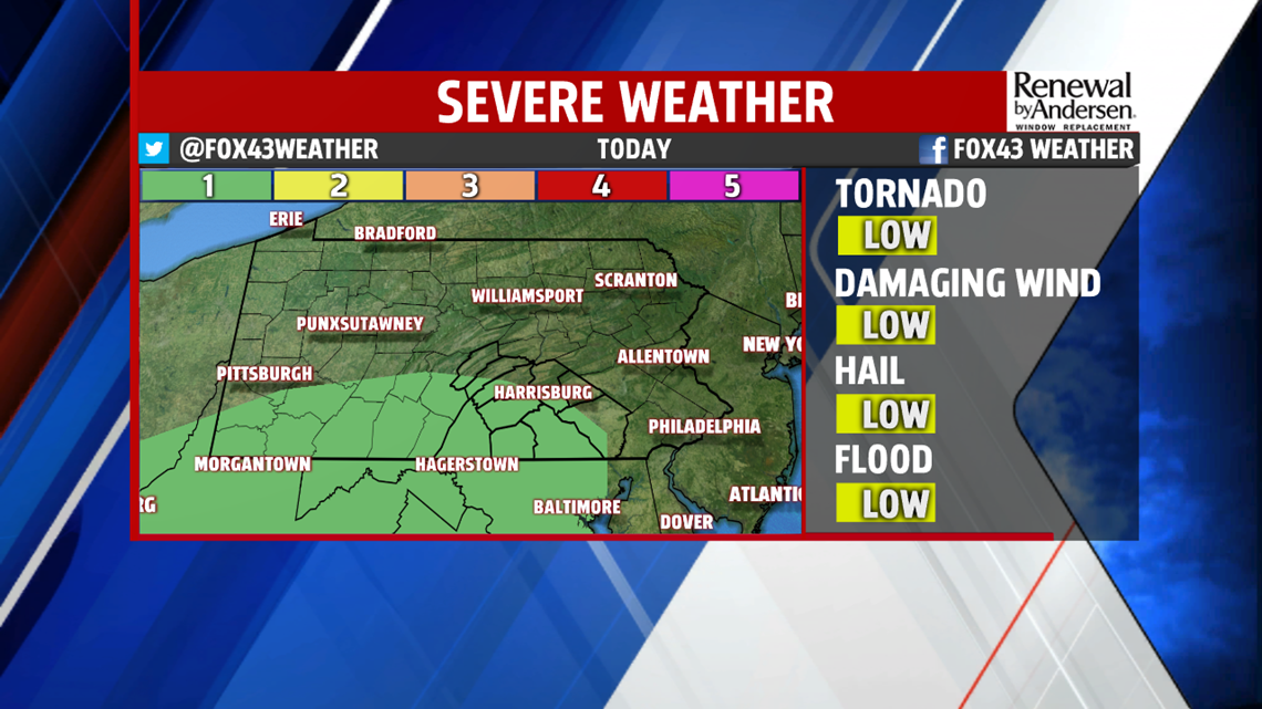
FINISHING UP FRIDAY: Isolated thunderstorms will be possible in our area throughout the rest of the afternoon. Morning cloud cover will limit development and severe capability, but a very low risk of severe weather still exists. Afterwards, later in the evening, a more widespread shower and thunderstorm chance persists into the overnight time frame. Lightning, gusty winds and flash flooding are the main concern. There is a very low tornado risk as well. Storms first develop, isolated in nature, beginning as early as 3-4PM. The isolated thunderstorms continue until the line becomes more widespread just after the dinner time frame. We slowly quiet down after midnight.

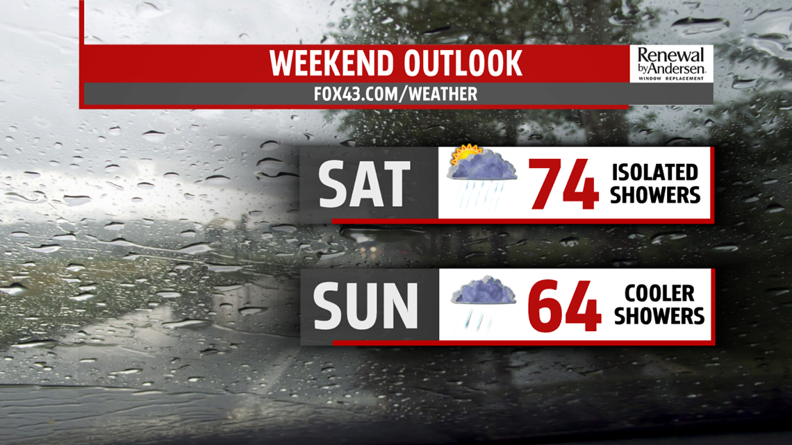
RAINY WEEKEND: Spotty showers will remain with cloudy conditions Saturday. Highs near 70-degrees will be the norm. More widespread showers persist on Sunday with much cooler conditions and overcast skies for most of the day. Highs stay in the mid-60s with morning lows in the 50s.
HEADING INTO NEXT WEEK: We dry out a bit early next week, but late showers will be possible on Monday with highs in the mid-70s. A few thunderstorms will be possible Tuesday before more significant chances of thunderstorm activity move in next Wednesday and Thursday with current forecast guidance. Stay tuned for updates. Highs stay in the mid-to-upper 70s for most of next week.
Stay “Weather Smart” with the FOX43 Weather Team all week long!
-Chief Meteorologist MaryEllen Pann