
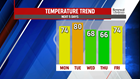
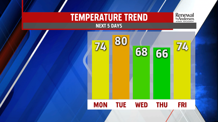


TURNING CLOUDIER & MORE UNSETTLED: The front stalls nearby across the region, and an east flow starts to build through the middle of the week. It’s enough to bring plenty of clouds for Wednesday, and perhaps a few showers. Temperatures are much cooler, but close to seasonal averages for this time of year. Expect highs in the middle to upper 60s. Thursday looks fairly cloudy with a better chance for a few showers. Temperatures are in the lower to middle 60s. Another cold front approaches for Friday, and this brings a return to more widespread showers and thunderstorms. It should allow some warming to take place too. Temperatures reach the lower to middle 70s depending on the timing of the next cold front.
WEEKEND OUTLOOK: The weekend looks 50/50 at this point. Saturday could bring a few clouds to start, but there should be plenty of sunshine for the afternoon. Temperatures are in the upper 60s to lower 70s. Sunday turns more unsettled. Expect plenty of clouds and the chance for showers. Temperatures turn cooler, with readings in the lower to middle 60s.
Stay Weather Smart with FOX43! Have a great Monday!
-Andrea Michaels
