


ENJOY THE COOL ONE: Cooler air continues to dominate as we head into Tuesday. After a near-record setting morning low, temperatures raise into the low-to-mid 70s area-wide by the afternoon. A few places may stay in the upper-60s. Sunny skies persist on an otherwise gorgeous Tuesday afternoon.


THUNDERSTORMS RETURN: Morning lows are milder for Wednesday with partly cloudy skies. Lows dip into the 50s. By the afternoon, thunderstorm chances return. We are in a low severe weather threat tomorrow. On a scale of 1-to-5, we’re only at a 1. Isolated thunderstorms start in the mid-afternoon and increase in number through the mid-evening hours. Gusty winds and heavy downpours are the main concern with the possibility of some small hail. The tornado threat is next-to zero. Highs hit the low-80s. We’ll do it all again Thursday with highs in the mid-80s, a few degrees warmer than Wednesday.

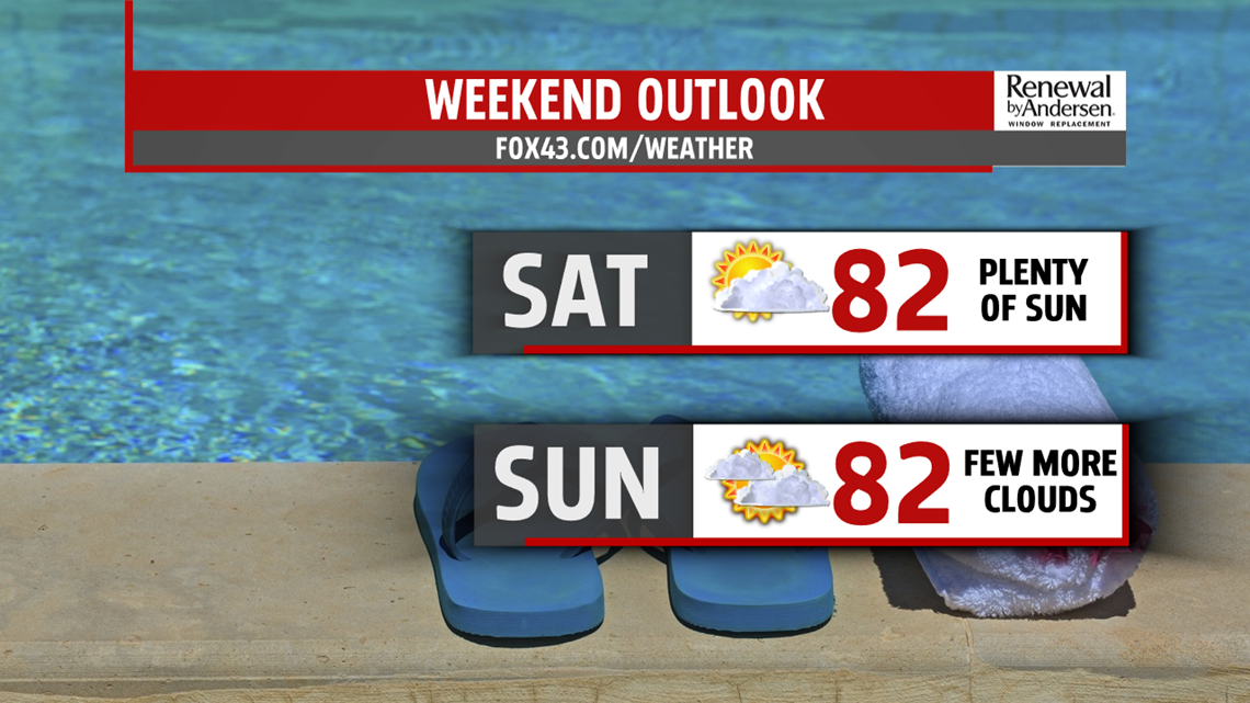
HEADING INTO THE WEEKEND: We quiet down for Friday to finish the work week. Partly cloudy skies will be the norm with highs in the low-to-mid 80s. Much of the same starts our Saturday and continues into Sunday. A few showers or rumbles of thunder will be possible Sunday, but the overall chance is low heading into next week.
Stay “Weather Smart” with the FOX43 Weather Team all week long!
-Meteorologist Bradon Long
