


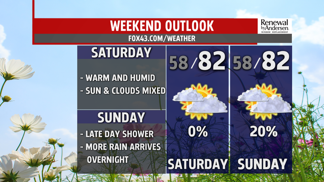
WEEKEND OUTLOOK: Dry conditions should continue into the weekend, but we’ll be watching an approaching system, particularly on Sunday. Expect partly cloudy skies on Saturday. Temperatures reach the upper 70s to lower 80s. Conditions are similar for Sunday. The only difference for now appears to be a little extra cloud cover. So, it’s partly sunny to mostly cloudy skies. Temperatures are back into the upper 70s to lower 80s. There’s a small chance for a stray shower or thunderstorm later during the day, but most spots should manage to stay dry. More widespread shower activity moves in through the evening and overnight.
UNSETTLED NEXT WEEK: Shower and thunderstorm chances increase through early next week. Monday brings a shot at widespread showers and thunderstorms, with some heavy downpours possible. Temperatures are in the middle to upper 70s. There are still some lingering shower chances for Tuesday morning. The afternoon looks drier with some sunshine. Temperatures reach the middle to upper 70s. Conditions are muggier too for both Monday and Tuesday. Wednesday brings drier conditions and near seasonable temperatures. There’s sunshine, with temperatures in the middle 70s. The humidity is a bit more comfortable too.
Stay Weather Smart with FOX43! Have a great Thursday!
-Andrea Michaels
