


HEADING INTO THE WEEKEND: Breezy conditions continue into the early evening hours after a high in the mid-70s. Winds calm overnight with lows in the mid-50s. They tick back up again, just not as strong as today, heading into Saturday afternoon. Our humidity increases as well. Partly cloudy skies dominate with highs in the low-80s. A warm southerly wind keeps us mild heading into Sunday with a bit more cloud cover. Morning lows for Father’s Day stay in the mid-60s.

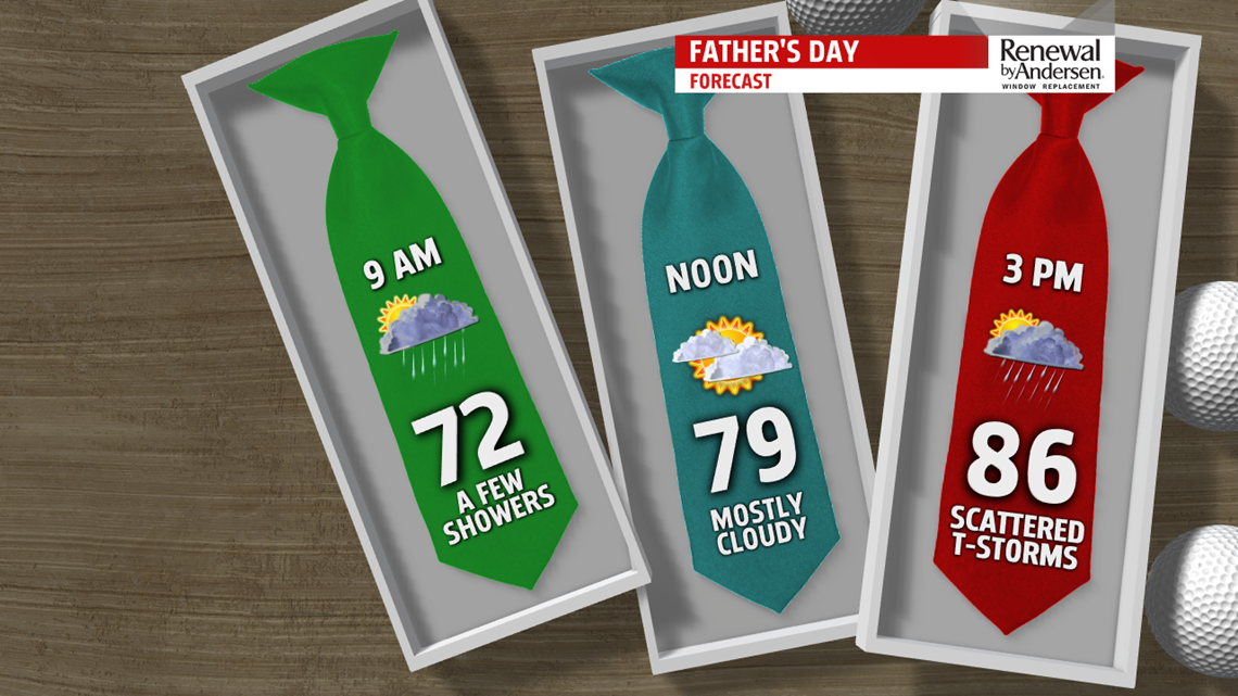
FATHER’S DAY: A few showers can’t be ruled out Sunday morning to kick off the holiday. Some dry time allows temperatures to warm into the mid-80s, which will be enough fuel for afternoon and evening thunderstorms. A few could be strong with a muggy afternoon feel. Temperatures drop into the mid-60s again heading into Monday morning with some lingering shower activity.
STORMY NEXT WEEK: Muggy and stormy conditions continue into next week. Morning lows stay in the mid-60s through Thursday and afternoon highs range from the low-to-mid 80s. Thunderstorm chances will be possible each and every day, many of which will likely be strong if they come to fruition. Stay tuned on-air, online and on the FOX43 Weather App for updates to your location.
Stay “Weather Smart” with the FOX43 Weather Team all week long!
-Chief Meteorologist MaryEllen Pann
