


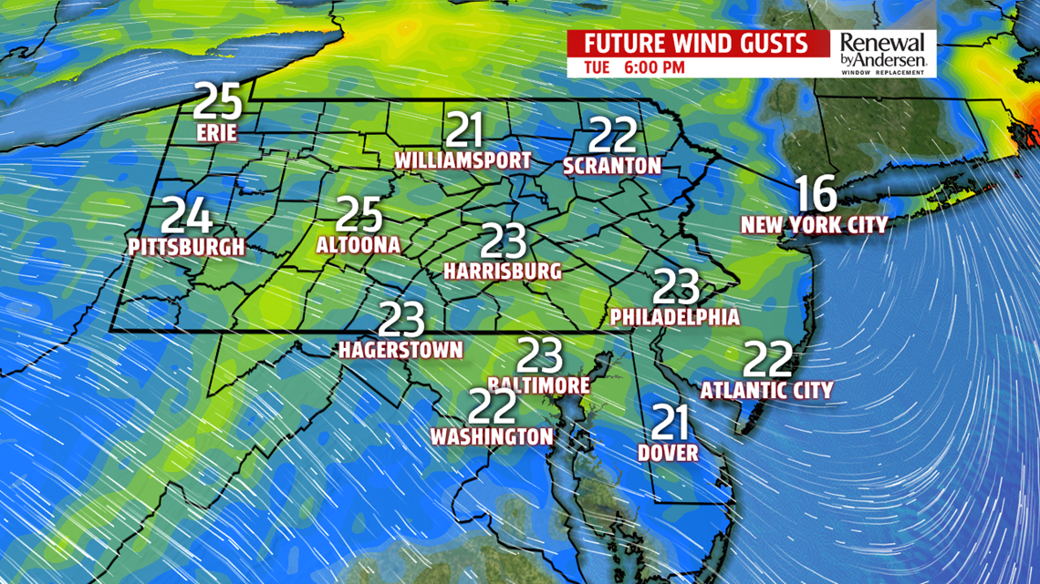
ENJOY A BREAK FROM THE MUGGINESS: Humidity values continue to drop throughout the rest of the afternoon and into tomorrow morning. Though, we’re still plenty warm with highs in the upper-80s for most. We’re occasionally breezy with westerly winds gusting to 20MPH. That should be our only complaint. Lows drop into the low-to-mid 60s as skies clear the further we press on into the day and overnight. Humidity values begin to return Wednesday and rise back up into the muggy category by Wednesday afternoon. Highs in the upper-80s will be the norm again. A stray late evening thunderstorm will be possible, but not likely.

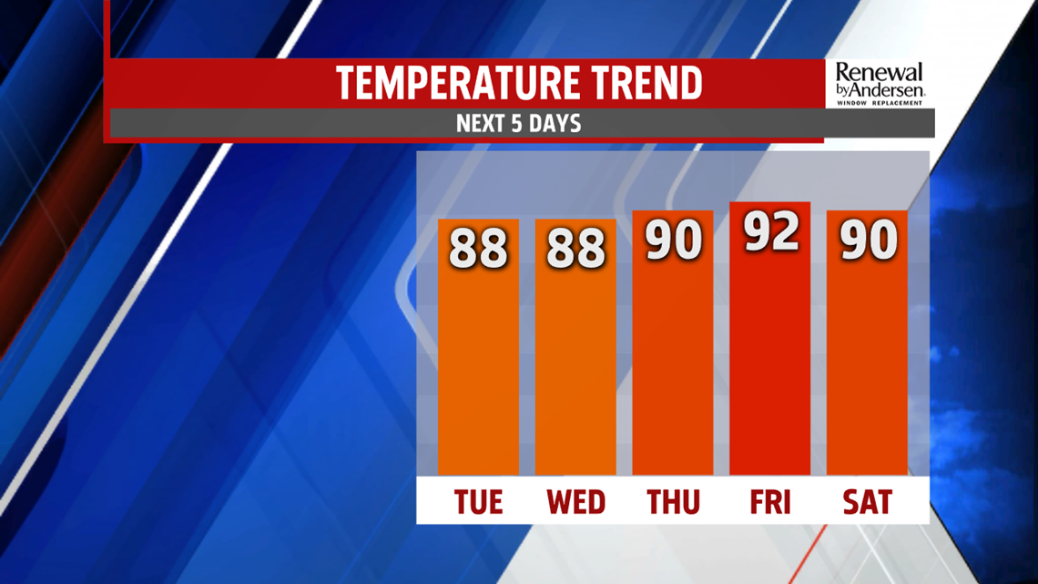
IT GETS HOT: With the added humidity and partly-to-mostly clear skies, lows stay in the low-70s Thursday morning. Abundant sunshine and a slight wind shift means we’re forecasted to hit the 90-degree mark Thursday afternoon. Not only that, heat index values will rise into the mid-to-upper 90s. High UV index values will bring burn times into the 15-minute range as well. Stay hydrated and try to limit work outdoors. Friday is a near carbon copy of Thursday, but highs get an extra degree or two by the afternoon.

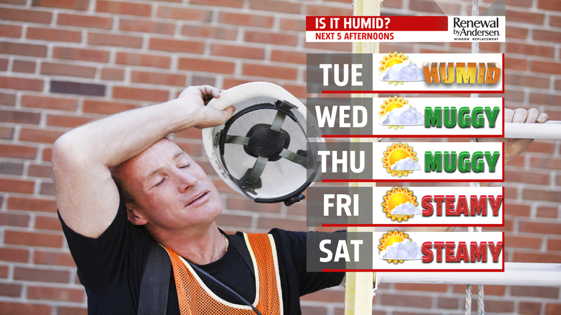
HEADING INTO THE WEEKEND: A thunderstorm or two can’t be ruled out Saturday, but the chance is relatively low. Highs right around the 90-degree mark persist with continuous high humidity values. Morning lows stay near 70-degrees as well with partly-to-mostly sunny skies. Upper-80s finish the weekend before a slightly cooler and drier start to next week.
Stay “Weather Smart” with the FOX43 Weather Team all week long!
-Meteorologist Jessica Pash
