


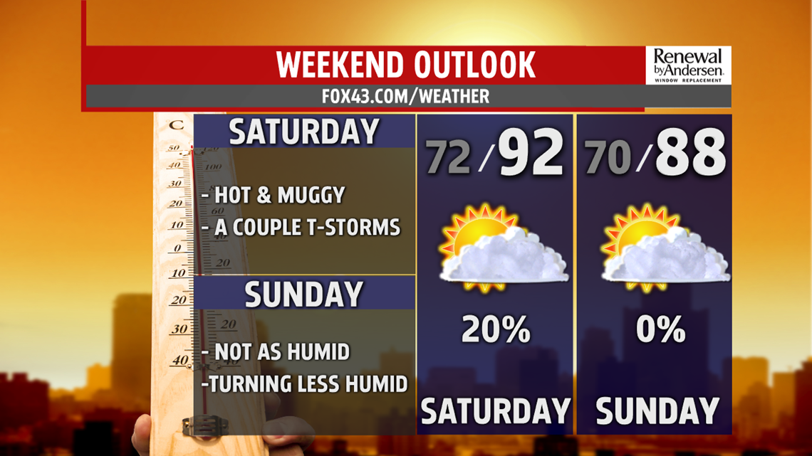
WEEKEND OUTLOOK: Temperatures likely come down a touch through the end of the week, with some thunderstorm chances sneaking into South Central PA. Saturday brings this chance for a couple thunderstorms during the afternoon. Otherwise, it’s muggy again. Temperatures are in the middle to upper 80s, but some spots could touch 90 degrees again depending on the thunderstorm chances. Sunday sees slightly lower temperatures, and humidity levels come down just a touch too. So far, skies look partly cloudy and dry. Temperatures reach the middle to upper 80s.
NOT AS HOT NEXT WEEK: Temperatures are near average to begin the new week, but the warmth should build fast. Monday temperatures come down just a touch compared to Sunday, with readings in the middle 80s. Humidity levels are more comfortable too, especially during the morning! Skies are partly cloudy, but there is a small chance for a stray shower or thunderstorm. The warmth starts to increase again, and so does the humidity, on Tuesday. Expect sunshine mixed with some clouds. Temperatures reach the middle 80s to near 90 degrees. A stray shower or thunderstorm is a possibility again. Wednesday brings more of the same. Temperatures make a go at 90 degrees again, with the chance for a stray shower or thunderstorm. Heat indices are in the lower to middle 90s.
Stay Weather Smart with FOX43! Have a great Thursday!
-Andrea Michaels
