
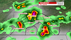


FOURTH OF JULY: Our muggy and hot stretch continues into the holiday. After a Wednesday high in the low-90s with isolated thunderstorms, morning lows dip into the low-70s. Partly cloudy skies remain. A slightly higher chance of showers and storms moves in during the afternoon. These will be slow-moving storms based off of the humidity. They could be quite strong with localized heavy rainfall. If they move slow enough, flash flooding could be a brief concern. These popcorn storms will continue into the evening. High temperatures reach the low-90s once again with a heat index in the upper-90s. Don’t cancel any plans, but be ready to head indoors if a storm is near you. Keep the FOX43 Weather App handy.


HEADING INTO THE WEEKEND: More storms likely heading into Friday after a morning low, again, in the low-70s. Afternoon highs make it just shy of 90-degrees with similar timing for showers and storms. Same goes for Saturday with highs near 90 and afternoon storm chances. Otherwise, muggy skies remain partly-to-mostly sunny. Heat index values near the 100-degree mark.
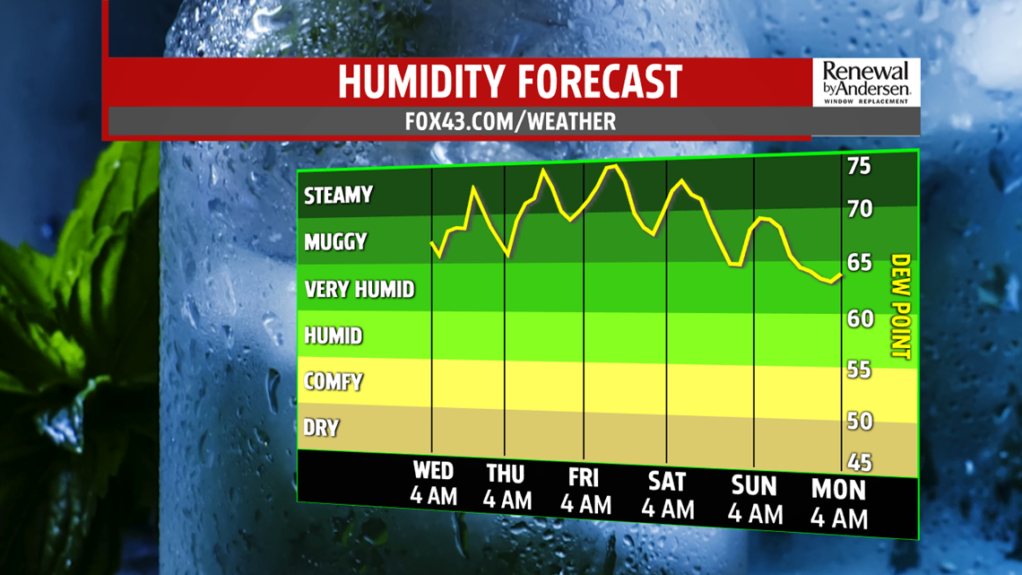
LESS HUMID NEXT WEEK: Humidity values begin to decline late Sunday with a stray storm possible in the afternoon. Highs stay in the upper-80s. Monday morning kicks off in the upper-60s with partly cloudy skies. Highs only make it into the mid-80s with a significantly more comfortable feel as humidity values remain lower through the middle of next week.
Stay “Weather Smart” with the FOX43 Weather Team all week long!
-Chief Meteorologist MaryEllen Pann
