

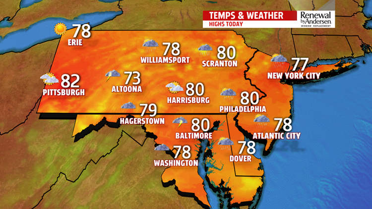


SHOWERS FIZZLE, CLOUDS STAY: Showers persist throughout the remaining morning hours and fizzle out by lunchtime. A FLASH FLOOD WATCH is in effect for our entire area, except Lancaster County, until 10AM. Don’t be surprised if that is canceled before its official expiration time. Regardless, temperatures struggle after the showers because of leftover cloud cover. We keep the humidity through Monday, but high temperatures near the 80-degree mark will be the trend area-wide. We start to lose the humidity overnight with slowly clearing skies and lows in the mid-60s.

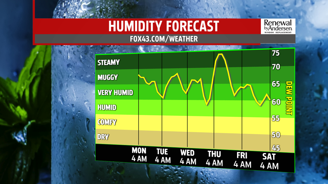
WARMING UP, BUT DRY: Drier air is pulled into the area heading into Tuesday with partly cloudy skies. Temperatures, however, will rebound into the mid-80s with a stray pop-up shower possible. Most, if not all of us, stay dry. A near copy for Wednesday with morning lows in the upper-60s. We’ll see a little more sunshine with mostly sunny skies. Highs creep up an extra degree or two with highs in the mid-to-upper 80s.
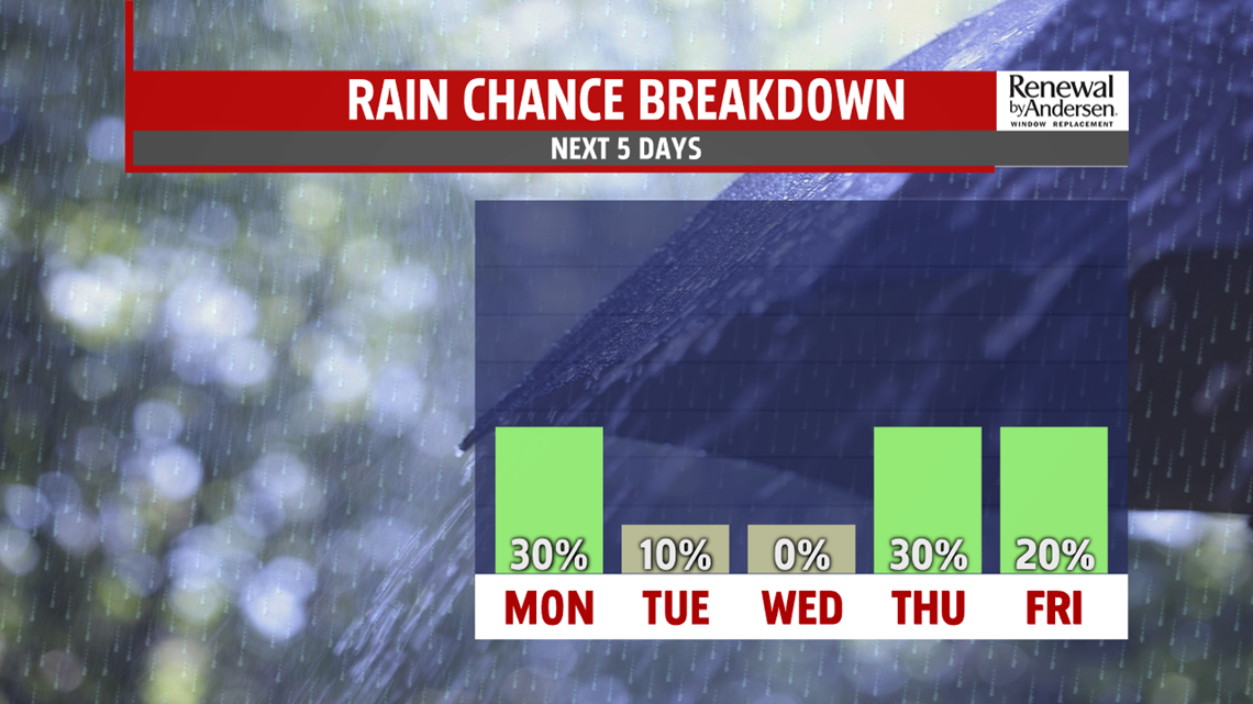
HEADING INTO THE WEEKEND: Our only organized threat for storms moves in on Thursday. A quick uptick in humidity occurs ahead of the storm chance with highs in the mid-to-upper 80s. A few of these storms could be strong-to-severe with current forecast guidance. Stay tuned for updates. We dry back out heading into the weekend, but temperatures stay near average in the mid-to-upper 80s with a 90 creeping back in by Sunday.
Stay “Weather Smart” with the FOX43 Weather Team all week long!
-Meteorologist Bradon Long
