


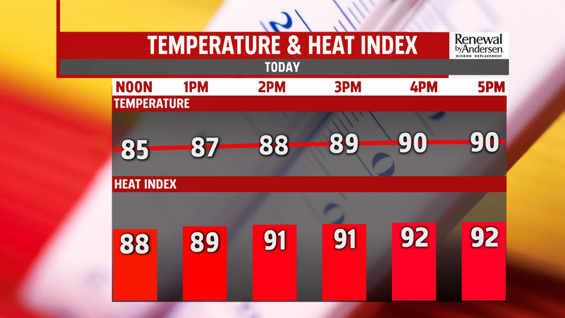
HOT AND SUNNY: A usual July Wednesday on tap for our area today. Morning temperatures start in the upper-60s with afternoon highs in the near-90 degrees. This will be just slightly above average. Heat index values will be in the low-90s with light winds and mostly sunny skies. Increasing cloud cover begins in the evening hours. We dip back just shy of 70-degrees heading into Thursday morning.

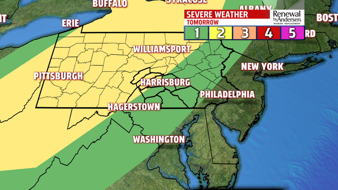
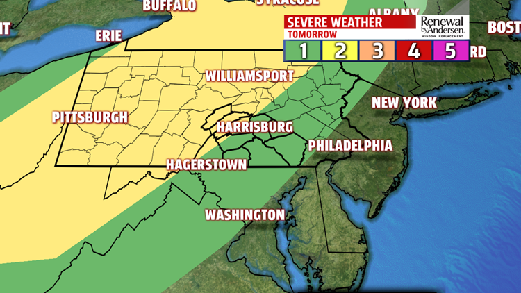
SEVERE WEATHER THREAT: Thursday afternoon brings back the only thunderstorm threat of this week. On a scale of 1-to-5, our northwestern counties are at a 2 in the yellow-shaded region. The rest of the area is at a 1 in the green. Isolated thunderstorms will begin in the early afternoon, perhaps as early as 1PM. These could be strong, will be slow-moving with heavy rain and gusty winds. The main line of thunderstorms with the highest severe weather potential will move in starting around 4-5PM in our northwestern counties. These will track through the area throughout the evening. Damaging winds, heavy rain which could lead to localized flash flooding and lightning are our main concerns. However, there is a very low tornado threat. Stay tuned for updates heading into tomorrow. Temperatures reach the mid-to-upper 80s before the storms move through. We dry out heading into Friday morning with a straggling shower or two, keeping some of the cloud cover, with a morning low near 70-degrees.

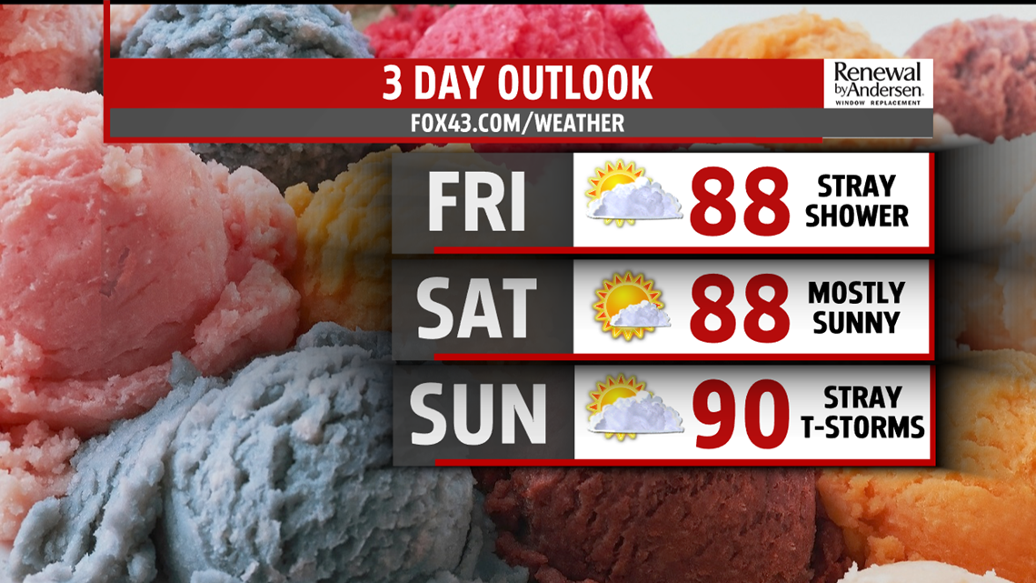
HEADING INTO THE WEEKEND: Friday shapes up mostly dry with partly-to-mostly sunny skies. Afternoon highs reach the upper-80s and just shy of 90-degrees. A near exact copy for Saturday with a bit more sunshine. Morning temperatures start the weekend in the mid-to-upper 60s and afternoon highs in the upper-80s. Stray thunderstorms will be possible Sunday through Tuesday with morning temperatures near 70 and afternoon temperatures on either side of the 90-degree mark.
Stay “Weather Smart” with the FOX43 Weather Team all week long!
-Meteorologist Bradon Long
