


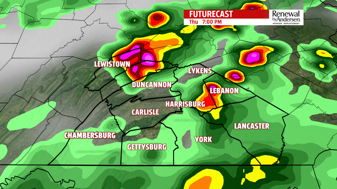


SEVERE WEATHER THREAT: Muggy conditions return in a big way throughout the day today. This is ahead of our severe weather chance. Heat index values before showers and storms move in will reach the mid-90s. A FLASH FLOOD WATCH is in effect for Adams, Cumberland, Dauphin, Franklin, Lancaster, Lebanon and York counties until 1AM Friday. Thunderstorms will develop in the afternoon with the potential to go severe. We are in a slight risk of severe weather this afternoon. On a scale of 1-to-5, we’re at a 2. Damaging winds and localized flash flooding are our main concerns. Small hail is a lesser concern with the lowest-of-all tornado threats. Keep the FOX43 Weather App handy. Starting as early as 1PM, pop-up storms develop ahead of the main show later in the afternoon. These will be relatively slow-moving until the cool front driving the main line forces them to get their act together. The main line of storms heads in for the later portions of the evening rush and into the mid-evening hours, around 5-8PM. We’ll have stragglers throughout the 10PM hour with stray lingering showers into the overnight.

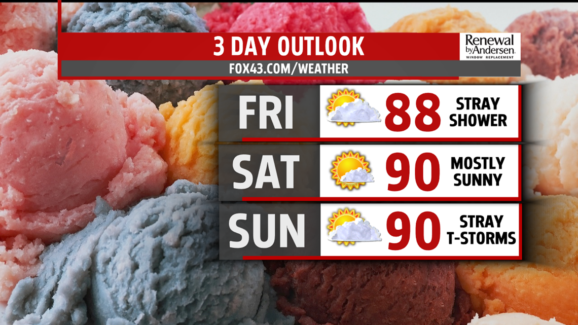
HEADING INTO THE WEEKEND: We dry out Friday morning but still stay firm in our humid category through the weekend. Temperatures reach the mid-to-upper 80s with otherwise under partly-to-mostly sunny skies. We get to 90 for Saturday after a morning low in the mid-to-upper 60s. Mostly sunny skies dominate the first half of the weekend with light winds.
POP-UP STORMS RETURN: A slight kick in humidity Sunday steps in Sunday and stays through the middle part of next week. This means a return of our pop-up (a.k.a “popcorn”) thunderstorms. Few and far between, stray slow-moving thunderstorms with locally heavy rainfall could develop. Don’t change any plans. Highs reach the 90-degree mark once again and continue on either side of it through the middle part of next week.
Stay “Weather Smart” with the FOX43 Weather Team all week long!
-Meteorologist Bradon Long
