
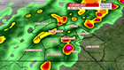


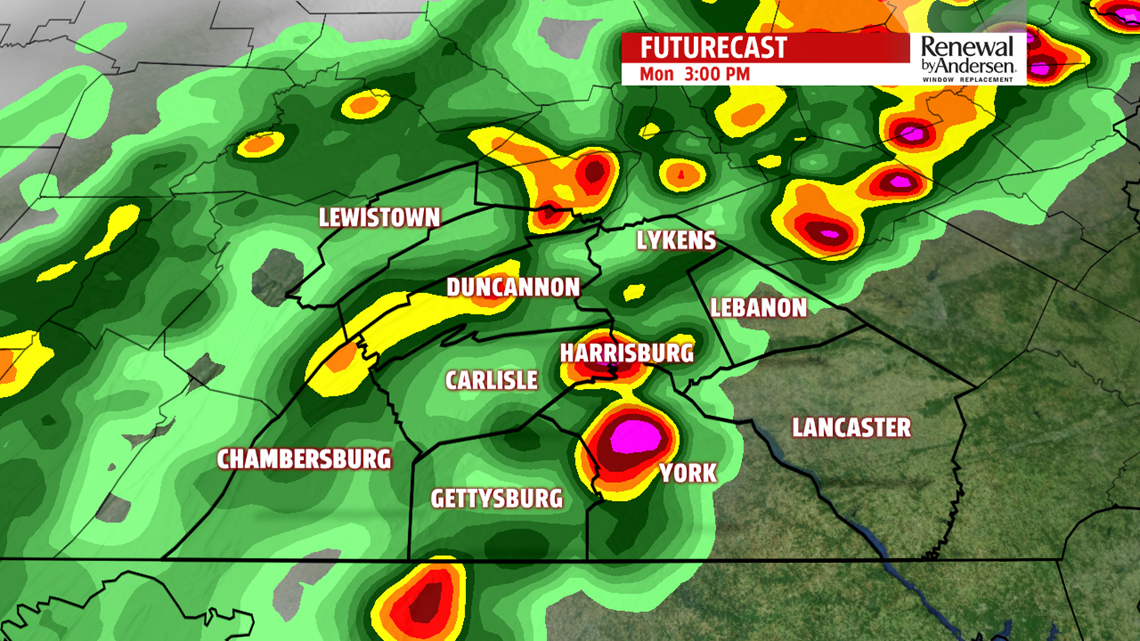

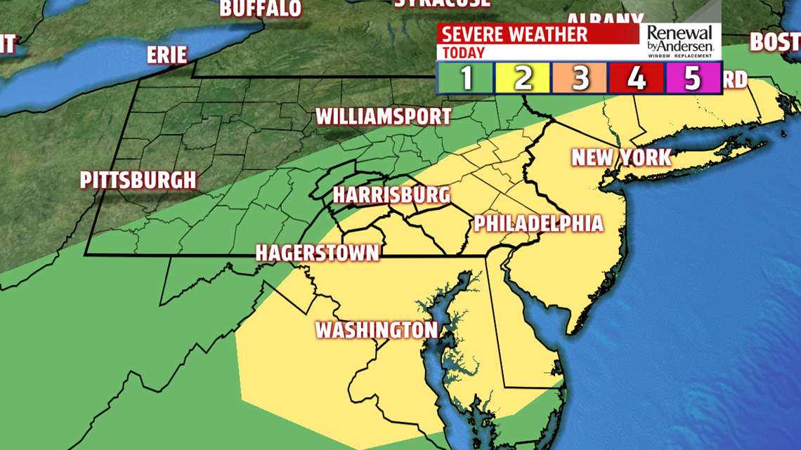

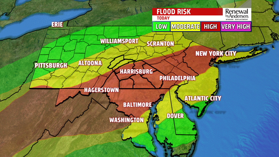
SEVERE STORMS POSSIBLE: Thunderstorms are likely this afternoon and evening with a low severe weather threat. On a scale of 1-to-5 we’re at a 2 in the yellow-shaded region, including most of the area south and east of I-81. Our northwestern counties are in a marginal risk, a 1 on a scale of 1-to-5. Thunderstorms develop in the early afternoon in our northwestern counties and progress throughout the area into the evening time frame. The frontal system with the storms will begin to stall out as it pushes to the south. Thunderstorms could linger into the overnight time frame especially our southern counties. Our main concerns today are flash flooding and damaging winds. A FLASH FLOOD WATCH is in effect for most of the area (except Mifflin and Juniata counties) until 2AM Tuesday. There is a very low threat for hail and an even smaller threat for a tornado. Keep the FOX43 Weather up handy and stay tuned for updates throughout the afternoon and evening.
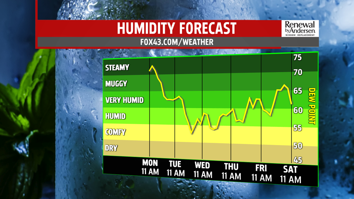
PRETTY COMFY: After a lingering morning shower, we clear out by Tuesday morning as humidity declines quickly. Mostly cloudy skies dominate with a high near 80-degrees.. Overnight lows dip into the low-60s heading into Wednesday morning with partly cloudy skies in the afternoon. Highs will remain in the mid-80s both Wednesday and Thursday for a much more comfortable feel to the work week.
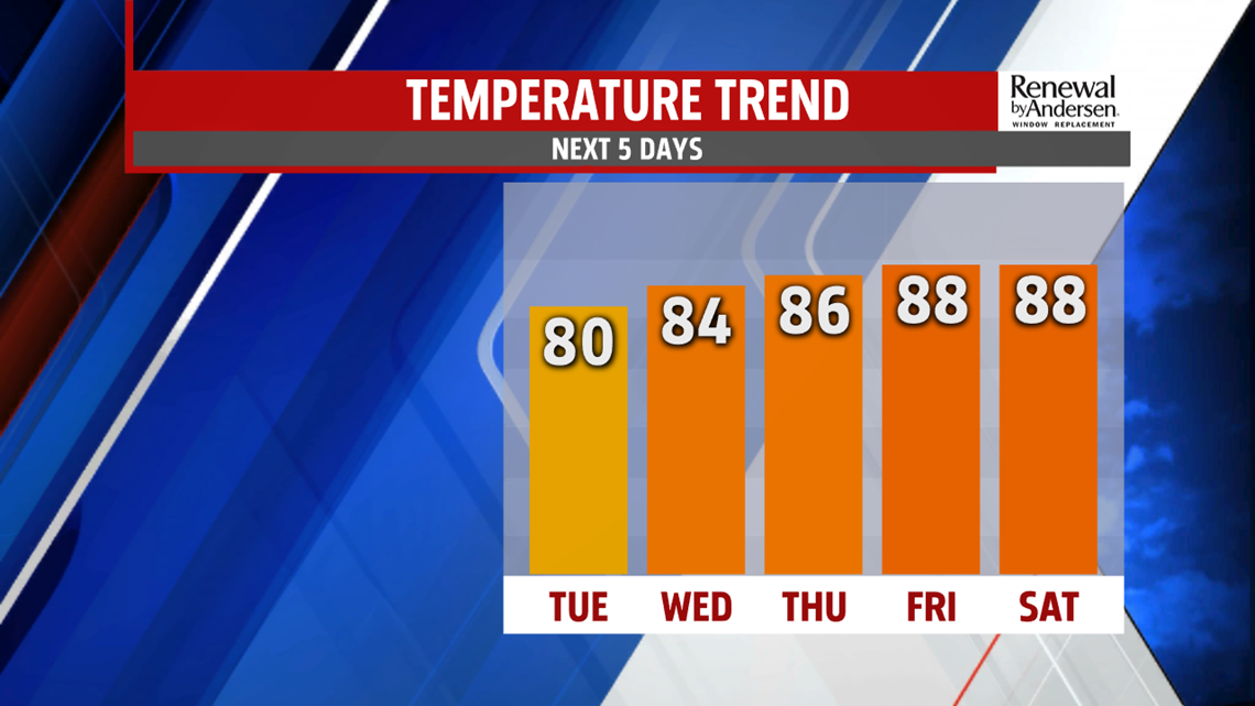
HEADING INTO THE WEEKEND: Humidity begins to rise as we head into the weekend with warmer temperatures. Mostly sunny skies dominate Friday with a high near 90-degrees. The same can be said for Saturday and Sunday with morning low rising to just shy of 70-degree mark. Otherwise, a mostly dry end of the Weather Smart 7-Day Forecast until the beginning of next week.
Stay “Weather Smart” with the FOX43 Weather Team all week long!
-Chief Meteorologist MaryEllen Pann
