


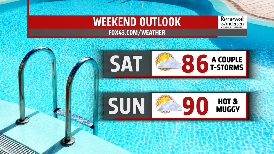
WEEKEND OUTLOOK: The pattern remains mainly dry through much of the weekend, with temperatures slowly starting to creep back up. Saturday brings partly sunny skies with the chance for a couple thunderstorms. Temperatures reach the middle 80s, near average for this time of year. Sunday is dry under partly cloudy skies. Temperatures are in the upper 80s to near 90 degrees. High humidity makes heat indices feel like the lower 90s. It’s still muggy through the weekend.
NEXT WEEK: Monday brings lower temperatures, with readings back into the 80s everywhere. The humidity remains in place. Tuesday turns hotter, with temperatures in the middle 80s to near 90 degrees. With high humidity levels in place, heat index values reach the lower to middle 90s. An approaching cold front brings the chance for isolated afternoon thunderstorms.
Stay Weather Smart with FOX43! Have a wonderful Wednesday!
-Andrea Michaels
