
SETTING THE STAGE: We stay dry finishing the afternoon and evening after a high around the 90-degree mark. Clouds increase as humidity continues to rise through the overnight time frame. This will bottle in the humidity and keep morning temperatures mild, near 70-degrees, ahead of Tuesday’s severe weather threat.


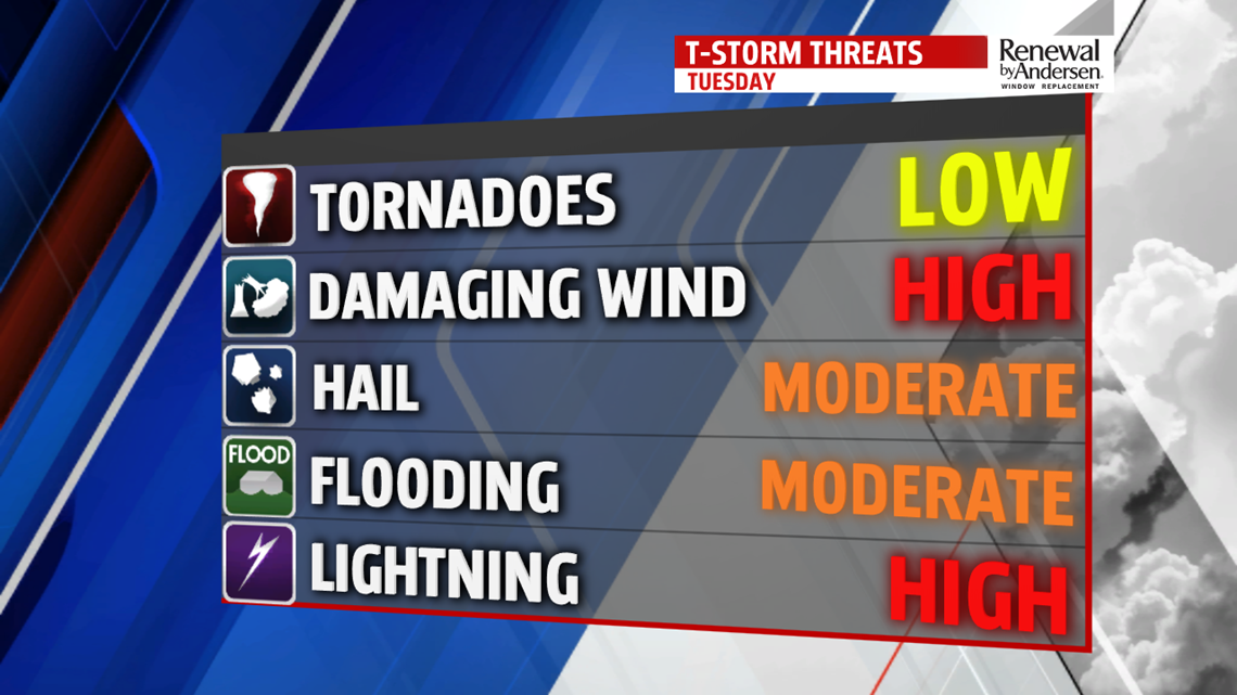
STORMS TOMORROW, COULD BE SEVERE: Storms will develop Tuesday, and there is a larger-than-normal risk of them becoming severe. Highs will be in the mid-to-upper 80s. A lot of variables are at play. The Storm Prediction Center issued an ENHANCED risk of severe weather for portions of our area south of the Turnpike. On a scale of 1-to-5 in the peach-shaded region, we’re at a 3. Areas in the yellow are at a 2, in the green at a 1. However, there is a concern of the risk being undermined tomorrow morning. If we get more showers and storms in the morning and the cloud cover doesn’t budge, we could easily lower the severe weather threat for the afternoon. If we see clearing and sunshine in the late morning, then the severe weather threat will be active. Stay tuned for updates as we go throughout the evening tonight and into tomorrow.

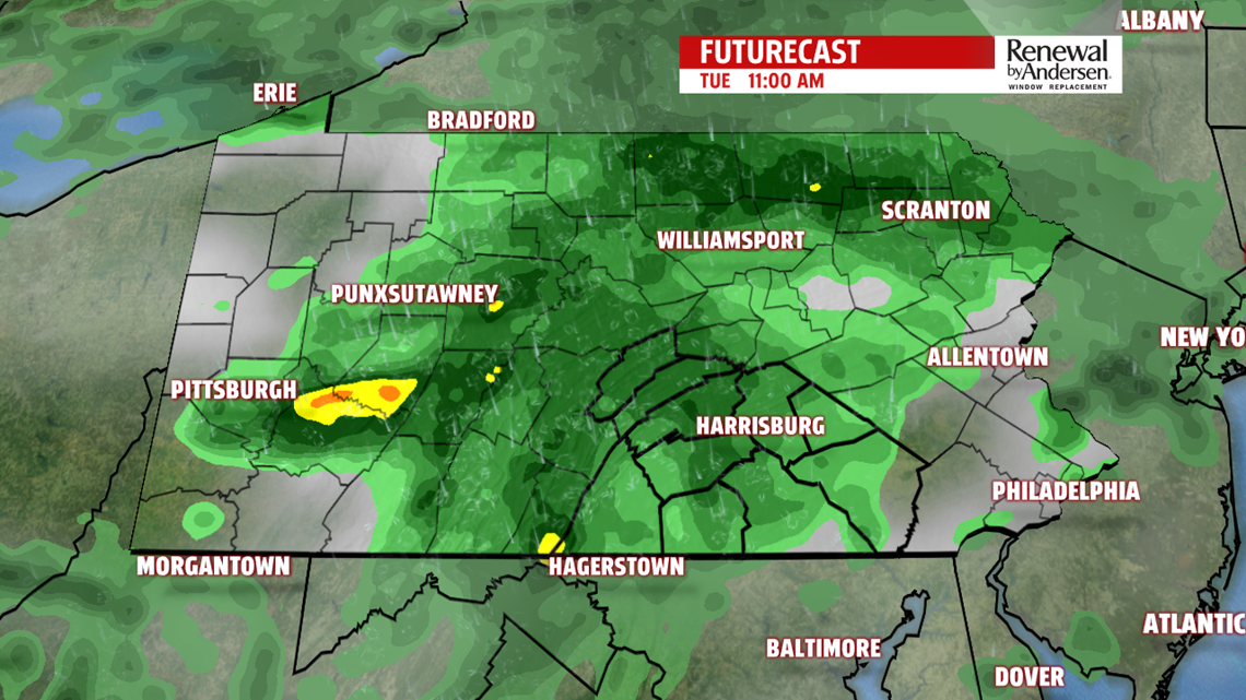
Currently, it looks like a small wave of showers and storms develop in the late morning, but give way to a brief period of clearing. Earlier storms could be strong with heavy rainfall and some gusty winds. If storms develop in the afternoon, they will have the potential to be severe with hail up to the size of quarters or more, torrential rainfall leading to flash flooding and winds over 60MPH. There is a tornado threat tomorrow afternoon.


The main line of storms look to push through in the late lunchtime hours and continue through the area in the early, mid and late afternoon. We’ll be mostly done with storms around or before sunset and dry out into Wednesday morning with a lingering shower possible. As mentioned earlier, keep the FOX43 Weather App handy for severe weather alerts directly to your phone and for the latest forecast updates. We’ll update you on-air, online and on the app as we get closer to time.

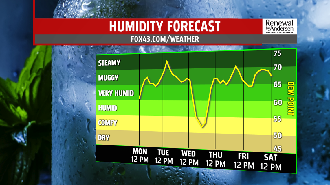
THE REST OF THE WEEK: A stray shower could linger into Wednesday morning, but most of the area remains dry. Low temperatures dip just below 70-degrees. Mostly cloudy skies clear out slowly with highs in the low-to-mid 80s. A lower chance of storms will be present Thursday afternoon with highs in the mid-80s. After enjoying a brief dip in humidity, it begins to climb by the end of the work week with highs in the mid-to-upper 80s Friday and Saturday.
Stay “Weather Smart” with the FOX43 Weather Team all week long!
-Chief Meteorologist MaryEllen Pann