


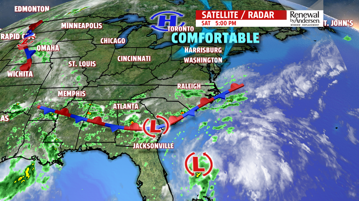
A relief from the Summer heat is welcome this weekend with temperatures below seasonable normal, and much lower humidity! A large area of high pressure over the Great Lakes dominates the forecast for the next 36 hours – providing cooler and drier weather. Highs in the mid-to-upper 70s will continue to average below normal for late August.
SUNDAY: After a cool morning start in the mid-50s, we’ll round out the rest of the weekend with nearly a repeat of Saturday’s weather, but perhaps with more sunshine and a few degrees warmer. Look for afternoon high temperature on Sunday near 78 degrees under mostly sunny skies.
BACK TO SCHOOL: Heading to the bus stop Monday morning looks great for back to school photos! Temperatures start out at sunrise near 60 degrees under partly cloudy skies. We’ll keep the trend going with a seasonally cool day with afternoon high temperatures into the mid-70s.
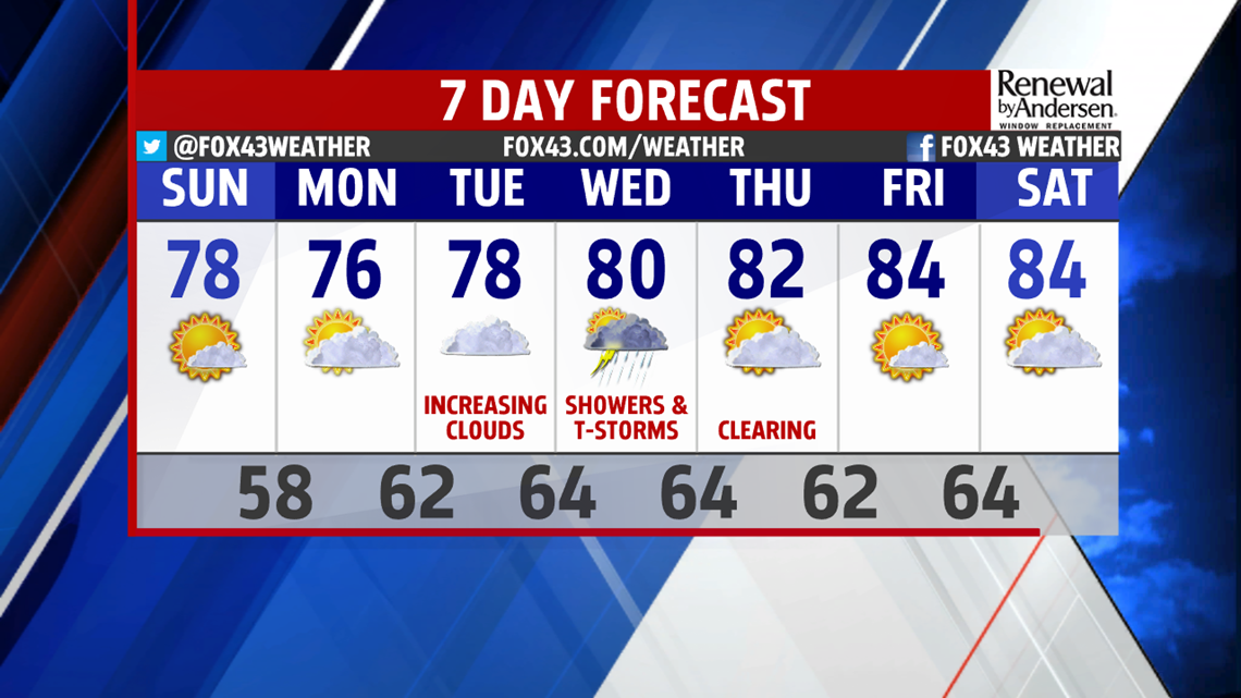
LAST WEEK OF AUGUST: The main weather drivers as we finish August 2019 are the strong area of high pressure moving east across New England – setting up easterly flow to the mid-Atlantic states, and a cold front arriving in the middle of the week. Clouds are on the increase Tuesday and hang around Wednesday as the front arrives. A few showers are likely and thunderstorms possible Wednesday. Warmer temperatures also return into the low 80s for the latter half of the week. Wednesday’s high is near 80. The skies settle down Thursday through Saturday with mostly sunny conditions and highs in the low 80s.
Enjoy the rest of the weekend!
– Meteorologist Alan Petko
