


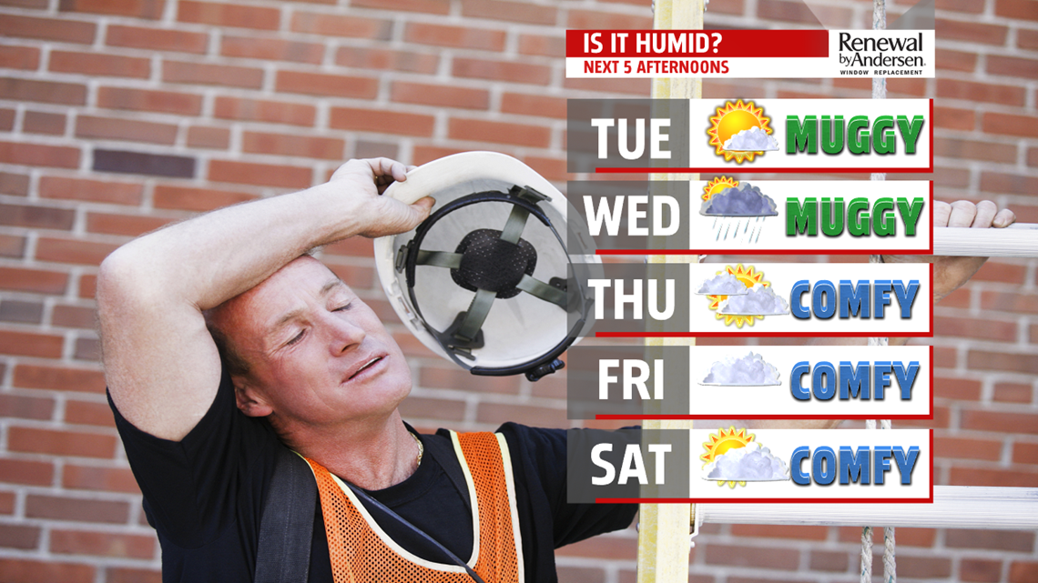
TURNING COOLER: Cooler and less humid air starts to slide in behind the cold front, but Hurricane Dorian starts traveling faster up the coast and will have some influence as well, although for Central PA, it’s minimal. The combination of these factors brings a mostly cloudy to overcast day with cooler temperatures in the place and breezy conditions to the Thursday forecast. Humidity levels are very low too! Expect temperatures are in the middle to upper 70s. Friday brings overcast skies and much cooler temperatures as Dorian passes nearby offshore. Temperatures are in the lower 70s.

WEEKEND OUTLOOK: Skies brighten up for Saturday as Dorian speeds away from the East Coast. Expect partly cloudy skies. Temperatures are a bit higher with the return to sunshine. Expect those afternoon highs in the middle 70s to near 80 degrees. Humidity levels are low, and they stay that way through the rest of the weekend. Sunday brings partly sunny skies. Temperatures fall back into the 70s. Monday brings even cooler air! Expect temperatures in the lower to middle 70s under partly cloudy skies.
Stay Weather Smart with FOX43! Have a wonderful Tuesday!
-Andrea Michaels
