

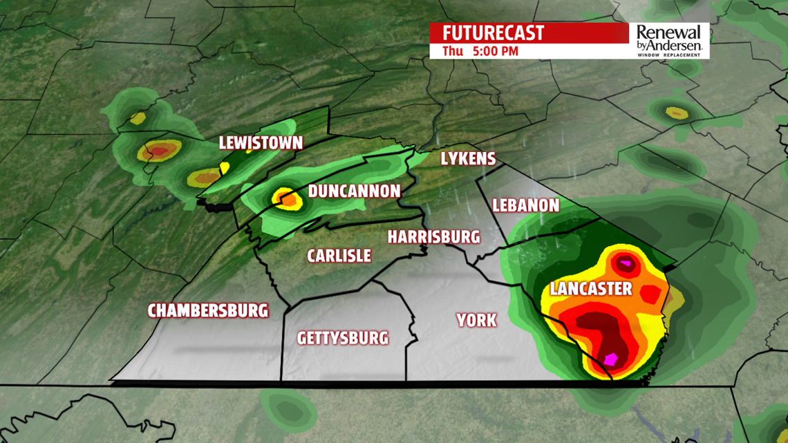
THURSDAY PM STORMS: Our eastern half is in a very low risk of severe weather through the early evening. On a scale of 1-to-5, we’re only at a 1. Storms begin to pop up in the early afternoon and continue to push through until around the dinner time hour. Highs reach the upper-80s with high humidity once again. The main concern with these storms is localized heavy rainfall and gusty winds. We get a break as the front slows, but it eventually pushes through and stalls, bringing in significant cloud cover overnight and a shower chance into tomorrow morning.


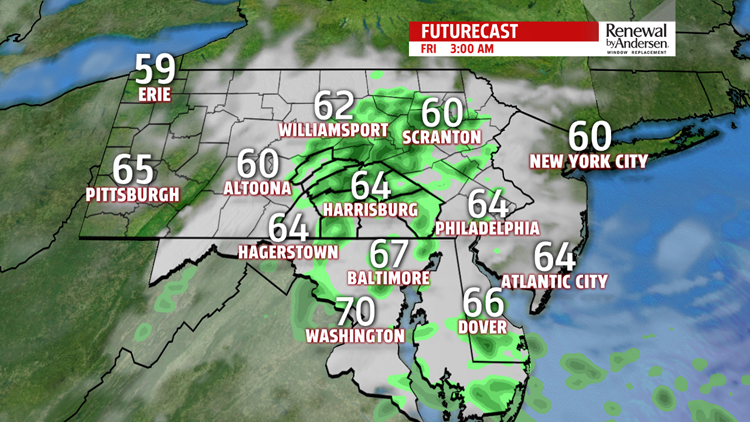
CLOUDY FRIDAY: The bulk of the rain chances end in the morning, but a lingering spot of drizzle can’t be ruled out into the early afternoon. Near-overcast skies remain throughout the bulk of the day. This keeps afternoon temperatures in the low-to-mid 70s with morning lows in the 60s. A few places may not even leave the upper-60s for highs if they see completely overcast skies all day long. A dreary finish to the work week!


STORMY SATURDAY START, REBOUND: Another round of storms comes in overnight into Saturday morning. This will be a weakening, more organized line. After it passes, we begin to clear in the mid-to-late morning. A surge of warm air pushes in from the south with a lifting front and allows temperatures to rise into the mid-80s by the afternoon with increasing humidity. Similar conditions stay Sunday with slightly warmer temperatures steadily rising into the beginning of next week.
Stay “Weather Smart” with the FOX43 Weather Team all week long!
-Chief Meteorologist MaryEllen Pann
