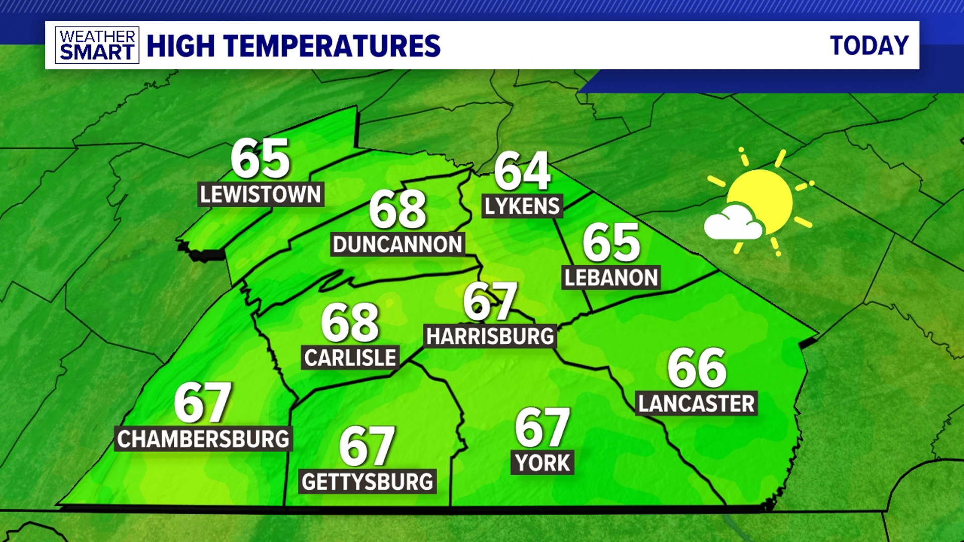


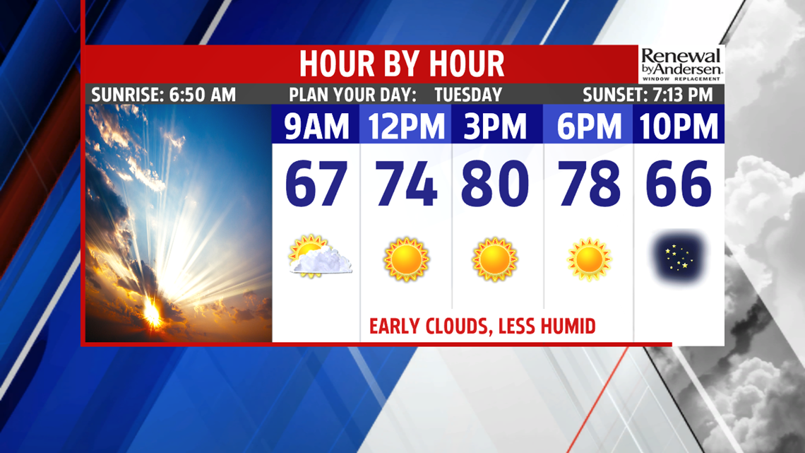


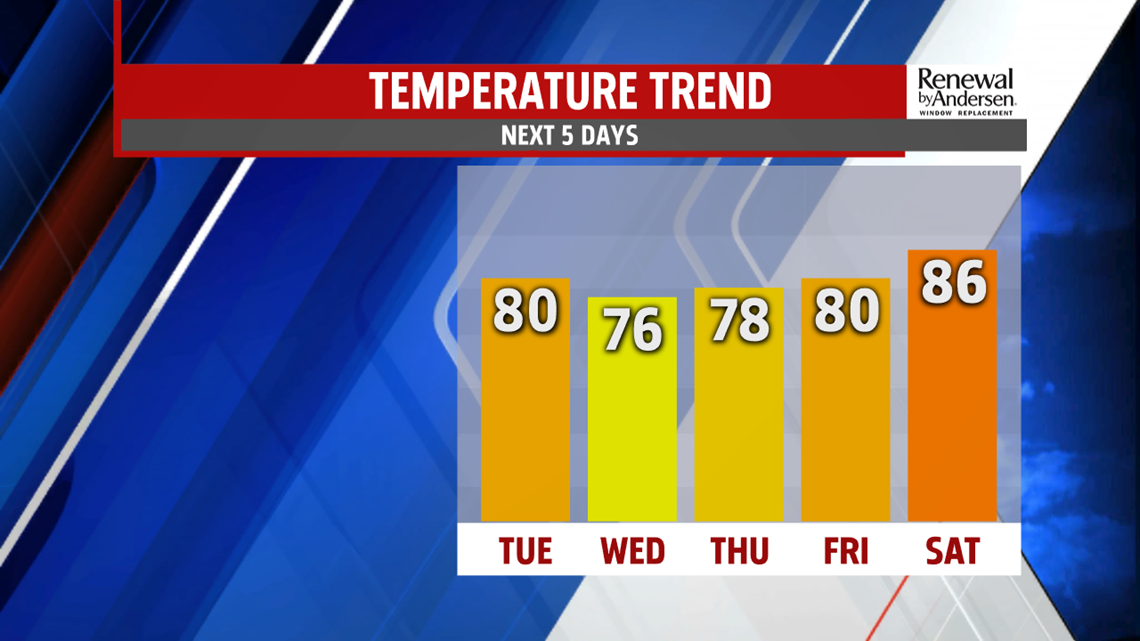
SLOW COOLING THROUGH MIDWEEK: Afternoon temperatures continue to fall through the middle of the week. It’s a dry period too, with plenty of sunshine. Wednesday brings abundant sunshine, with afternoon temperatures at their coolest point in the lower to middle 70s. These temperatures are near average, the numbers bounce back up through the remainder of the work week. There’s still plenty of sunshine for Thursday, with temperatures in the middle to upper 70s. Friday is a touch warmer, with afternoon highs approaching 80 degrees.
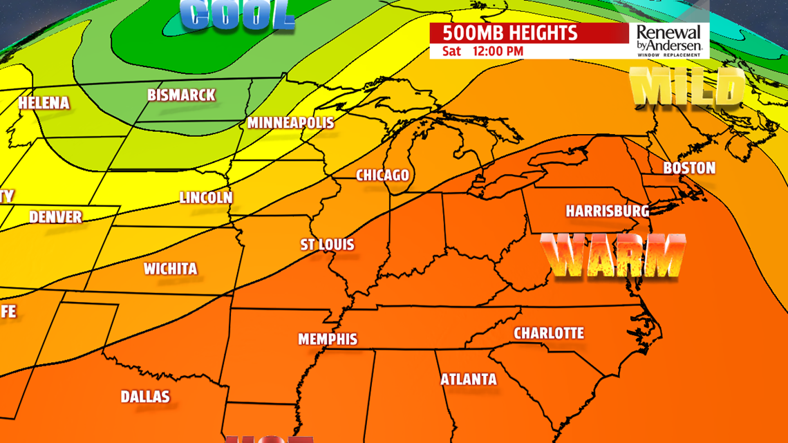
WARMING WEEKEND OUTLOOK: Temperatures continue swing back up through the weekend. Readings are toastier for Saturday under partly cloudy skies. Temperatures reach the lower to middle 80s. Sunday brings some more clouds as the next cold front approaches. Afternoon temperatures are a bit higher, with readings in the middle to upper 80s. Humidity levels are up a bit as well. On Monday, fall officially arrives, and it remains on the warm side for this time of year. There’s the chance for a couple late day showers or thunderstorms as the next cold front arrives.
Stay Weather Smart with FOX43! Have a wonderful Tuesday!
-Andrea Michaels