


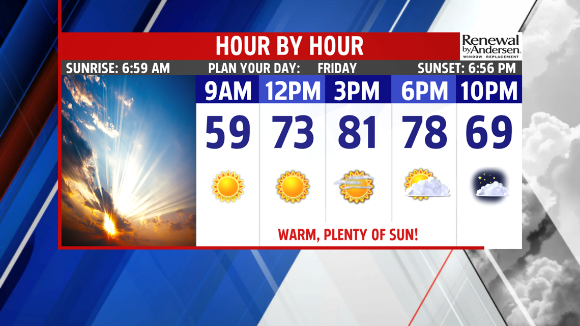

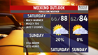

VERY WARM WEEKEND OUTLOOK: Temperatures boost a little higher for the weekend! Saturday brings partly cloudy skies, and the humidity makes a comeback. Afternoon high temperatures reach the middle to upper 80s. The next system approaches, so there’s a small chance for a shower or thunderstorm. Sunday is looking very similar, with a mixture of clouds and sunshine, humid conditions and toasty temperatures. Afternoon highs reach the middle to upper 80s.
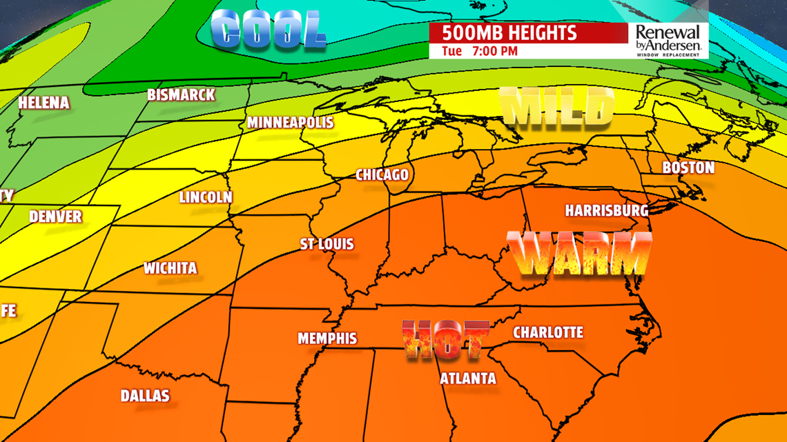
STAYING WARM NEXT WEEK: Monday brings partly sunny skies and dry conditions for Central PA. Temperatures are in the upper 70s to lower 80s. Tuesday turns even warmer under a mixture of clouds and sunshine. The mainly dry trend continues with temperatures in the middle to upper 80s. It continues to feel muggy through the early part of next week. Wednesday continues the warmth and the high humidity levels. Expect afternoon temperatures in the upper 80s! The hot pattern finally shows some signs of breaking down on Thursday. The next cold front drops down from the north. This brings the chance for afternoon thunderstorms. It’s still warm and stuffy, with temperatures in the lower to middle 80s.
Stay Weather Smart with FOX43! Have a wonderful weekend!
-Andrea Michaels
