
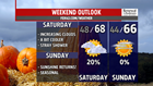


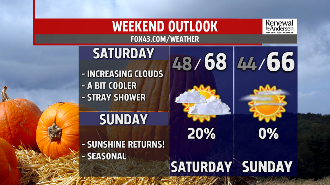
HEADING INTO THE WEEKEND: Mostly sunny skies persist into the evening. High temperatures near 70-degrees will not only be the norm for Friday, but all weekend long. Overnight lows dip into the mid-to-upper 50s. Partly-to-mostly cloudy skies do take over Saturday with a very low shower chance. Most of us stay dry with highs at or just shy of 70-degrees. Abundant sunshine returns Sunday, but temperatures only reach the mid-to-upper 60s. Morning lows dip into the mid-40s.
STARTING NEXT WEEK: Monday morning starts off chilly once again. Morning lows dip into the mid-40s. But, we gain a couple of degrees with mostly sunny skies. Afternoon highs near 70-degrees will be the norm both Monday and Tuesday. Tuesday is nearly an exact copy of Monday, as mostly sunny conditions persist with highs near 70-degrees.

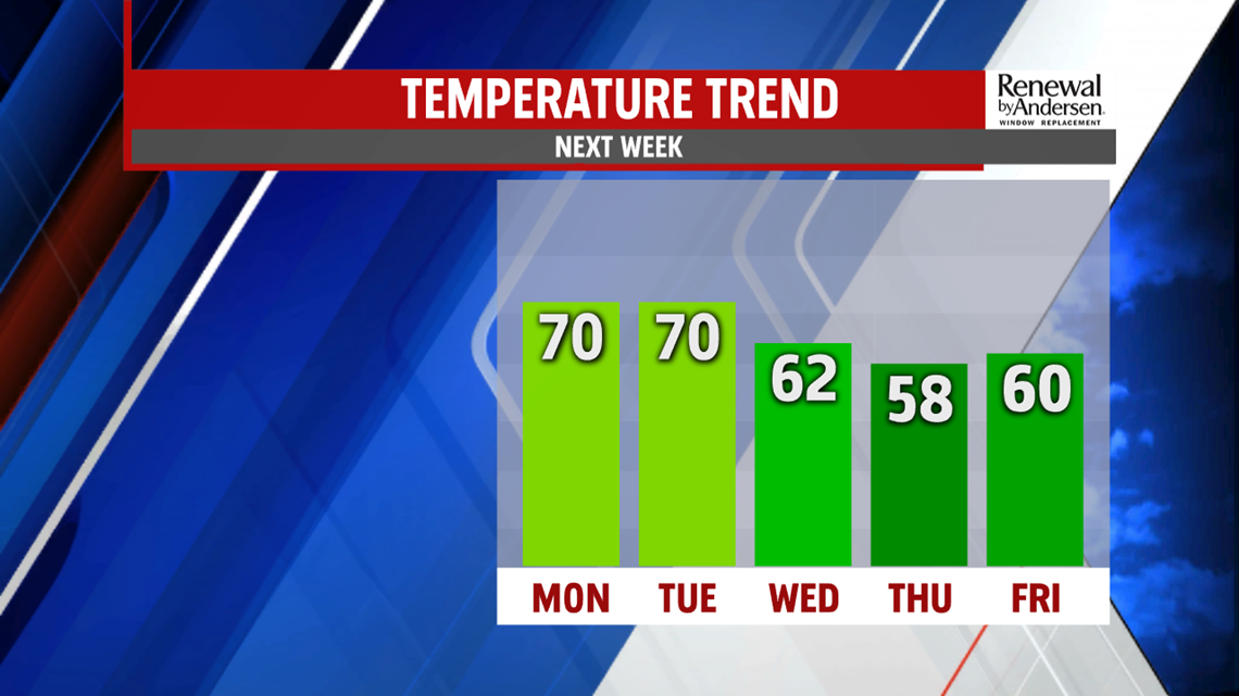
NEXT WEEK RAIN CHANCE: Our next change in the overall pattern moves in Wednesday. A relatively powerful system brings rain chances into the fold Wednesday. Showers begin in the mid-to-late morning and persist throughout the day. Highs in the low-60s will be the norm. Perhaps the bigger impact will be after the showers on the back side of the system. Once the rain clears, breezy conditions start for Thursday and limit Thursday afternoon temperatures to the mid-to-upper 50s.
Stay “Weather Smart” with the FOX43 Weather Team all week long!
-Chief Meteorologist MaryEllen Pann
