

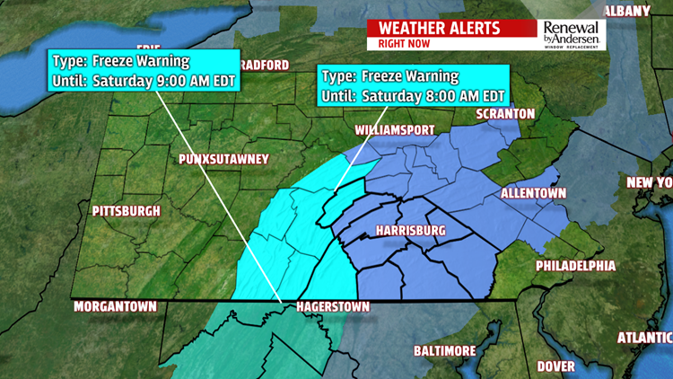


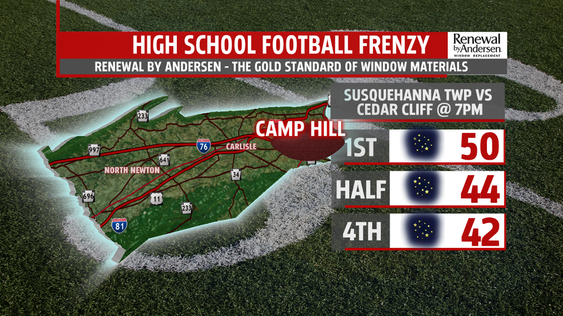
FROSTY NIGHT: After a breezy day that struggled to hit 60-degrees, our winds finally calm down as the sun sets. Our High School Football Frenzy Game of the Week is Susquehanna at Cedar Cliff, and it’ll be a chilly one! Temperatures fall through the 50s and into the 40s by halftime. We continue to tumble further overnight with morning lows in the mid-to-upper 30s. Because of the light winds, clearing skies and cold temperatures, a FREEZE WARNING is in effect for Mifflin and Franklin counties Saturday morning. A FROST ADVISORY is in effect for the rest of the area. Either bring your plants in, or cover them with a blanket tonight! Bring those pets inside, too!

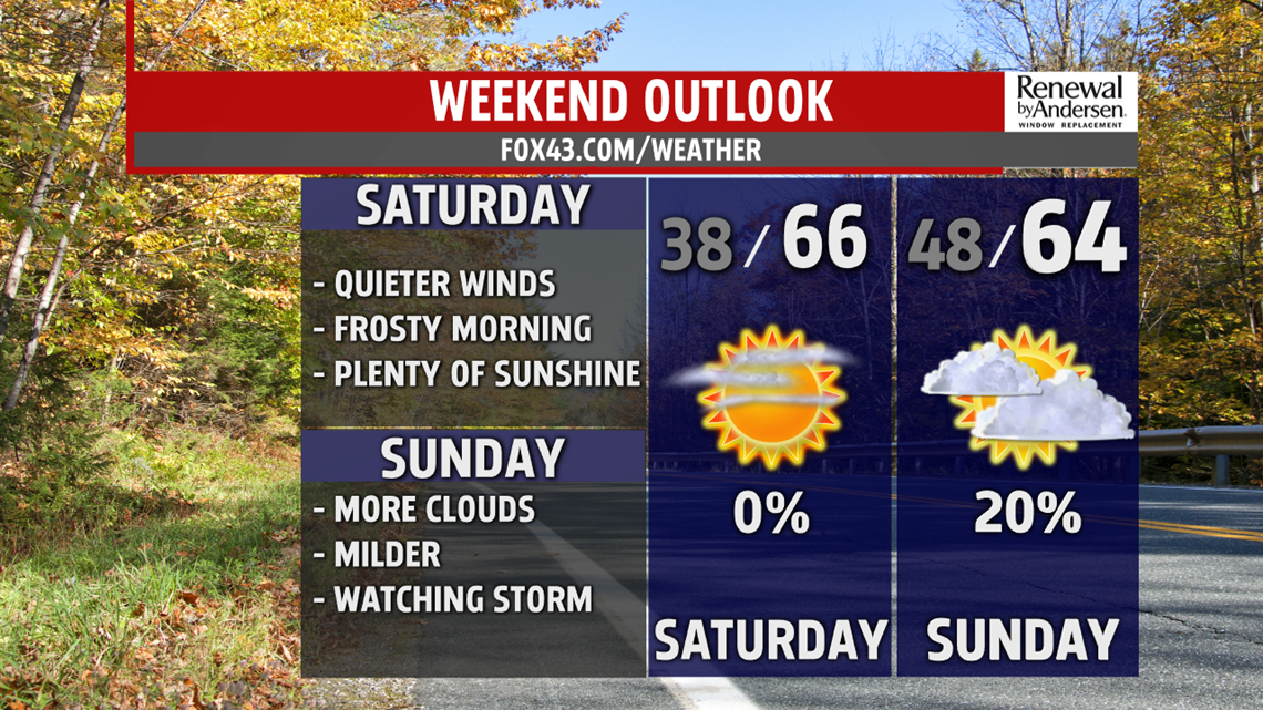
NICE SATURDAY, WATCHING SUNDAY: We recover nicely Saturday with abundant sunshine. Afternoon highs reach the mid-60s for most with calm, clear skies. We dip into the upper-40s Sunday morning. Cloud cover increases with an approaching storm system from the south. Mostly cloudy skies dominate the day with a low rain chance. Our southern counties, right along the Mason-Dixon, have the best chance of any Sunday moisture. Highs hit the low-60s. Stay tuned for updates.
NEXT WEEK RAIN CHANCE: We kick off Monday with clearing skies and lows in the mid-40s. By the afternoon, we enjoy plenty of sunshine with a high near 70-degrees. This gives way to more rain chances by Tuesday with afternoon highs only reaching the mid-60s. Breezy conditions return on the back side of the storm system for Wednesday and highs only in the low-60s.
Stay “Weather Smart” with the FOX43 Weather Team all week long!
-Chief Meteorologist MaryEllen Pann
