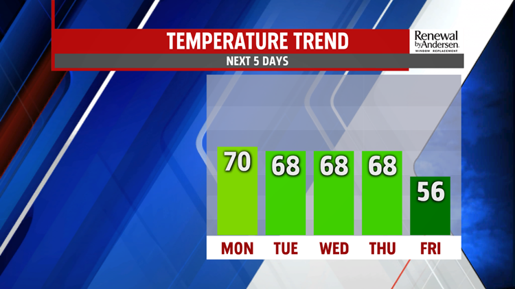

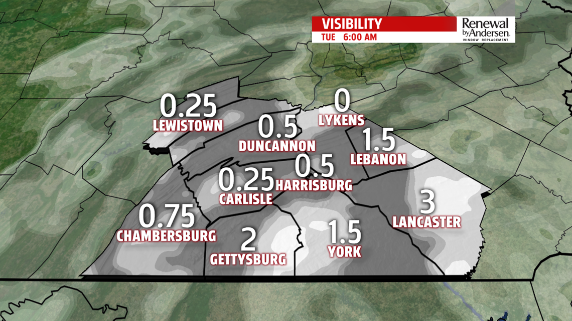
CLOUDS INCREASE OVERNIGHT: After abundant sunshine and a high near 70-degrees, temperatures drop into the upper-50s after sunset with mostly clear skies. Overnight, clouds begin to increase. This will keep our morning low relatively mild once again, in the upper-40s and low-50s. With the wind shift that causes the cloud cover, a bit more moisture will be in the area as well. This could lead to more widespread visibility issues in the morning. Mostly cloudy skies dominate Tuesday. Spotty drizzle to the southeast can’t be ruled out, but most, if not all of us, stay dry. Highs Tuesday stay in the upper-60s because of the additional cloud cover.

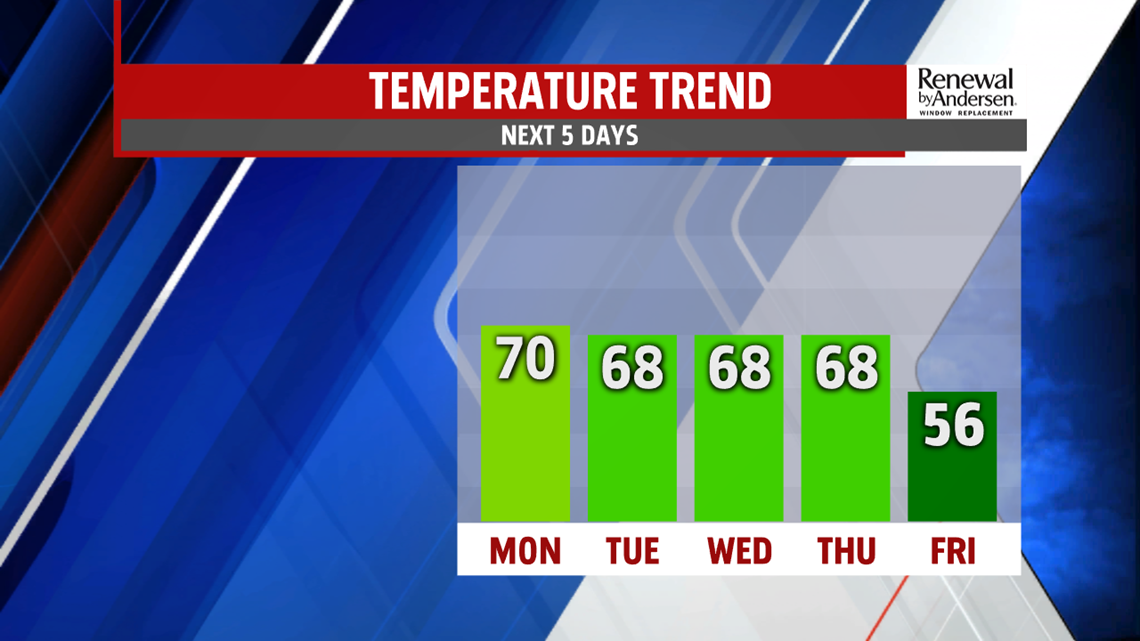
STAYING CLOUDY THROUGH WEDNESDAY: A few more clouds move in for Wednesday. Otherwise, the day shapes up pretty similar to Tuesday. Morning lows start near 50-degrees with afternoon highs in the upper-60s. Late in the day, a few showers begin to move in before more develop heading into Halloween on Thursday.

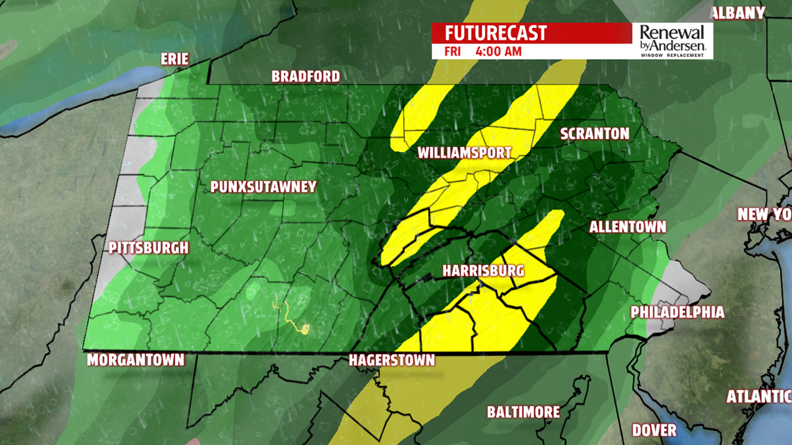

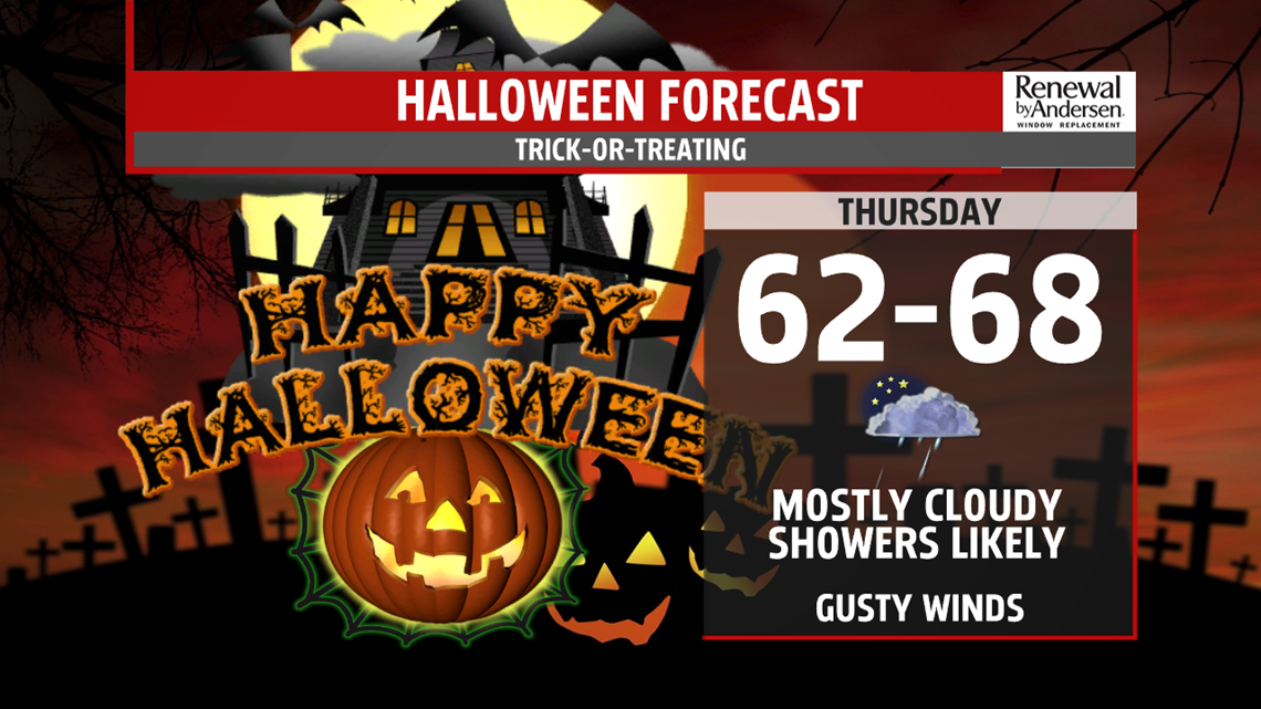
HALLOWEEN RAIN: As a powerful and slow-moving front approaches Wednesday night, morning lows stay in the mid-50s with spotty showers to start. Off-and-on rain persists all day long on Halloween. Rain could be heavy at times. Temperatures in the 60s will be the norm. Rain persists into Friday morning with overnight lows in the low-to-mid 50s. But as we dry out Friday, a powerful northwesterly breeze replaces the rain with much cooler air. Afternoon temperatures have the potential to go nowhere. Our high temperature may even be at midnight. When all is said and done, 1-2″ of rain will be the norm across Central PA. The weekend looks dry and starts off breezy heading into Saturday.
Stay “Weather Smart” with the FOX43 Weather Team all week long!
-Meteorologist Jessica Pash