


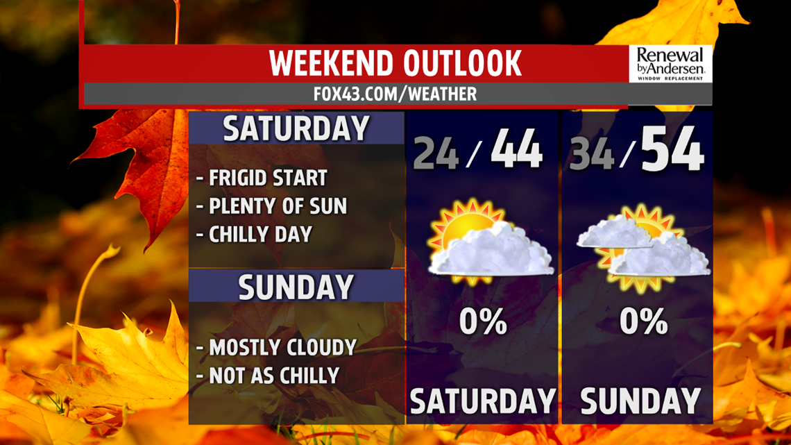
CHILLY WEEKEND OUTLOOK: Saturday brings more sunshine, but it does little to warm the region. It’s a cold start with temperatures in the lower to middle 20s. The winds are light to calm, and they stay that way the rest of the day. Temperatures reach the lower 40s during the afternoon despite more sunshine. Sunday is a milder day, but it’s still a bit on the cool side for this time of year. Temperatures reach the lower to middle 50s with partly sunny to mostly cloudy skies. Winds remain light.

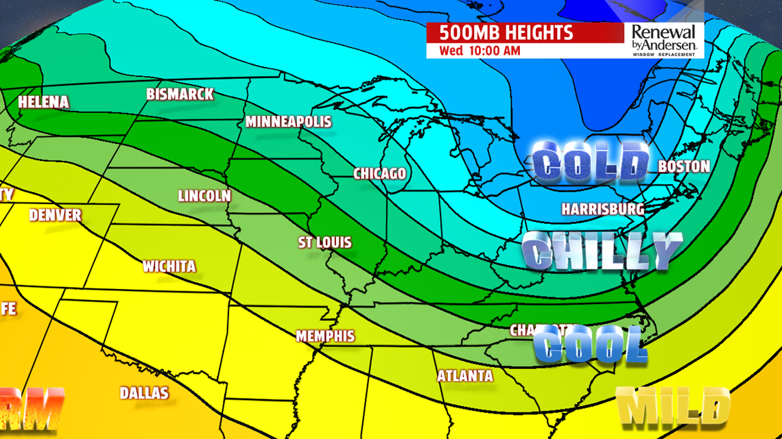
COLD NEXT WEEK: A taste of winter slowly moves in early next week. Monday is a cool but quiet day as the cold out west prepares for its arrival. Temperatures are in the upper 40s to near 50 degrees. A late day rain or snow shower is possible, and those chances increase through the night. The cold air starts to slide in on Tuesday. Temperatures likely drop into the 30s by the afternoon, with rain and snow showers likely as this all unfolds. Wednesday is the coldest day so far, with afternoon high temperatures only in the middle to upper 30s. Skies are mostly cloudy and it’s still breezy. There are flurries too!
Stay Weather Smart with FOX43! Have a wonderful Thursday!
-Andrea Michaels
