


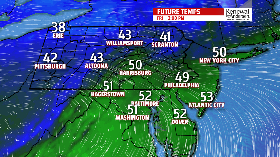
WARMER FRIDAY: We continue our brief warming period heading into Friday. Morning lows dip into the upper-20s as breezes calm down during the overnight period as well. Mostly sunny persist Friday, but warmer air takes over. Highs hit the 50-degree mark for many, making for a much better night for the high school football playoffs compared to last Friday. But a dry front passes through heading into the weekend, once again reducing temperatures for Saturday and Sunday.

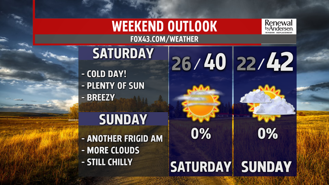
COLD WEEKEND: Starting the weekend, mostly clear skies enable morning lows to dip into the mid-20s. But with a shifting wind direction and increasing breezes, afternoon highs struggle to hit the 40-degree mark Saturday afternoon. Wind chills in the upper-20s and low-30s will be the norm. Morning lows dip into the upper-teens and low-20s starting Sunday for a bitter cold start for this time of the year. Breezes improve, reducing the impact of a wind chill Sunday. But, temperatures stay well below average with highs only in the low-40s to finish the weekend.

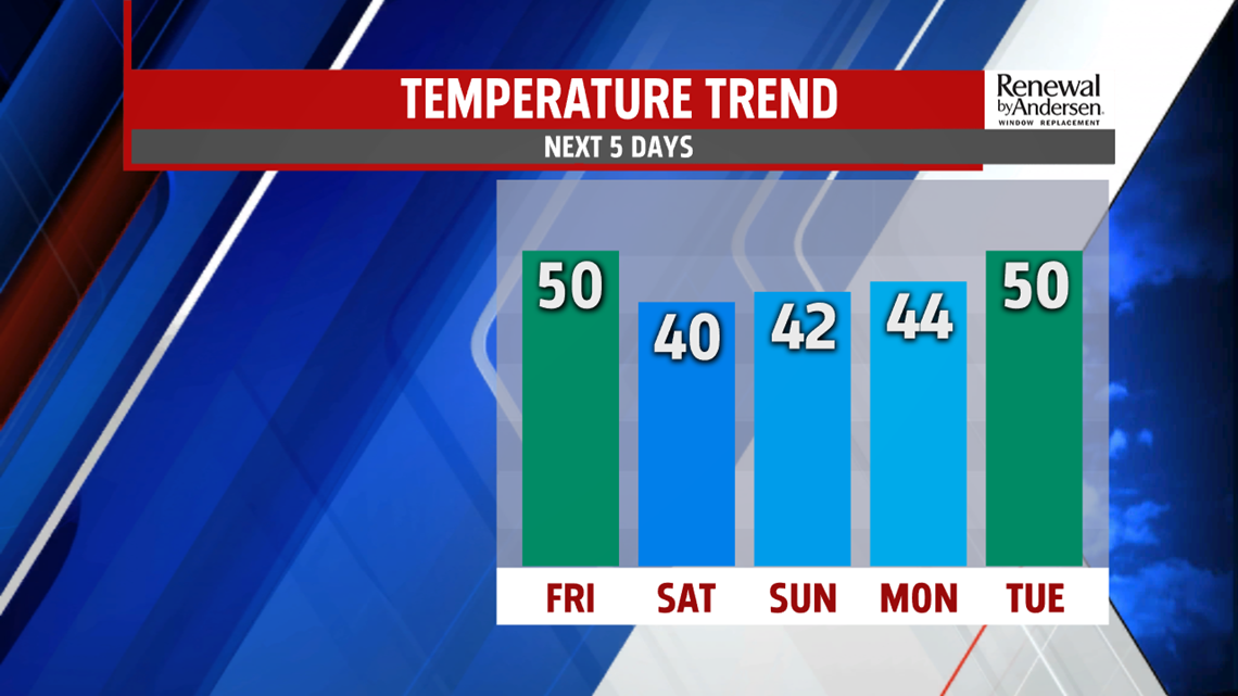
HEADING INTO NEXT WEEK: Slow improvement with increasing cloud cover starts Monday. Morning lows stay in the low-to-mid 30s thanks to that increasing cloud cover heading into Monday morning. Afternoon highs stay, though, in the mid-40s. We return to the 50-degree mark Tuesday before rain chances possibly return for Wednesday. Stay tuned for updates as we get closer to time and bundle up this weekend!
Stay “Weather Smart” with the FOX43 Weather Team all week long!
-Chief Meteorologist MaryEllen Pann
