

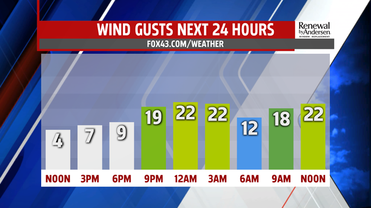


FINISHING OUT THE WORK WEEK: Increased cloud cover this afternoon persists into the evening and overnight. In turn, this enables temperatures to stay warmer heading into Friday morning. We fall only into the mid-40s by Friday morning with a very low, brief shower chance in the late morning hours. Winds pick up a bit heading into the afternoon with highs in the mid-50s. However, cloud cover does clear out heading into Friday night with breezy and cooler northwesterly winds replacing it heading into the weekend.

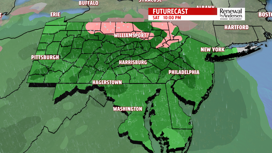

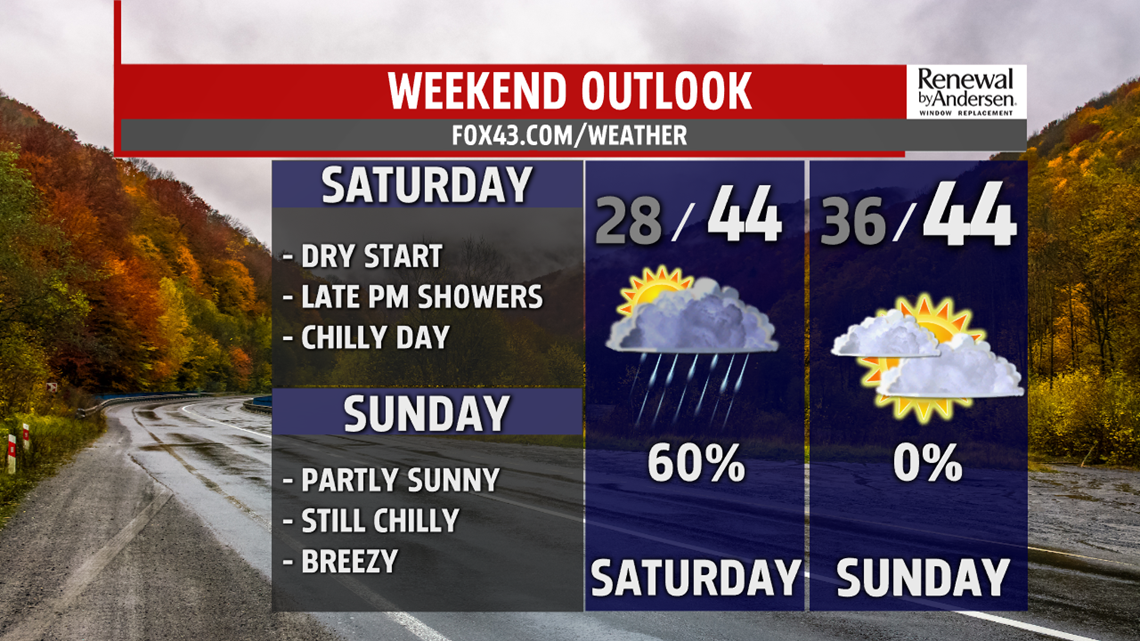
COLDER WEEKEND: Morning lows dip into the upper-20s to start Saturday morning. We stay dry heading into the early afternoon. Highs only reach the low-40s with a lot of cloud cover. Rain chances begin in the mid-to-late afternoon and persist throughout the evening. A few showers could linger into dawn of Sunday with morning temperatures in the mid-30s. A breezy and mostly cloudy Sunday afternoon is in store for Central Pennsylvania after the rains end. Highs again stay in the mid-40s for a cold finish to the weekend.

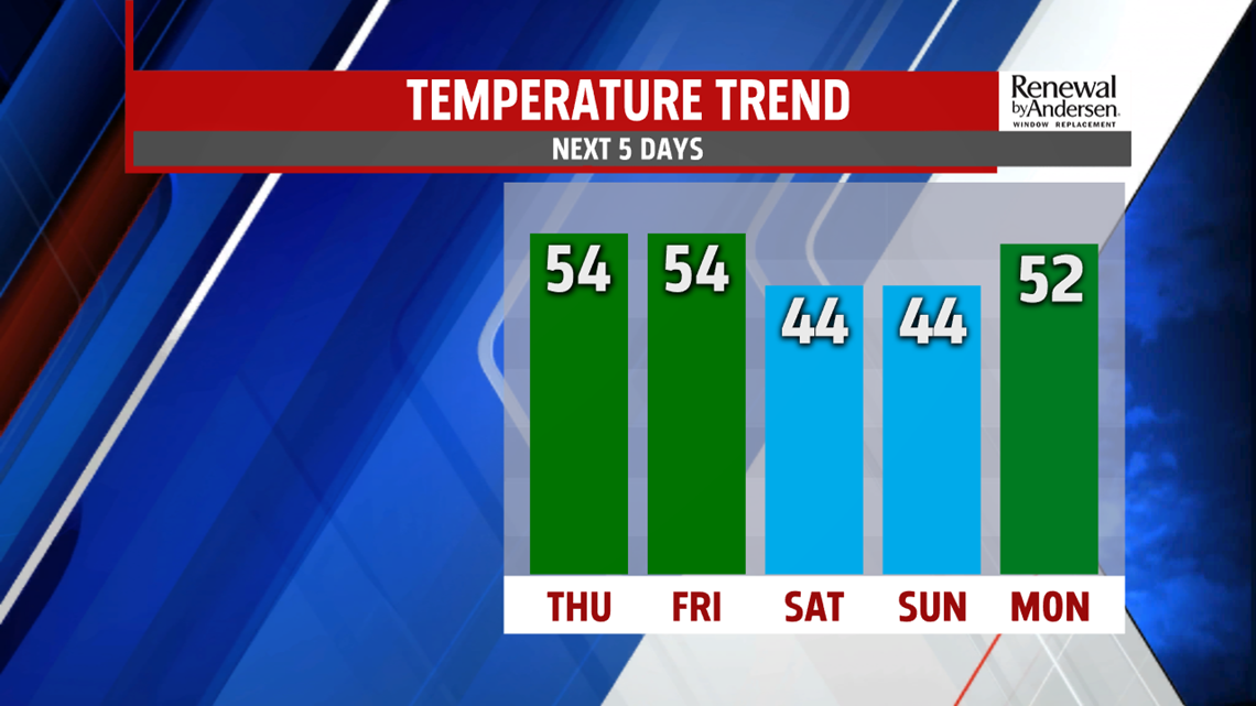
HEADING INTO NEXT WEEK: A warm-up begins heading into next week as we near the Thanksgiving holiday. Afternoon temperatures steadily climb into the low-50s with partly cloudy skies Monday afternoon. Temperatures rise to near 60-degrees Tuesday afternoon. However, though staying mild, rain chances return Wednesday with highs in the upper-50s. This could affect some holiday travel plans, so stay tuned for updates as we get closer to time.
Stay “Weather Smart” with the FOX43 Weather Team all week long!
-Chief Meteorologist MaryEllen Pann
