

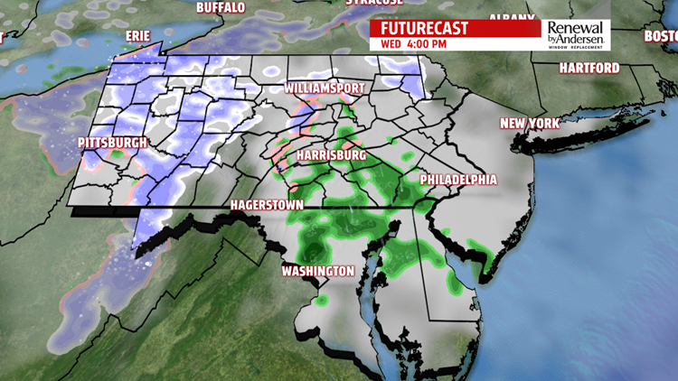


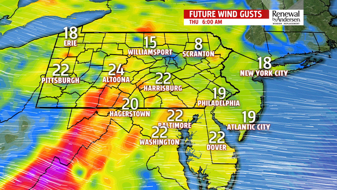
MIDDLE PART OF THE WEEK: This morning’s snow melts on the grassy surfaces throughout the day. Highs hit the low-40s with mostly cloudy skies. A few light showers pass through in the early and mid afternoon hours. Our northern tier counties could see a little mixing, but the probability is pretty low. Winds increase after sunset and become breezy overnight. Morning lows dip near 30-degrees, but wind chills will be in the mid-20s out the door Thursday morning.


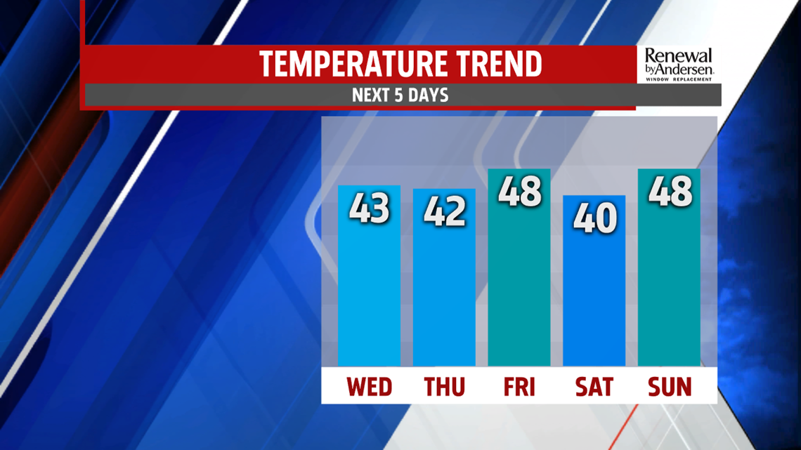
WINDS INCREASE, UP AND DOWN TEMPS: Dry conditions and warming temperatures become the norm heading into the weekend. Highs Thursday hit the low-40s once again with a bit more sunshine, but wind chills down in the low-30s in the afternoon. Friday is better with highs just shy of 50-degrees under partly cloudy skies. A dry system passes into Saturday, lowering Saturday highs to the upper-30s and low-40s with abundant sunshine. Morning lows stay below freezing, into the 20s. We jump again Sunday with highs just shy of 50-degrees before our next rain chance.

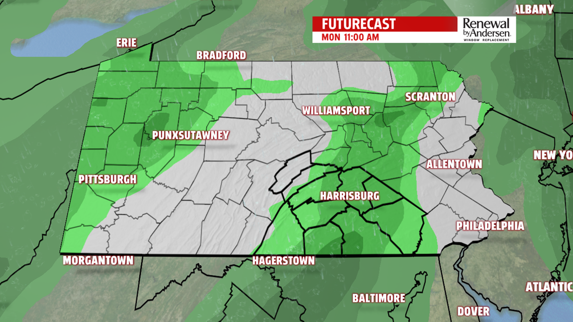
PRECIPITATION CHANCES RETURN: We continue our warming trend with a lot of cloud cover Sunday night. Morning lows stay near the 40-degree mark. Rain chances return both Monday and Tuesday. Highs climb into the mid-50s both days as well with lows in the upper-40s Tuesday morning. Shower chances stick with us Tuesday before much cooler temperatures heading into Wednesday, where we could even be watching for another snow chance. Stay tuned for updates closer to time.
Stay “Weather Smart” with the FOX43 Weather Team all week long!
-Meteorologist Bradon Long
