

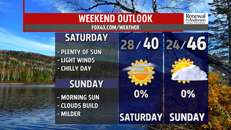


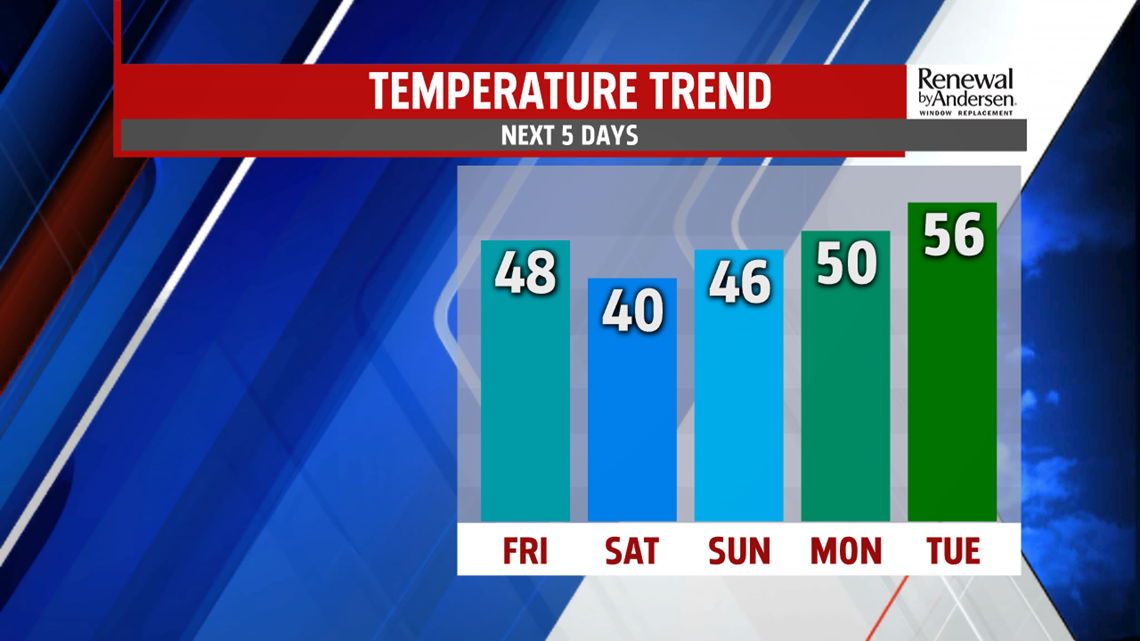
HEADING INTO THE WEEKEND: As our mostly dry system clears out, highs today in the upper-40s will yield to much cooler air overnight and for Saturday. Lows dip into the mid-20s, but afternoon highs only reach the upper-30s to right at 40-degrees by Saturday afternoon under mostly sunny skies. We start in the 20s again for Sunday with afternoon highs a little warmer, back into the mid-40s with partly cloudy skies.

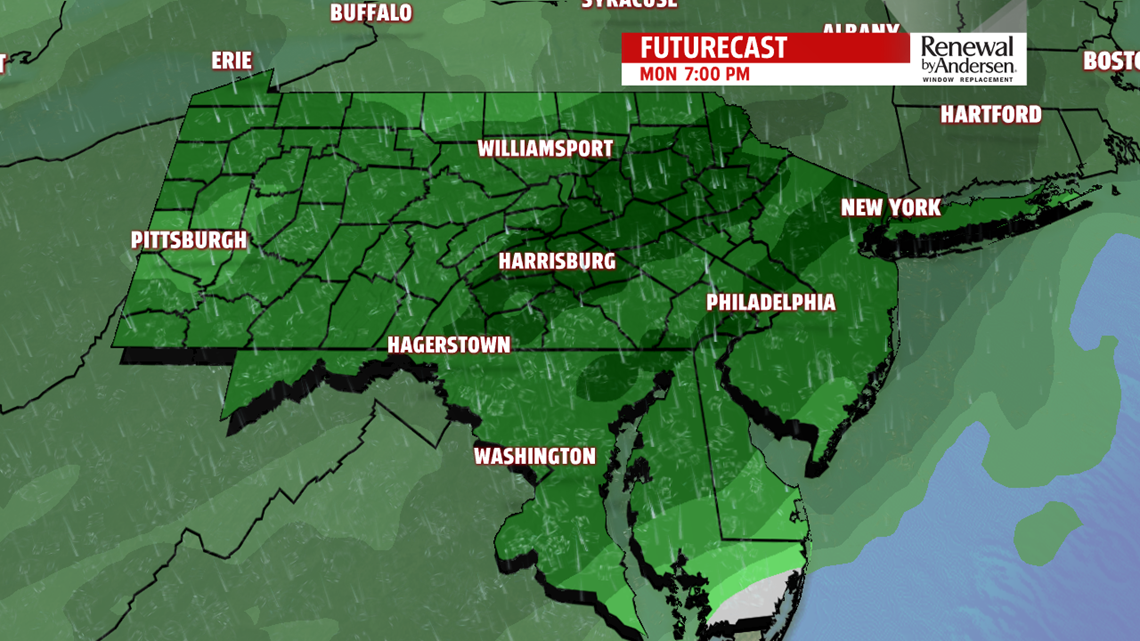
WARMING, BUT WITH RAIN: We continue the warm-up into Monday, with increasing cloud cover overnight and lows in the mid-30s out the door Monday morning. But that comes with shower activity off-and-on throughout the day, even during the morning hours. Highs reach the low-50s with a good amount of the day under light-to-moderate shower activity all day long. A similar Tuesday shapes up after morning lows in the mid-to-upper 40s. Highs hit the mid-50s with a slightly lower amount of shower activity, but off-and-on light showers still in the forecast for an otherwise overcast day. Once the rain stops, a powerful cold front drastically reduces temperatures heading into Wednesday.

POWERFUL COLD FRONT NEXT WEEK: Gusty winds replace the rain overnight Tuesday into Wednesday. A few flurries will be possible throughout the day with highs only in the mid-30s under otherwise blustery conditions. Wind chills will be in the upper-20s for most all day long as well. We stay cold into next Thursday towards the end of the 7-Day Forecast.
Stay “Weather Smart” with the FOX43 Weather Team all week long!
-Chief Meteorologist MaryEllen Pann
