

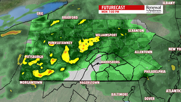

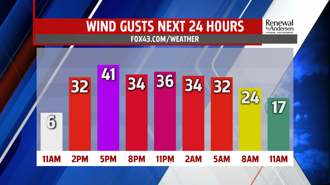

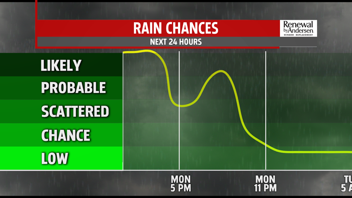
WIND AND RAIN: Temperatures steadily climb throughout the day and into the evening. Highs reach the low-50s for most. Rain continues throughout the end of the afternoon with steady, light-to-moderate rainfall. Winds ramp up with gusts out of the south up to 35MPH late in the afternoon and through Tuesday morning. We get a break in the rain overnight before another round moves in Tuesday. Overnight temperatures stay in the upper-40s. A widespread 0.5″ of rain will be the norm across the area for round one, with locally higher totals possible.

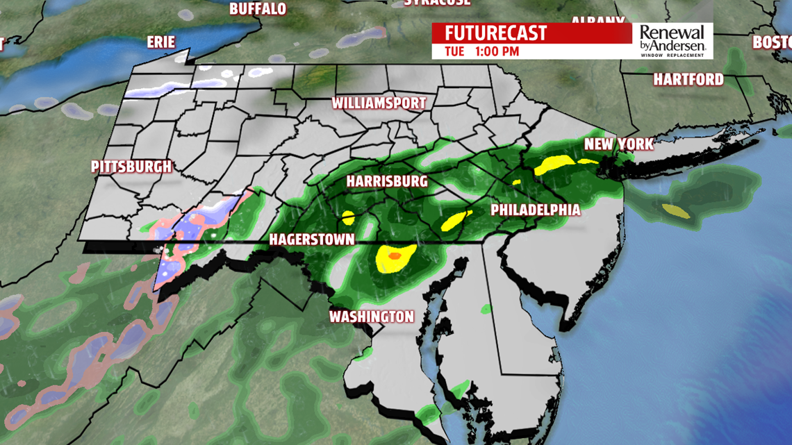
WATCHING A CHANCE FOR SNOW: Temperatures reach the mid-50s Tuesday afternoon with a slightly spottier rain chance. Most of the area still sees precipitation throughout Tuesday, especially after lunch. Breezes slowly subside throughout the afternoon, which is a key factor in cooling/keeping temperatures warmer overnight into Wednesday morning. We’re watching the positioning of the storm system to determine a couple of crucial things.

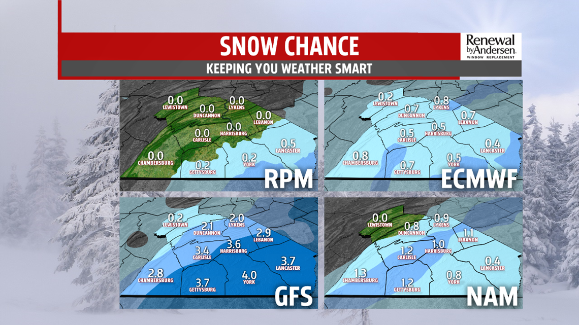
If the system pushes a little further south, we miss out on more Tuesday moisture, but we’re cooler heading into Wednesday morning where snow chances begin. But, the snow would be further south and east. If the system stays further north, we see more precipitation Tuesday, but then we introduce the rain/snow line into the area with slightly warmer air overnight Tuesday and into Wednesday. Temperatures do dip into the 30s by Wednesday morning, it’s just a question of how fast and if the moisture content will be in our area. Regardless, any snow we do see currently seems relatively un-impactful and on grassy surfaces, with highest areas of concern for our southeastern counties. Stay tuned for updates as we get closer to time for the latest information on a very tricky Tuesday night and Wednesday morning.

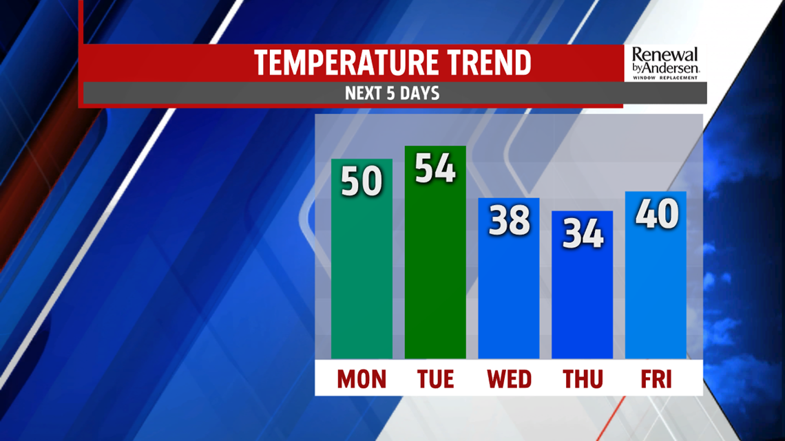
THE REST OF THE WEEK: Winds pick up again once the precipitation ends heading into Wednesday afternoon. Temperatures are drastically cooler as well. Highs stay in the mid-to-upper 30s with wind chills in the upper-20s and low-30s. Dry Thursday, slightly lighter winds but cooler temperatures again with morning lows near 20-degrees and an afternoon high in the low-to-mid 30s. We’re watching for more precipitation chances late Friday and into Saturday, so stay tuned for the latest information as get closer to time on that as well.
Stay “Weather Smart” with the FOX43 Weather Team all week long!
-Chief Meteorologist MaryEllen Pann
