

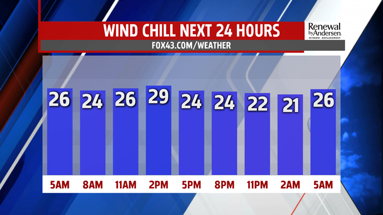

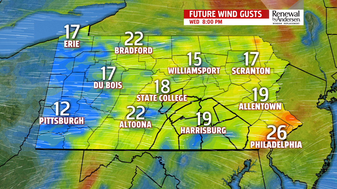


COOLER, WINDY: Flurries end by the end of the morning commute, quickly giving way to sunshine by the mid-morning hours. Breezes kick up throughout the day with gusts up to 25MPH. Temperatures go nowhere with highs in the mid-to-upper 30s and wind chills right around the 30-degree mark all day long. Overnight lows dip into the upper-teens and low-20s before a calmer Tuesday with sunshine and highs in the mid-30s.

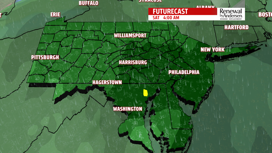
WEEKEND RAIN: A chilly Friday starts with lows in the mid-20s. Mostly cloudy skies take over by the lunch time hour with highs in the low-40s. Late in the day, spotty showers take over into Friday evening. Rain increases overnight and into Saturday. Lows near 40 will be the norm both Saturday and Sunday morning. Off-and-on showers will be he norm Saturday with highs in the low-50s. We’re dry but cooler after the frontal passage for Sunday with highs in the mid-40s and breezy conitions.
HEADING INTO NEXT WEEK: 30s dominate Monday with mostly cloudy skies. A late mix looks likely overnight into Tuesday morning with lows near freezing. Mix chances continue further into Tuesday, so stay tuned for updates as we get closer to time.
Stay “Weather Smart” with the FOX43 Weather Team all week long!
-Meteorologist Bradon Long
