

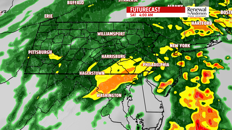

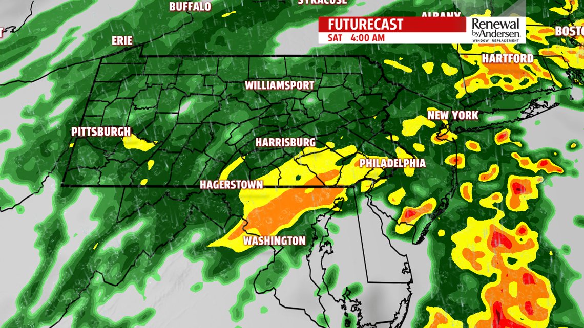

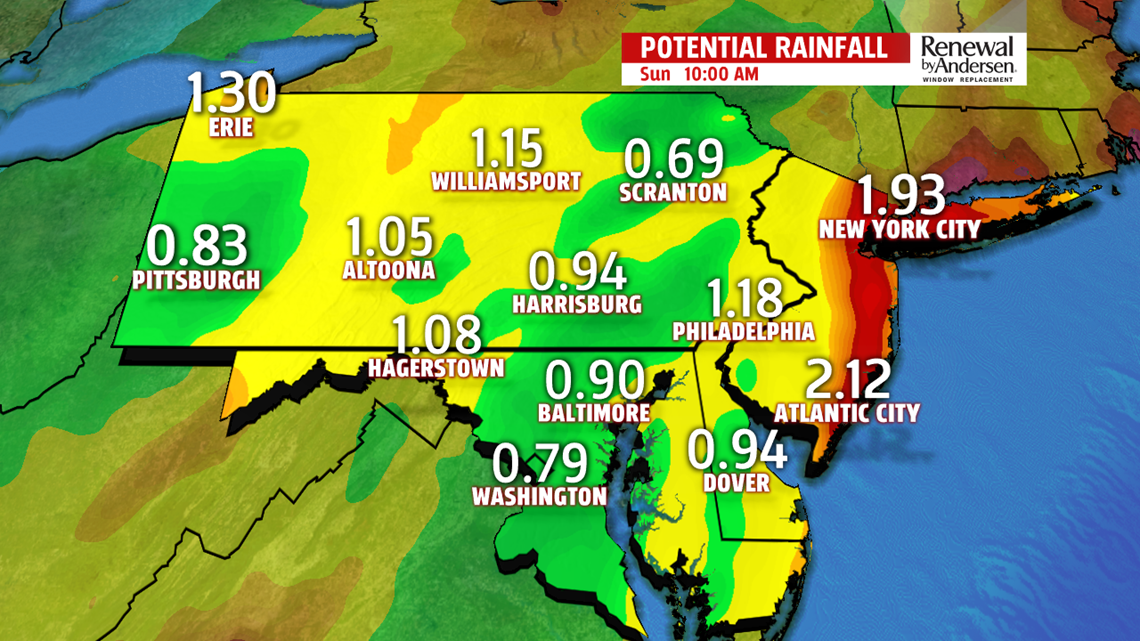
FRIDAY AND SATURDAY: Showers move in by the early lunch time hour. There is a WINTER WEATHER ADVISORY for Mifflin, Juniata and Franklin counties from 8AM until 2PM for the potential for freezing rain or freezing mist in our higher elevations. The overall chance is low, as temperatures for the majority of the area will be above freezing. High temperatures struggle to hit the low-40s today as spotty showers and overcast skies dominate. By 10PM tonight, the main show begins with abundant shower activity. Rain could be occasionally heavy through the overnight. Temperatures rise throughout the night and into Saturday morning because of the warm front that’s driving this storm system, bringing warmer temperatures. Showers break briefly Saturday morning before another round in the afternoon. Highs make it to the low-50s for most. A final round of rainfall moves in on the back side of the system late Saturday. If temperatures cool quick enough, we could see a very brief transition to snow, especially in our western counties. When all is said and done, a widespread 0.5″-1″ of rain will be the norm with locally higher totals possible.

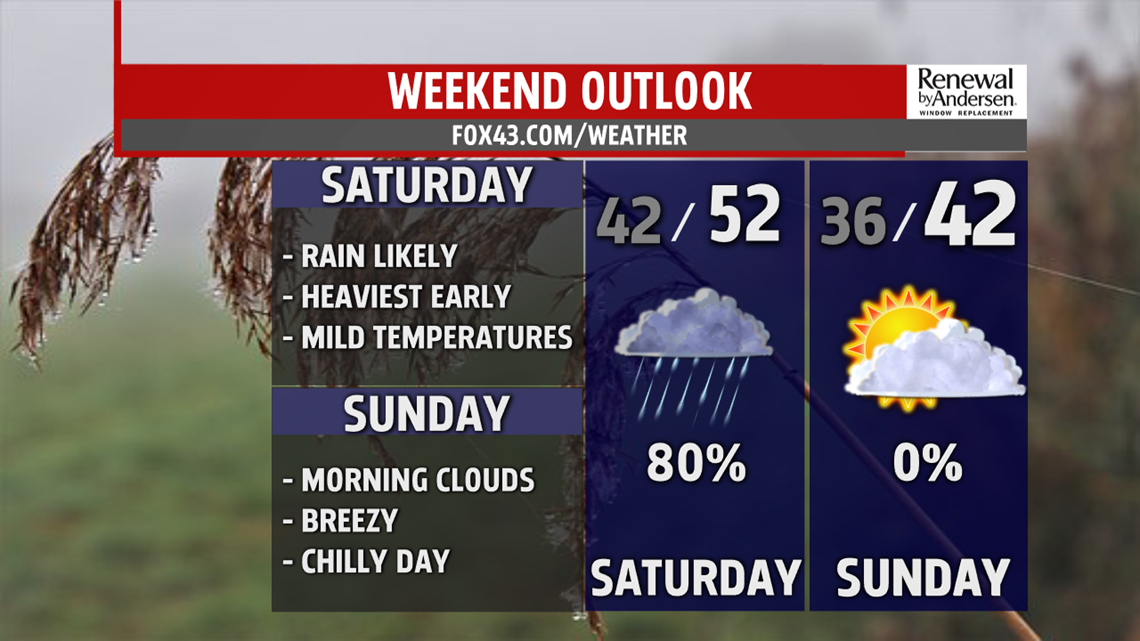
DRY END TO THE WEEKEND: Breezy conditions quickly move in Sunday, with partly-to-mostly sunny skies throughout the day. Highs are cooler, in the low-40s. Wind chills stay in the upper-30s. We drop below freezing overnight and into Monday morning.
MORE PRECIP NEXT WEEK: A chance of snow and rain moves in Monday. We will be very close to freezing throughout the day, so this forecast is going to be a tricky one.

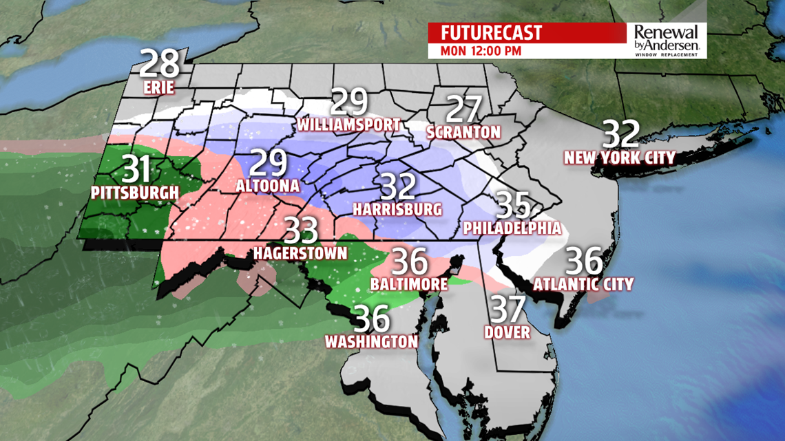
Off-and-on winter mixing looks likely throughout the day Monday and into Tuesday morning. with lows near freezing again. After that, temperatures warm Tuesday and rise into the mid-40s with a transition to rain in the early morning. The rest of Tuesday afternoon dries out with breezy conditions. There is plenty of time for this forecast to change, so stay tuned for updates. We dip back into the mid-30s with breezy conditions by Wednesday.
Stay “Weather Smart” with the FOX43 Weather Team all week long!
-Meteorologist Bradon Long
