

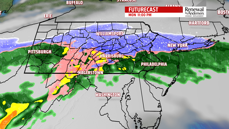

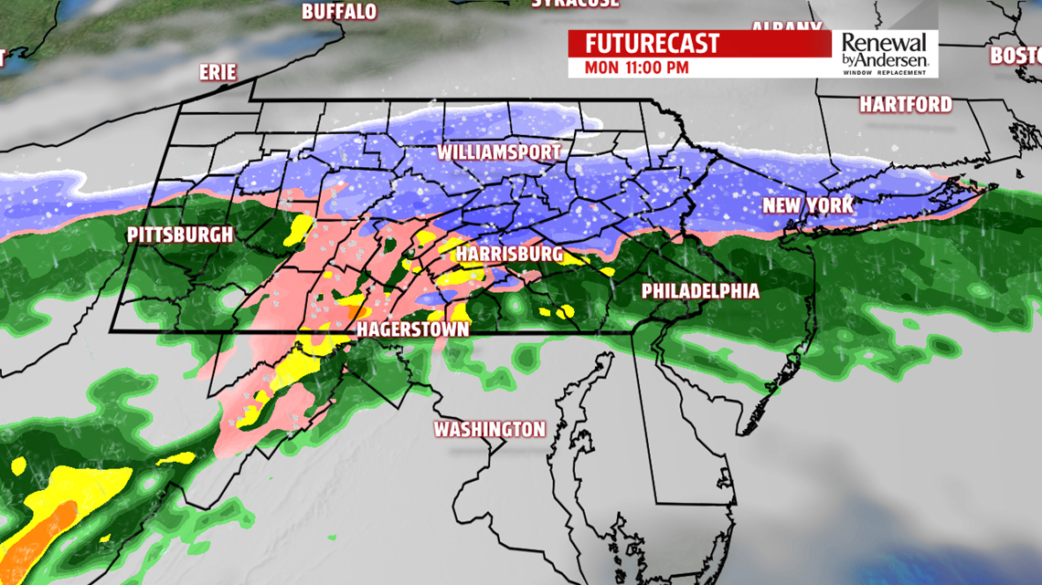

WINTER WEATHER: After a break in constant precipitation, round two moves in during the late afternoon and early evening. A mix of rain, sleet and snow will fall throughout the evening and all night long. A WINTER WEATHER ADVISORY is in effect for the entire area until 1AM Tuesday, except for Mifflin and Juniata County – which is in a WINTER WEATHER ADVISORY until 11AM Tuesday. Temperature will be key, as a difference of even less than one degree could easily change the type of precipitation that makes it to the ground as lows will be near freezing. South of the Turnpike will see a mix of sleet and mostly rain as we progress into the morning hours.

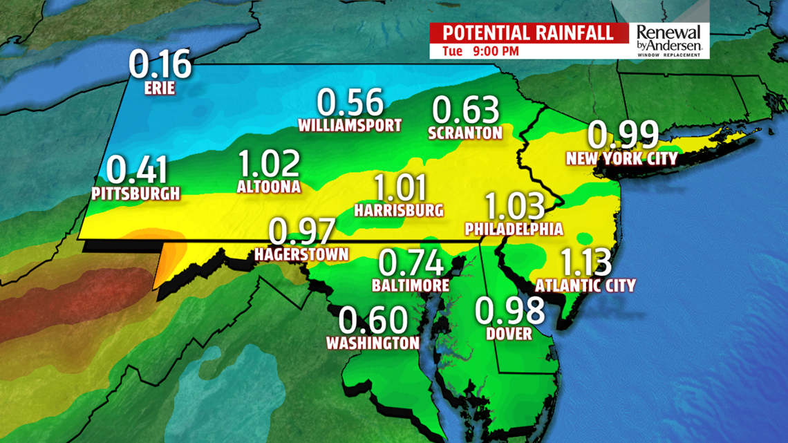
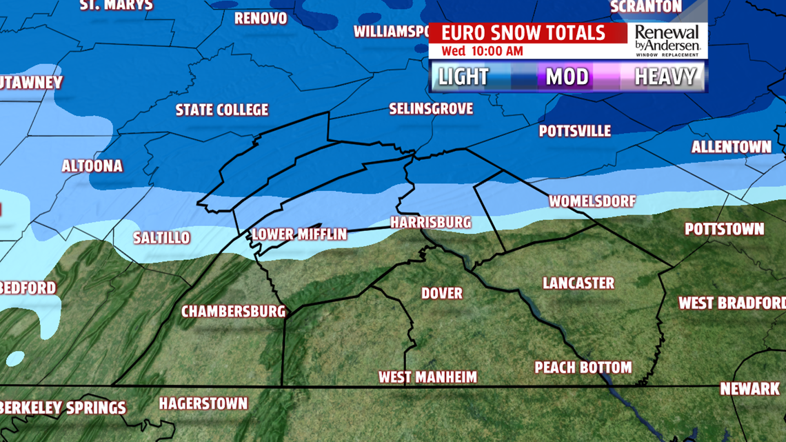
The further north you travel, the higher likelihood for more sleet or perhaps mixing in with snow in between bursts of rain. The higher elevations to the west and north also have a likelihood of more frozen precipitation. We turn to plain rain for most of our area during the morning commute as steady precipitation ends as we approach sunrise. Off-and-on showers will continue into the morning before ending by around the lunch time hour. Highs hit the low-40s. When all is said and done, a coating of snow will be the norm, with higher totals north. A light sleet accumulation will be possible, with higher totals to the north. Half-an-inch to one-inch of rain accumulation will be the norm along the Turnpike and points towards the Mason-Dixon as well.

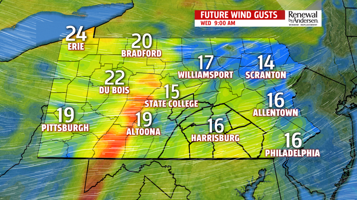
DRY, GUSTY, COLD MIDDLE PART OF THE WEEK: Winds pick up quickly overnight Tuesday into Wednesday morning. Lows dip into the 20s. Wind chills will be in the 20s all day long with dry air and gusts up to 25MPH likely. Highs make it to the mid-30s under partly cloudy skies.An Arctic boundary swinging through will produce lake effect snow bands, which may reach far enough south and east, to cause a quick covering of snow and brief white-out conditions. A blast of frigid air moves in too. Overnight lows dip into the teens Thursday morning with highs in the upper 20s to near 30 degrees and partly-to-mostly cloudy skies. Wind chills stay in the upper-teens and low-20s with gusty winds Thursday as well.

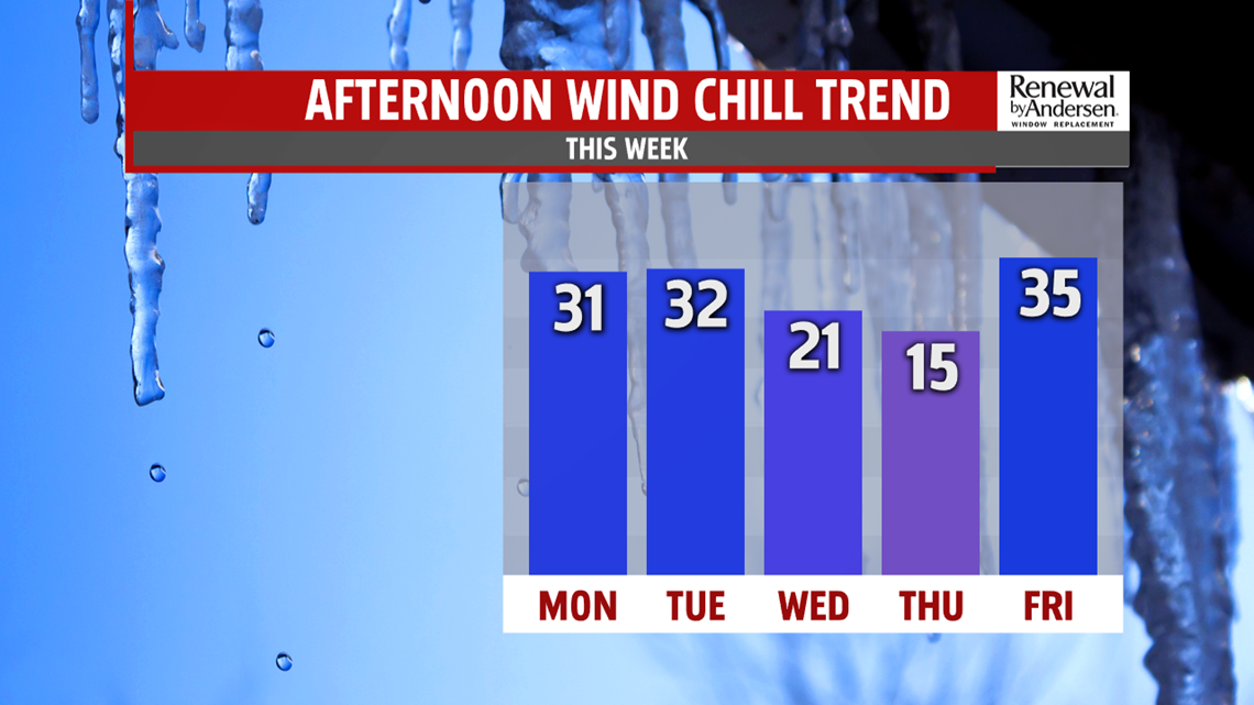
HEADING INTO THE WEEKEND: We start Friday chilly once again with lows near 20-degrees. Highs reach the mid-30s with a bit more sunshine. The weekend looks dry. Morning lows seasonable in the middle to upper 20s. Highs are near 40 Saturday, and middle 40s Sunday.
Stay “Weather Smart” with the FOX43 Weather Team all week long!
-Chief Meteorologist MaryEllen Pann
