


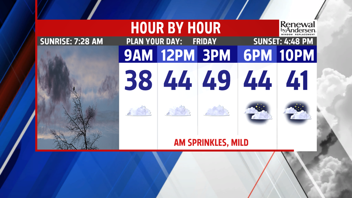

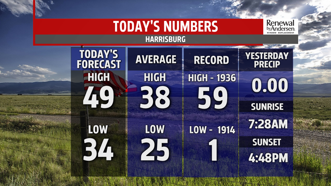
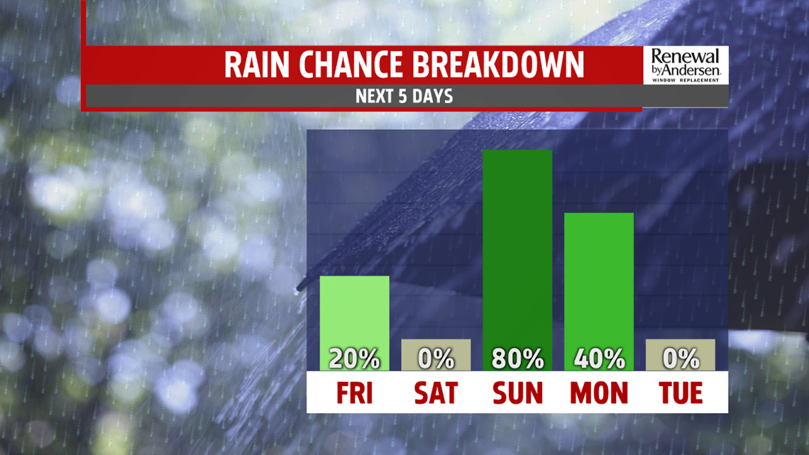
STAYING MILD TO END THE WEEK: A weak cold front crosses Central PA today, bringing plenty of clouds and the chance for a few light showers. There’s haze and fog to start Friday morning, with temperatures in the 30s for most areas. Once the haze and fog thins out through the morning, expect plenty of clouds throughout the day. There’s a small chance for a few sprinkles or a light shower, mainly during the morning and midday hours. Expect afternoon highs to remain on the mild side with temperatures in the middle to upper 40s. The clouds start to break much later during the evening, but all is quiet for and Friday evening plans. Temperatures fall through the 40s. Skies turn partly to mostly clear through the night. Lows dip into the middle 30s to near 40 degrees.

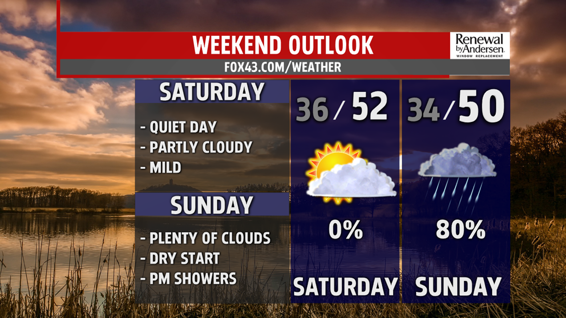
50/50 WEEKEND AHEAD: A 50/50 weekend is ahead for the Commonwealth. Saturday is the dry day. Skies are partly sunny ahead of the next system. We’re dry as it develops, and temperatures look a bit milder too! Expect afternoon high temperatures to reach the upper 40s to lower 50s. Sunday starts dry with plenty of clouds, but it will not end dry. Later during the afternoon showers arrives. Temperatures reach the middle 40s to near 50 degrees. Rain showers are expected to continue through the rest of the night and into Monday morning as well. Conditions dry out by midday, and even some sunshine should break out! Afternoon highs are back into the 50s for most!

HEADING INTO 2020: New Year’s Eve and New Year’s Day conditions are looking good for any plans! Temperatures are a bit cooler New Year’s Eve under partly sunny skies. It’s a bit breezy too. Temperatures are in the lower to middle 40s. New Year’s Day brings partly cloudy skies. Temperatures are back into the 40s. Clouds thicken fast Thursday ahead of the next system, but it should stay dry. Temperatures reach the middle 40s.
Stay Weather Smart with FOX43! Have a wonderful weekend!
-Andrea Michaels
