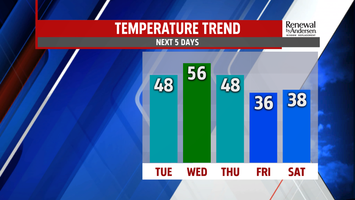

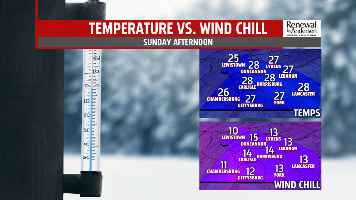
with temperatures below average! A strong area of high pressure will position itself to our north Thursday heading into Friday. This high will tap into a pool of significantly colder air and northerly to northeasterly flow will allow that air to rush our way. High on Friday are likely to only top out in the mid 30s. Snow arrives overnight Friday into early Saturday as temperatures are likely to be in the 20s. Temperatures will try to warm above freezing with some warm air advection, but it is looking like we will see primarily snow and sleet as opposed to freezing rain and plain rain. All winter weather will be coming to an end Sunday night.

Stay “Weather Smart” with the Fox 43 Weather Team all week long!
Have a great day!
– Chief Meteorologist MaryEllen Pann