

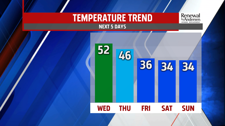


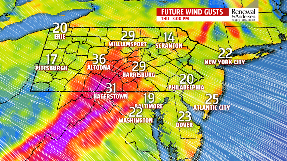


COOLING DOWN: Conditions are dry again for Thursday, but some chillier air works back into the region. Temperatures fall into the upper 30s to middle 40s for the afternoon, which is still a bit above average for this time of year. It’s breezy with partly sunny to mostly cloudy skies. Friday brings a return to seasonally cold air! There sunshine and clouds mixed, with temperatures in the lower to middle 30s. It will be a shock to the system after the mild stretch!

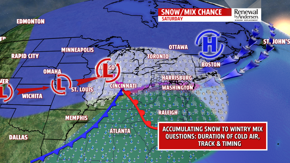
WINTRY WEEKEND OUTLOOK: The weekend is looking much more like January, bringing cold and even the chance for some winter weather now that the cold is back! We’re still eyeing Saturday for our next winter storm. Confidence continues to increase for a wintry mix. This system likely starts as snow before transitioning to a wintry mix, and even some rain for parts of the area later during the day. There’s still discrepancy on precipitation timing, although it looks like snow arrives during the late morning and early afternoon before starting to transition to a wintry mix of snow, sleet and freezing rain. A transition to rain for some takes place by evening before the precipitation exits, but lingering freezing rain is possible in colder valley locations. Questions still remain on how long the colder air stays in place, and this is what determines exactly how much of each precipitation type (snow, sleet, freezing rain) the area sees. It is still too early to be specific about those amounts. Colder and breezy conditions settle in for Sunday, with temperatures in the lower 30s. Wind chills are in the upper teens and 20s!
BRUTAL COLD EARLY NEXT WEEK: Even colder air spirals in for Monday! Expect partly sunny skies and breezy conditions with the chance for some snow showers or snow squalls. Temperatures only reach the middle 20s to near 30 degrees, with wind chills in the teens. Tuesday brings even colder conditions to the region! Temperatures are well below average for this time of year, with highs in the middle to upper 20s. It’s still a bit breezy, so wind chills remain in the teens.
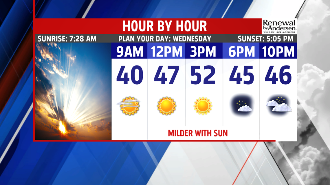
Stay Weather Smart with FOX43! Have a wonderful Wednesday!
-Andrea Michaels
